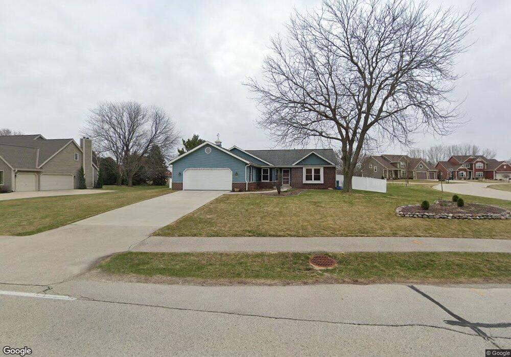
S77W14315 Mcshane Dr Muskego, WI 53150
Estimated Value: $509,000 - $548,545
3
Beds
2
Baths
1,800
Sq Ft
$290/Sq Ft
Est. Value
About This Home
This home is located at S77W14315 Mcshane Dr, Muskego, WI 53150 and is currently estimated at $522,386, approximately $290 per square foot. S77W14315 Mcshane Dr is a home located in Waukesha County with nearby schools including Bay Lane Elementary School, Lake Denoon Middle School, and Muskego High School.
Ownership History
Date
Name
Owned For
Owner Type
Purchase Details
Closed on
Jan 17, 2018
Sold by
Sell Mark F and Sell Joanne L
Bought by
Manholl Elixabeth A and Macholl Elizabeth
Current Estimated Value
Home Financials for this Owner
Home Financials are based on the most recent Mortgage that was taken out on this home.
Original Mortgage
$256,000
Outstanding Balance
$143,932
Interest Rate
3.94%
Mortgage Type
New Conventional
Estimated Equity
$378,454
Create a Home Valuation Report for This Property
The Home Valuation Report is an in-depth analysis detailing your home's value as well as a comparison with similar homes in the area
Home Values in the Area
Average Home Value in this Area
Purchase History
| Date | Buyer | Sale Price | Title Company |
|---|---|---|---|
| Manholl Elixabeth A | $320,000 | None Available |
Source: Public Records
Mortgage History
| Date | Status | Borrower | Loan Amount |
|---|---|---|---|
| Open | Manholl Elixabeth A | $256,000 |
Source: Public Records
Tax History Compared to Growth
Tax History
| Year | Tax Paid | Tax Assessment Tax Assessment Total Assessment is a certain percentage of the fair market value that is determined by local assessors to be the total taxable value of land and additions on the property. | Land | Improvement |
|---|---|---|---|---|
| 2024 | $3,914 | $343,400 | $73,100 | $270,300 |
| 2023 | $3,863 | $343,400 | $73,100 | $270,300 |
| 2022 | $3,774 | $343,400 | $73,100 | $270,300 |
| 2021 | $3,741 | $343,400 | $73,100 | $270,300 |
| 2020 | $3,657 | $264,600 | $63,500 | $201,100 |
| 2019 | $3,626 | $264,600 | $63,500 | $201,100 |
| 2018 | $3,669 | $264,600 | $63,500 | $201,100 |
| 2017 | $3,663 | $264,600 | $63,500 | $201,100 |
| 2016 | $3,758 | $241,200 | $60,000 | $181,200 |
| 2015 | $3,796 | $241,200 | $60,000 | $181,200 |
| 2014 | $4,132 | $241,200 | $60,000 | $181,200 |
| 2013 | $4,132 | $241,200 | $60,000 | $181,200 |
Source: Public Records
Map
Nearby Homes
- W145S7644 Durham Dr
- S70W14845 Dartmouth Cir
- S70W14872 Dartmouth Cir
- S76W12788 Cambridge Ct E
- Lt8 Twin Silos Ct
- S76W12739 Cambridge Ct E
- N51W19119 Quietwood Dr
- S68W13611 Hale Park Cir
- S67W14570 Gaulke Ct
- Wilshire Prairie Plan at Mallard Reserve
- Winfield II Plan at Mallard Reserve
- Wilshire Prairie Signature Series Plan at Mallard Reserve
- Wilshire III Plan at Mallard Reserve
- Wilshire Manor III Plan at Mallard Reserve
- Wilshire IV Plan at Mallard Reserve
- Wilshire II Plan at Mallard Reserve
- Wakefield Plan at Mallard Reserve
- Savannah Plan at Mallard Reserve
- Rochester Plan at Mallard Reserve
- Rivershire Plan at Mallard Reserve
- S77W14281 Mcshane Dr
- S77W14350 Independence Ct
- S76W14378 Mcshane Dr
- S77W14255 Mcshane Dr
- W143S7693 Independence Dr
- S76W14262 Mcshane Dr
- S77W14233 Mcshane Dr
- W143S7644 Independence Dr
- S77W14434 Independence Ct
- W143S7667 Independence Dr
- S76W14224 Mcshane Dr
- W143S7651 Indian Trail
- S76W14291 Independence Dr
- S76W14253 Independence Dr
- S76W14180 Mcshane Dr
- W143S7632 Indian Trail
- W143S7625 Indian Trail
- S76W14225 Independence Dr
- W141S7736 Freedom Ave
- S76W14140 Mcshane Dr