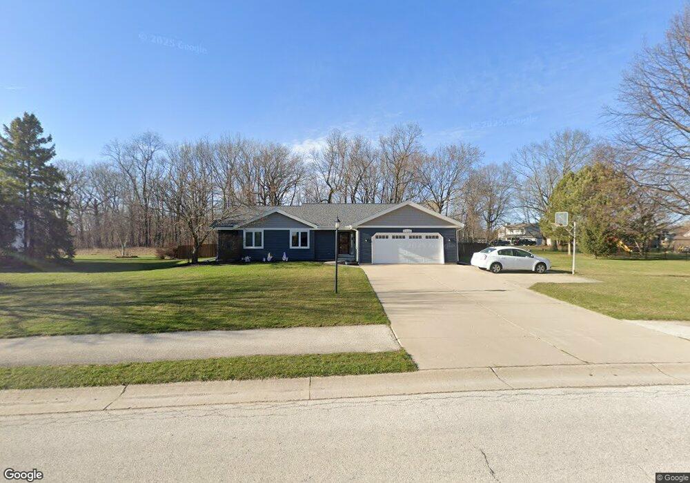
S77W16486 Bridgeport Way Muskego, WI 53150
Estimated Value: $505,000 - $557,000
3
Beds
3
Baths
1,780
Sq Ft
$302/Sq Ft
Est. Value
About This Home
This home is located at S77W16486 Bridgeport Way, Muskego, WI 53150 and is currently estimated at $538,242, approximately $302 per square foot. S77W16486 Bridgeport Way is a home located in Waukesha County with nearby schools including Muskego Lakes Middle School, Muskego High School, and St. Leonard School.
Ownership History
Date
Name
Owned For
Owner Type
Purchase Details
Closed on
Oct 30, 2020
Sold by
Becker Randall J and Becker Susan M
Bought by
Kampa Kevin A and Spencer Stephanie L
Current Estimated Value
Home Financials for this Owner
Home Financials are based on the most recent Mortgage that was taken out on this home.
Original Mortgage
$288,000
Interest Rate
2.8%
Mortgage Type
New Conventional
Purchase Details
Closed on
Sep 3, 2002
Sold by
Alder Kevin and Alder Rebecca G
Bought by
Becker Randall J and Becker Susan M
Home Financials for this Owner
Home Financials are based on the most recent Mortgage that was taken out on this home.
Original Mortgage
$142,000
Interest Rate
6.4%
Purchase Details
Closed on
Nov 16, 2000
Sold by
Bednarz John L and Bednarz Janice L
Bought by
Alder Kevin and Alder Rebecca G
Home Financials for this Owner
Home Financials are based on the most recent Mortgage that was taken out on this home.
Original Mortgage
$149,600
Interest Rate
7.86%
Create a Home Valuation Report for This Property
The Home Valuation Report is an in-depth analysis detailing your home's value as well as a comparison with similar homes in the area
Home Values in the Area
Average Home Value in this Area
Purchase History
| Date | Buyer | Sale Price | Title Company |
|---|---|---|---|
| Kampa Kevin A | $360,000 | Pavile Robert | |
| Becker Randall J | $213,000 | -- | |
| Alder Kevin | $187,000 | -- |
Source: Public Records
Mortgage History
| Date | Status | Borrower | Loan Amount |
|---|---|---|---|
| Previous Owner | Kampa Kevin A | $288,000 | |
| Previous Owner | Becker Randall J | $142,000 | |
| Previous Owner | Alder Kevin | $149,600 |
Source: Public Records
Tax History Compared to Growth
Tax History
| Year | Tax Paid | Tax Assessment Tax Assessment Total Assessment is a certain percentage of the fair market value that is determined by local assessors to be the total taxable value of land and additions on the property. | Land | Improvement |
|---|---|---|---|---|
| 2024 | $4,080 | $357,200 | $86,000 | $271,200 |
| 2023 | $4,029 | $357,200 | $86,000 | $271,200 |
| 2022 | $3,935 | $357,200 | $86,000 | $271,200 |
| 2021 | $3,901 | $357,200 | $86,000 | $271,200 |
| 2020 | $3,753 | $271,200 | $75,400 | $195,800 |
| 2019 | $3,722 | $271,200 | $75,400 | $195,800 |
| 2018 | $3,766 | $271,200 | $75,400 | $195,800 |
| 2017 | $4,427 | $271,200 | $75,400 | $195,800 |
| 2016 | $3,976 | $254,500 | $71,700 | $182,800 |
| 2015 | $4,015 | $254,500 | $71,700 | $182,800 |
| 2014 | $4,371 | $254,500 | $71,700 | $182,800 |
| 2013 | $4,371 | $254,500 | $71,700 | $182,800 |
Source: Public Records
Map
Nearby Homes
- S78W16730 Spinnaker Dr
- W169S7647 Gregory Dr Unit D
- W170S7579 Gregory Dr Unit H
- N51W19119 Quietwood Dr
- W163S7358 Bay Lane Dr
- Lt4 Lannon Dr
- W170S7361 Parkland Dr Unit 13
- W171S7452 Lannon Dr
- S73W17268 Lake Dr
- S75W17553 Harbor Cir Unit 1B
- W162S7043 Olive Cir Unit 22
- W177S7495 Harbor Cir Unit 6D
- S76W15088 Roger Dr
- W179S7953 Scenic Dr
- S83W17591 Cedarcrest Ln
- W145S7644 Durham Dr
- S70W14897 Cornell Cir
- S66W16256 Chestnut Ridge Ct
- W186S7576 Kingston Dr
- S70W14845 Dartmouth Cir
- W164S7683 Bay Lane Terrace
- S77W16491 Bridgeport Way
- S77W16518 Bridgeport Way
- S77W16523 Bridgeport Way
- W164S7727 Bay Lane Dr
- W164S7690 Bay Lane Terrace
- W164S7741 Bay Lane Dr
- S77W16552 Bridgeport Way
- S77W16555 Bridgeport Way
- W164S7674 Bay Lane Terrace
- W164S7761 Bay Lane Dr
- W165S7657 Bay Lane Terrace
- W164S7696 Bay Lane Dr
- W164S7734 Bay Lane Dr
- W164S7716 Bay Lane Dr
- W164S7775 Bay Lane Dr
- W164S7750 Bay Lane Dr
- W164S7670 Bay Lane Dr
- S77W16583 Bridgeport Way
- W164S7764 Bay Lane Dr