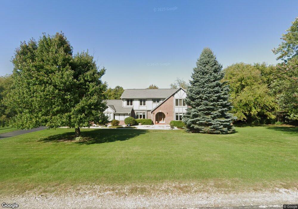
S77W29840 High Cross Dr Mukwonago, WI 53149
Estimated Value: $550,310 - $640,000
--
Bed
--
Bath
--
Sq Ft
1
Acres
About This Home
This home is located at S77W29840 High Cross Dr, Mukwonago, WI 53149 and is currently estimated at $601,328. S77W29840 High Cross Dr is a home located in Waukesha County with nearby schools including Section Elementary School, Park View Middle School, and Mukwonago High School.
Ownership History
Date
Name
Owned For
Owner Type
Purchase Details
Closed on
Jul 19, 2005
Sold by
Legawiee Mark S and Legawiee Julie E
Bought by
Piemeisel Kenneth J and Piemeisel Cecilia A
Current Estimated Value
Home Financials for this Owner
Home Financials are based on the most recent Mortgage that was taken out on this home.
Original Mortgage
$84,000
Outstanding Balance
$44,629
Interest Rate
5.74%
Mortgage Type
Credit Line Revolving
Estimated Equity
$556,699
Purchase Details
Closed on
Jun 23, 2000
Sold by
Jeffery D Dennis and Jeffery Ricki R
Bought by
Legawiec Mark S and Legawiec Julie E
Home Financials for this Owner
Home Financials are based on the most recent Mortgage that was taken out on this home.
Original Mortgage
$217,600
Interest Rate
8.55%
Create a Home Valuation Report for This Property
The Home Valuation Report is an in-depth analysis detailing your home's value as well as a comparison with similar homes in the area
Home Values in the Area
Average Home Value in this Area
Purchase History
| Date | Buyer | Sale Price | Title Company |
|---|---|---|---|
| Piemeisel Kenneth J | $370,000 | Jolie Semancik Wauwalosa Tit | |
| Legawiec Mark S | $272,000 | -- |
Source: Public Records
Mortgage History
| Date | Status | Borrower | Loan Amount |
|---|---|---|---|
| Open | Piemeisel Kenneth J | $84,000 | |
| Previous Owner | Piemeisel Kenneth J | $150,000 | |
| Previous Owner | Legawiec Mark S | $217,600 |
Source: Public Records
Tax History Compared to Growth
Tax History
| Year | Tax Paid | Tax Assessment Tax Assessment Total Assessment is a certain percentage of the fair market value that is determined by local assessors to be the total taxable value of land and additions on the property. | Land | Improvement |
|---|---|---|---|---|
| 2024 | $4,900 | $520,800 | $105,000 | $415,800 |
| 2023 | $5,155 | $352,100 | $88,000 | $264,100 |
| 2022 | $5,072 | $352,100 | $88,000 | $264,100 |
| 2021 | $4,732 | $352,100 | $88,000 | $264,100 |
| 2020 | $4,689 | $352,100 | $88,000 | $264,100 |
| 2019 | $4,278 | $352,100 | $88,000 | $264,100 |
| 2018 | $4,436 | $352,100 | $88,000 | $264,100 |
| 2017 | $4,400 | $352,100 | $88,000 | $264,100 |
| 2016 | $4,488 | $352,100 | $88,000 | $264,100 |
| 2015 | $4,302 | $352,100 | $88,000 | $264,100 |
| 2014 | $4,774 | $352,100 | $88,000 | $264,100 |
| 2013 | $4,774 | $352,100 | $88,000 | $264,100 |
Source: Public Records
Map
Nearby Homes
- S81W30467 Bailey
- S87W29868 Leppin Ct
- W309S8296 County Road I
- 365 Woods Edge Dr
- Lt24 Woods Edge Dr
- Lt28 Woods Edge Dr
- Lt26 Woods Edge Dr
- Lt25 Woods Edge Dr
- 1522 Sandhill Ln Unit 802
- 1526 Sandhill Ln Unit 801
- 1544 Sandhill Ln Unit 902
- 1548 Sandhill Ln Unit 901
- 1547 Sandhill Ln Unit 2002
- 1521 Sandhill Ln Unit 2101
- 1525 Sandhill Ln Unit 2102
- 1543 Sandhill Ln Unit 2001
- 1564 Fairwinds Blvd
- 1584 Fairwinds Blvd
- 1624 Fairwinds Blvd
- 1534 Fairwinds Blvd
- S77W29802 High Cross Dr
- S77W29882 High Cross Dr
- S77W29837 High Cross Dr
- S77W29970 Crossgate Dr
- S77W29795 High Cross Dr
- S78W29892 Crossgate Dr
- S77W29760 High Cross Dr
- S77W29763 High Cross Dr
- S77W29935 Crossgate Dr
- S78W29800 Crossgate Dr
- S78W29887 Crossgate Dr
- S77W29731 High Cross Dr
- S78W29911 Crossgate Dr
- S77W29716 High Cross Dr
- S78W29859 Crossgate Dr
- S78W29764 Crossgate Dr
- S78W29833 Crossgate Dr
- S78W29728 Crossgate Dr
- S78W29809 Crossgate Dr
- S77W29695 High Cross Dr