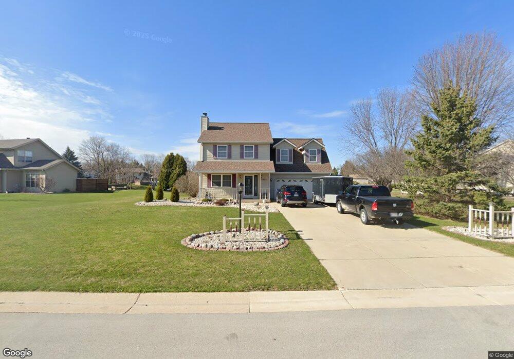
S78W15424 Foxtail Cir Muskego, WI 53150
Estimated Value: $574,256 - $608,000
3
Beds
2
Baths
1,752
Sq Ft
$334/Sq Ft
Est. Value
About This Home
This home is located at S78W15424 Foxtail Cir, Muskego, WI 53150 and is currently estimated at $585,814, approximately $334 per square foot. S78W15424 Foxtail Cir is a home located in Waukesha County with nearby schools including Bay Lane Elementary School, Lake Denoon Middle School, and Muskego High School.
Ownership History
Date
Name
Owned For
Owner Type
Purchase Details
Closed on
Aug 4, 2025
Sold by
Gaffney James L and Gaffney Laura L
Bought by
James L Gaffney And Laura L Gaffney Revocable and Gaffney
Current Estimated Value
Purchase Details
Closed on
Dec 20, 1996
Sold by
Kosobucki Brothers Partnership Llp
Bought by
Gaffney James L and Gaffney Laura L
Home Financials for this Owner
Home Financials are based on the most recent Mortgage that was taken out on this home.
Original Mortgage
$145,900
Interest Rate
7.87%
Create a Home Valuation Report for This Property
The Home Valuation Report is an in-depth analysis detailing your home's value as well as a comparison with similar homes in the area
Home Values in the Area
Average Home Value in this Area
Purchase History
| Date | Buyer | Sale Price | Title Company |
|---|---|---|---|
| James L Gaffney And Laura L Gaffney Revocable | -- | None Listed On Document | |
| Gaffney James L | $39,000 | -- |
Source: Public Records
Mortgage History
| Date | Status | Borrower | Loan Amount |
|---|---|---|---|
| Previous Owner | Gaffney James L | $145,900 |
Source: Public Records
Tax History Compared to Growth
Tax History
| Year | Tax Paid | Tax Assessment Tax Assessment Total Assessment is a certain percentage of the fair market value that is determined by local assessors to be the total taxable value of land and additions on the property. | Land | Improvement |
|---|---|---|---|---|
| 2024 | $4,869 | $403,500 | $78,700 | $324,800 |
| 2023 | $4,584 | $403,500 | $78,700 | $324,800 |
| 2022 | $4,475 | $403,500 | $78,700 | $324,800 |
| 2021 | $4,438 | $403,500 | $78,700 | $324,800 |
| 2020 | $5,402 | $327,200 | $68,000 | $259,200 |
| 2019 | $5,459 | $327,200 | $68,000 | $259,200 |
| 2018 | $5,500 | $327,200 | $68,000 | $259,200 |
| 2017 | $5,494 | $327,200 | $68,000 | $259,200 |
| 2016 | $5,333 | $281,500 | $64,400 | $217,100 |
| 2015 | $5,381 | $281,500 | $64,400 | $217,100 |
| 2014 | $4,855 | $281,500 | $64,400 | $217,100 |
| 2013 | $4,855 | $281,500 | $64,400 | $217,100 |
Source: Public Records
Map
Nearby Homes
- S76W15088 Roger Dr
- N51W19119 Quietwood Dr
- W145S7644 Durham Dr
- S78W16730 Spinnaker Dr
- W163S7358 Bay Lane Dr
- S75W16788 Jacob Ct Unit 12
- W169S7647 Gregory Dr Unit D
- S70W14845 Dartmouth Cir
- W162S7043 Olive Cir Unit 22
- W170S7361 Parkland Dr Unit 13
- Lt4 Lannon Dr
- W171S7452 Lannon Dr
- W169S7219 Avon Ct
- S73W17268 Lake Dr
- Lt8 Twin Silos Ct
- S67W14570 Gaulke Ct
- S75W17553 Harbor Cir Unit 1B
- W177S7495 Harbor Cir Unit 6D
- S83W17591 Cedarcrest Ln
- S66W16256 Chestnut Ridge Ct
- S78W15388 Foxtail Cir
- S78W15460 Foxtail Cir
- S78W15423 Foxtail Cir
- S78W15451 Foxtail Cir
- S78W15357 Foxtail Cir
- S78W15524 Foxtail Cir
- S78W15485 Foxtail Cir
- S78W15536 Foxtail Cir
- S78W15350 Foxtail Cir
- S78W15349 Foxtail Cir
- S77W15441 Foxtail Cir
- S77W15403 Foxtail Cir
- S77W15489 Foxtail Cir
- W153S7875 Foxtail Ct
- S78W15517 Foxtail Cir
- S78W15525 Foxtail Cir
- S78W15332 Foxtail Cir
- S78W15541 Foxtail Cir
- W153S7867 Foxtail Ct
- W153S7873 Foxtail Ct