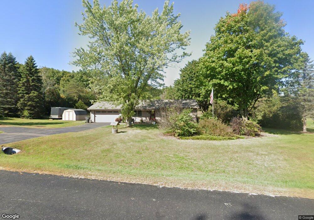
S86W30370 Stonegate Dr Mukwonago, WI 53149
Estimated Value: $324,647 - $479,000
Studio
--
Bath
--
Sq Ft
61,855
Sq Ft Lot
About This Home
This home is located at S86W30370 Stonegate Dr, Mukwonago, WI 53149 and is currently estimated at $420,412. S86W30370 Stonegate Dr is a home located in Waukesha County with nearby schools including Section Elementary School, Park View Middle School, and Mukwonago High School.
Ownership History
Date
Name
Owned For
Owner Type
Purchase Details
Closed on
Aug 14, 2007
Sold by
Haag Amanda J
Bought by
Haag Martin K
Current Estimated Value
Home Financials for this Owner
Home Financials are based on the most recent Mortgage that was taken out on this home.
Original Mortgage
$27,000
Interest Rate
6.01%
Mortgage Type
Stand Alone Second
Purchase Details
Closed on
Sep 30, 2005
Sold by
Juneau Peter J and Barlow Juneau Wendy
Bought by
Haag Martin and Haag Amanda J
Home Financials for this Owner
Home Financials are based on the most recent Mortgage that was taken out on this home.
Original Mortgage
$167,000
Interest Rate
5.82%
Mortgage Type
Fannie Mae Freddie Mac
Create a Home Valuation Report for This Property
The Home Valuation Report is an in-depth analysis detailing your home's value as well as a comparison with similar homes in the area
Home Values in the Area
Average Home Value in this Area
Purchase History
| Date | Buyer | Sale Price | Title Company |
|---|---|---|---|
| Haag Martin K | -- | None Available | |
| Haag Martin | $219,000 | -- |
Source: Public Records
Mortgage History
| Date | Status | Borrower | Loan Amount |
|---|---|---|---|
| Previous Owner | Haag Martin K | $27,000 | |
| Previous Owner | Haag Martin | $167,000 |
Source: Public Records
Tax History
| Year | Tax Paid | Tax Assessment Tax Assessment Total Assessment is a certain percentage of the fair market value that is determined by local assessors to be the total taxable value of land and additions on the property. | Land | Improvement |
|---|---|---|---|---|
| 2024 | $2,680 | $292,600 | $112,600 | $180,000 |
| 2023 | $3,137 | $219,600 | $75,000 | $144,600 |
| 2022 | $3,094 | $219,600 | $75,000 | $144,600 |
| 2021 | $2,854 | $219,600 | $75,000 | $144,600 |
| 2020 | $2,851 | $219,600 | $75,000 | $144,600 |
| 2019 | $2,590 | $219,600 | $75,000 | $144,600 |
Source: Public Records
Map
Nearby Homes
- 365 Woods Edge Dr
- Lt24 Woods Edge Dr
- Lt26 Woods Edge Dr
- Lt25 Woods Edge Dr
- 380 Woods Edge Dr
- 364 Woods Edge Dr
- 1479 Sandhill Ln Unit 2301
- 1575 Fairwinds Blvd
- 1625 Fairwinds Blvd
- 1534 Fairwinds Blvd
- 1564 Fairwinds Blvd
- 1584 Fairwinds Blvd
- 1624 Fairwinds Blvd
- 1547 Sandhill Ln Unit 2002
- 1521 Sandhill Ln Unit 2101
- 1525 Sandhill Ln Unit 2102
- 1543 Sandhill Ln Unit 2001
- 1522 Sandhill Ln Unit 802
- 1526 Sandhill Ln Unit 801
- 1544 Sandhill Ln Unit 902
- S86W30326 Stonegate Dr
- S86W30392 Stonegate Dr
- W303S8641 Rosewood Dr
- S86W30300 Stonegate Dr
- S86W30397 Stonegate Dr
- W303S8681 Rosewood Dr
- S85W30367 Greentree Ct
- S86W30432 Stonegate Dr
- W302S8640 Rosewood Dr
- S86W30423 Stonegate Dr
- S85W30379 Greentree Ct
- S85W30337 Greentree Ct
- S86W30474 Stonegate Dr
- W302S8668 Rosewood Dr
- W303S8691 Rosewood Dr
- W302S8588 Chestnut Dr
- W302S8692 Rosewood Dr
- S85W30380 Greentree Ct
- W302S8566 Chestnut Dr
- S86W30445 Stonegate Dr
Your Personal Tour Guide
Ask me questions while you tour the home.