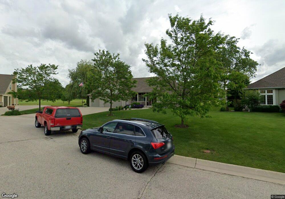
S96W13222 Links Way Ct Muskego, WI 53150
Estimated Value: $616,161 - $677,000
3
Beds
2
Baths
2,046
Sq Ft
$319/Sq Ft
Est. Value
About This Home
This home is located at S96W13222 Links Way Ct, Muskego, WI 53150 and is currently estimated at $652,040, approximately $318 per square foot. S96W13222 Links Way Ct is a home located in Waukesha County with nearby schools including Lakeview Elementary School, Lake Denoon Middle School, and Creative and Performing Arts.
Ownership History
Date
Name
Owned For
Owner Type
Purchase Details
Closed on
Jun 29, 2005
Sold by
Downing Brothers Builders Inc
Bought by
Bauer Roger A and Bauer Elaine M
Current Estimated Value
Home Financials for this Owner
Home Financials are based on the most recent Mortgage that was taken out on this home.
Original Mortgage
$379,000
Outstanding Balance
$181,136
Interest Rate
4.37%
Mortgage Type
Fannie Mae Freddie Mac
Estimated Equity
$470,904
Purchase Details
Closed on
Apr 4, 2003
Sold by
Villages At Muskego Lakes Partnership
Bought by
Downing Brothers Builders Inc
Create a Home Valuation Report for This Property
The Home Valuation Report is an in-depth analysis detailing your home's value as well as a comparison with similar homes in the area
Home Values in the Area
Average Home Value in this Area
Purchase History
| Date | Buyer | Sale Price | Title Company |
|---|---|---|---|
| Bauer Roger A | $95,000 | -- | |
| Downing Brothers Builders Inc | $87,400 | -- |
Source: Public Records
Mortgage History
| Date | Status | Borrower | Loan Amount |
|---|---|---|---|
| Open | Bauer Roger A | $379,000 |
Source: Public Records
Tax History Compared to Growth
Tax History
| Year | Tax Paid | Tax Assessment Tax Assessment Total Assessment is a certain percentage of the fair market value that is determined by local assessors to be the total taxable value of land and additions on the property. | Land | Improvement |
|---|---|---|---|---|
| 2024 | $5,345 | $462,200 | $123,800 | $338,400 |
| 2023 | $5,288 | $462,200 | $123,800 | $338,400 |
| 2022 | $5,159 | $462,200 | $123,800 | $338,400 |
| 2021 | $5,119 | $462,200 | $123,800 | $338,400 |
| 2020 | $5,444 | $387,300 | $108,000 | $279,300 |
| 2019 | $5,414 | $387,300 | $108,000 | $279,300 |
| 2018 | $5,471 | $387,300 | $108,000 | $279,300 |
| 2017 | $5,445 | $387,300 | $108,000 | $279,300 |
| 2016 | $5,258 | $332,700 | $102,800 | $229,900 |
| 2015 | $5,302 | $332,700 | $102,800 | $229,900 |
| 2014 | $5,517 | $332,700 | $102,800 | $229,900 |
| 2013 | $5,517 | $318,400 | $102,800 | $215,600 |
Source: Public Records
Map
Nearby Homes
- S94W14528 Ryan Dr
- Lt0 Ryan Dr
- W125S9708 N Cape Rd
- 9636 S Sophia Ct
- 9628 S Sophia Ct
- 9344 S Parkside Ln
- 9354 S Parkside Ln
- 9157 S Overlook Way
- W125S9782 N Cape Rd
- 9198 S Winding Way
- 9128 S Overlook Way
- 9186 S Winding Way
- 11699 W Ryan Rd
- 9607 S Bergamont Dr
- 11520 W Meadowview Dr
- 11223 W Loomis Rd
- 9546 S Bergamont Dr
- W129S8634 Muscovy Way
- 9878 S Bergamont Dr
- 9676 S Bergamont Dr
- S96W13214 Linksway Ct
- S96W13214 Linksway Ct Unit S96W13214
- S96W13214 Links Way Ct
- S96W13238 Links Way Ct
- S96W13238 Linksway Ct
- S96W13206 Linksway Ct
- S96W13206 Links Way Ct
- S96W13241 Links Way Ct
- S96W13219 Links Way Ct
- S96W13229 Links Way Ct
- S96W13219 Linksway Ct
- S96W13211 Links Way Ct
- S96W13182 Links Way Ct
- S96W13205 Links Way Ct
- S96W13140 Links Way Ct
- W130S9599 Jimmy Demaret Dr
- W130S9611 Jimmy Demaret Dr
- W130S9623 Jimmy Demaret Dr
- W130S9585 Jimmy Demaret Dr
- S96W13108 Links Way Ct