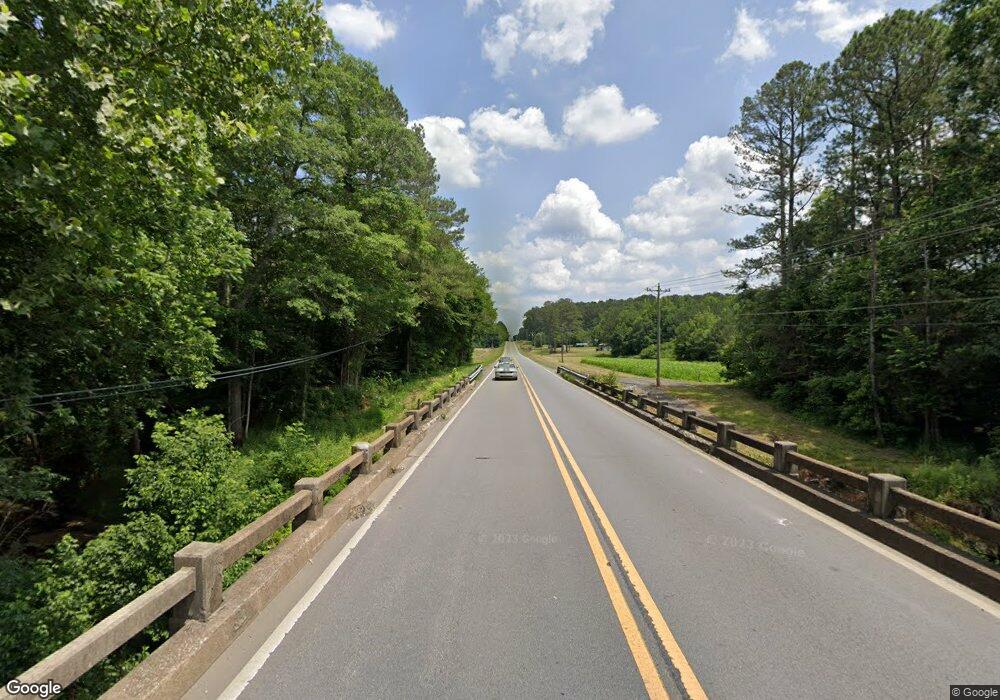
South Of Highway 67 Somerville, AL 35670
Estimated Value: $116,264
--
Bed
--
Bath
--
Sq Ft
1.14
Acres
About This Home
This home is located at South Of Highway 67, Somerville, AL 35670 and is currently estimated at $116,264. South Of Highway 67 is a home located in Morgan County with nearby schools including Eva School and Albert P. Brewer High School.
Ownership History
Date
Name
Owned For
Owner Type
Purchase Details
Closed on
Jan 25, 2023
Sold by
Anders Kenneth Lucas
Bought by
Frye Michael L and Greer Shirley R
Current Estimated Value
Purchase Details
Closed on
Sep 23, 2021
Sold by
Livingston Allen G and Livingston Tara S
Bought by
Anders Kenneth Lucas
Home Financials for this Owner
Home Financials are based on the most recent Mortgage that was taken out on this home.
Original Mortgage
$59,500
Interest Rate
2.9%
Mortgage Type
Future Advance Clause Open End Mortgage
Purchase Details
Closed on
Aug 7, 2021
Sold by
Morrow Leasing Llc
Bought by
Livingston Allen G and Livingston Tara S
Home Financials for this Owner
Home Financials are based on the most recent Mortgage that was taken out on this home.
Original Mortgage
$59,500
Interest Rate
2.9%
Mortgage Type
Future Advance Clause Open End Mortgage
Purchase Details
Closed on
May 10, 2005
Sold by
Knighten Rockie
Bought by
Morrow Family Partnership
Create a Home Valuation Report for This Property
The Home Valuation Report is an in-depth analysis detailing your home's value as well as a comparison with similar homes in the area
Home Values in the Area
Average Home Value in this Area
Purchase History
| Date | Buyer | Sale Price | Title Company |
|---|---|---|---|
| Frye Michael L | $100,000 | -- | |
| Frye Michael L | $100,000 | None Listed On Document | |
| Anders Kenneth Lucas | $80,000 | Roberts Jacob | |
| Anders Kenneth Lucas | $80,000 | Roberts Jacob | |
| Livingston Allen G | $70,000 | None Available | |
| Morrow Family Partnership | -- | None Available |
Source: Public Records
Mortgage History
| Date | Status | Borrower | Loan Amount |
|---|---|---|---|
| Previous Owner | Livingston Allen G | $59,500 |
Source: Public Records
Tax History Compared to Growth
Tax History
| Year | Tax Paid | Tax Assessment Tax Assessment Total Assessment is a certain percentage of the fair market value that is determined by local assessors to be the total taxable value of land and additions on the property. | Land | Improvement |
|---|---|---|---|---|
| 2024 | $334 | $6,980 | $1,930 | $5,050 |
| 2023 | $522 | $13,960 | $3,860 | $10,100 |
| 2022 | $468 | $12,520 | $3,500 | $9,020 |
| 2021 | $364 | $9,720 | $2,180 | $7,540 |
| 2020 | $364 | $9,720 | $2,180 | $7,540 |
| 2019 | $364 | $9,720 | $0 | $0 |
| 2015 | $224 | $6,060 | $0 | $0 |
| 2014 | $224 | $5,980 | $0 | $0 |
| 2013 | -- | $5,820 | $0 | $0 |
Source: Public Records
Map
Nearby Homes
- 155 Blue Spring Rd
- SITE 1A&1B All Jersey Rd
- SITE 2A&2B All Jersey Rd
- 1619 Peck Hollow Rd
- 39 Fort Bluff Rd
- Tract 1 Latham Rd
- 13 Acres Latham Rd
- 14 Acres Latham Rd
- 12 Peck Mountain Rd
- 0 Rock Creek Rd
- 80 acres Rock Creek Rd
- 21.85 Acres Tar Kil Rd
- 40.08 6 Mile Creek Rd
- 0 Crawford Bottom Rd Unit 24764408
- 1675 Six Mile Creek Rd
- 197 Cryer Rd
- 796 S Old Six Mile Rd
- 623 W Point Loop
- 249 Union Rd
- 335 S Old Six Mile Rd
- 23 Acres County Road 87
- 29 Blue Springs Rd
- 26 Blue Springs Rd
- 7261 Highway 67
- 75 Blue Springs Rd
- 72 Blue Springs Rd
- 72 Blue Spring Rd
- 64 Florette Park Rd
- 87 Blue Springs Rd
- 48 Florette Park Rd
- 111 Blue Springs Rd
- 98 Blue Springs Rd
- 35 Eva Rd
- 39 Pines Rd
- 122 Jenkins Rd
- 81D Couey Rd
- 0 Cotaco Florette Rd
- 0 Cotaco Florette Rd Unit 856174
- 253 Eva Rd
- 155 Blue Springs Rd
