NOT LISTED FOR SALE

TBD 2nd St Driggs, ID 83422

Estimated Value: $203,000 - $685,000

0.17 Acre
$2,786,276 Price per Acre
7,405 Sq Ft Lot

Last Sold May 01, 2020

Current estimated payment $2,512/month

50 Days on Market

Highlights

  • No HOA
  • Landscaped with Trees
  • Level Lot

About This Lot

As of May 2020

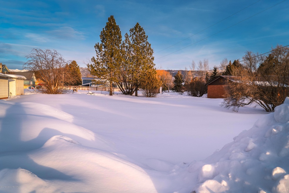
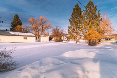
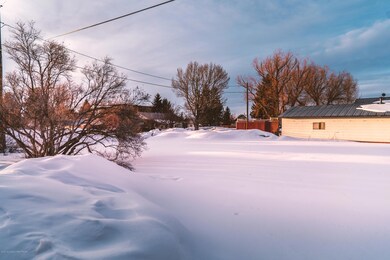
Located 2 blocks East of Main Street in Driggs, this city lot is zoned NX (Mixed Use) and meets all the criteria for allowing the construction of a residential Fourplex. Other uses allowed in this zone include a ''Live-Work'' application, retail store front and professional office space. This is one of only a few lots in the Driggs NX zone that are still undeveloped. No recorded CC&Rs or deed restrictions.

Last Agent to Sell the Property

Sam Lea

Teton Valley Realty License #SP20301 Listed on: 03/02/2020

Last Buyer's Agent

Sam Lea

Teton Valley Realty License #SP20301 Listed on: 03/02/2020

Property Details

Property Type

  • Land

Est. Annual Taxes

  • $398

Lot Details

  • 7,405 Sq Ft Lot
  • Year Round Access
  • Level Lot
  • Landscaped with Trees
  • Zoning described as Mixed Use

Community Details

  • No Home Owners Association

Listing and Financial Details

  • Tax Lot Parcel 2
  • Assessor Parcel Number RPA0015001001C

Property Details

Property Type

Land

Est. Annual Taxes

$398

Lot Details

0

Listing Details

  • Prop. Type: Building Site
  • Horses: No
  • Lot Size Acres: 0.17
  • Lot Size: 7567 Sq. Ft.
  • Road Surface Type: Paved
  • Subdivision Name: None
  • Directions: 2 Blocks East of traffic light in Driggs. South side of Little Ave. on East side of 2nd St.
  • Property Info:Horses Allowed: No
  • Property Features:Flat: Yes
  • Property Features:Trees: Yes
  • Property Features:Year Round Access: Yes
  • Property Info:_pound_ Horses Allowed: 0
  • Sale Status:Potential Short Sale: No
  • Water:Public: Yes
  • Sewer:Public2: Yes
  • Special Features: None
  • Property Sub Type: LotsLands

Exterior Features

  • Lot Features: Manufactured Allowed, Year Round Access, ST Rental Allowed, Modular Allowed, Level, No CC&R's, Not in Subdivision, Trees

Utilities

  • Sewer: Public Sewer
  • Water Source: Public

Condo/Co-op/Association

  • Association: No
  • Pets Allowed: Yes

Lot Info

  • Lot Size Sq Ft: 7405.2
  • Parcel #: RPA0015001001C
  • Zoning Description: Mixed Use
  • ResoLotSizeUnits: Acres

Tax Info

  • Tax Annual Amount: 397.78
  • Tax Lot: Parcel 2
  • Tax Year: 2019
Create a Home Valuation Report for This Property
The Home Valuation Report is an in-depth analysis detailing your home's value as well as a comparison with similar homes in the area

Home Values in the Area

Source: Public Records

Average Home Value in this Area


Source: Public Records

Property History

Date Event Price List to Sale Price per Sq Ft
05/01/2020 05/01/20 Sold -- -- --
04/22/2020 04/22/20 Pending -- -- --
03/02/2020 03/02/20 For Sale $120,000 -- --
Source: Teton Board of REALTORS®

Tax History Compared to Growth

Source: Public Records

Tax History

Year Tax Paid Tax Assessment Tax Assessment Total Assessment is a certain percentage of the fair market value that is determined by local assessors to be the total taxable value of land and additions on the property. Land Improvement
2025 $424 $105,098 $105,098 $0
2024 $374 $91,585 $91,585 $0
2023 $374 $90,084 $90,084 $0
2022 $357 $71,317 $71,317 $0
2021 $427 $52,549 $52,549 $0
2020 $401 $40,463 $40,463 $0
2019 $398 $40,463 $40,463 $0
2018 $391 $36,784 $36,784 $0
2017 $311 $31,529 $31,529 $0
2016 $311 $28,151 $28,151 $0
2015 $283 $18,392 $18,392 $0
2011 -- $17,341 $17,341 $0
Source: Public Records

Agents Affiliated with this Home

  • Section Image
See All Agents

Map

Source: Teton Board of REALTORS®

MLS Number: 20-357

APN: RPA0015001001C