
TBD County Road 12 Cotopaxi, CO 81223
Estimated payment $42,198/month
About This Lot
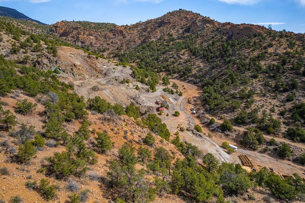
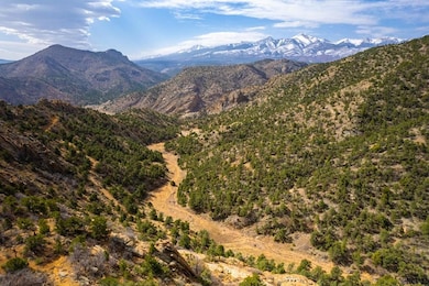
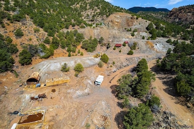
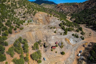
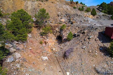
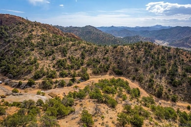
Large business opportunity with this 132 acre property was once home to the 1800's era Cotopaxi Mine. North of Hwy 50 in Cotopaxi Colorado, both parcels are being sold together and feature mineral and water rights. This property includes multiple patented mining claims and is surrounded by BLM land. So much history and minerals to be discovered on this land of endless opportunity. Some of the minerals pulled out of this mine include Gold, Silver, Copper, Mica, Molybdenum and much more. Panoramic views of the Sangre de Cristos, Wet Mountains and other local peaks (Mount Otto, Galena Peak, and others). Mine is not currently being used for active production. Reports are available about the mineral deposits present in the mine. This unique, once in a lifetime property is a must see!!
Listing Agent
Keller Williams Performance Realty Brokerage Phone: 7192697355 Listed on: 10/08/2024

Property Details
Property Type
- Land
Est. Annual Taxes
- $410
Lot Details
- 132 Acre Lot
Schools
- Cotopaxi Elementary School
Listing and Financial Details
- Assessor Parcel Number 79000160 & 170
Map
Home Values in the Area
Average Home Value in this Area
Property History
| Date | Event | Price | List to Sale | Price per Sq Ft |
|---|---|---|---|---|
| 07/23/2025 07/23/25 | For Sale | $8,000,000 | 0.0% | -- |
| 07/23/2025 07/23/25 | Off Market | $8,000,000 | -- | -- |
| 10/08/2024 10/08/24 | For Sale | $8,000,000 | -- | -- |
Source: Royal Gorge Association of REALTORS®
MLS Number: 71587
Disclaimer: Certain information contained herein is derived from information provided by parties other than Homes.com. All information provided is deemed reliable, but is not guaranteed to be accurate and should be independently verified.
![]() IDX information is provided exclusively for personal, non-commercial use, and may not be used for any purpose other than to identify prospective properties consumers may be interested in purchasing. Information is deemed reliable but not guaranteed.
IDX information is provided exclusively for personal, non-commercial use, and may not be used for any purpose other than to identify prospective properties consumers may be interested in purchasing. Information is deemed reliable but not guaranteed.
- 50 County Road 12
- TBD 26th Trail
- 14527 Highway 50
- 16373 U S 50
- 830 High Peaks Ranch Rd
- 14564 Highway 50 Unit 2
- 350 Sangre de Cristo
- 13564 County Road 45
- 0 Tbd County Road 45
- 4351 County Road 12
- 47 Dinkle Ditch Rd
- 24938 Us Highway 50
- 758 Basin Dr
- 2490 County Road 1a
- 2490 Co Rd 1a
- 161 Shannon Rd
- 25500 U S 50
- 1310 Sunrise Ridge
- 11648 County Road 45
- 640 Ridgeway Dr