
TBD County Road 203 Burnet, TX 78611
Estimated payment $1,531/month
Total Views
1,078
10
Acres
$23,000
Price per Acre
435,600
Sq Ft Lot
About This Lot
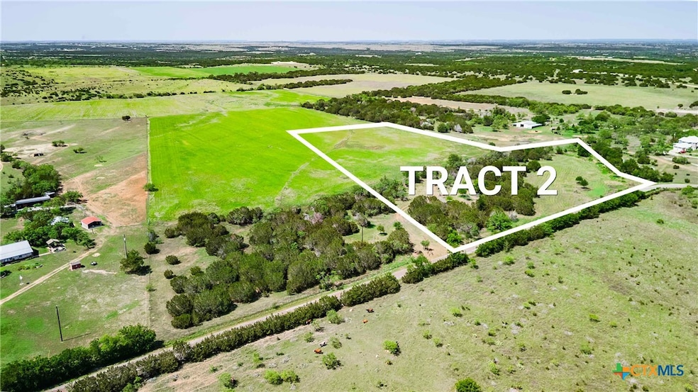
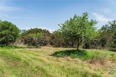
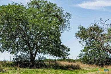
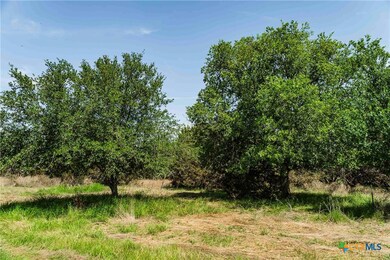
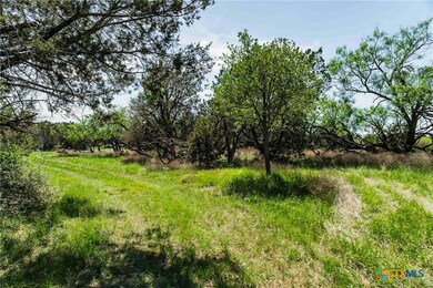
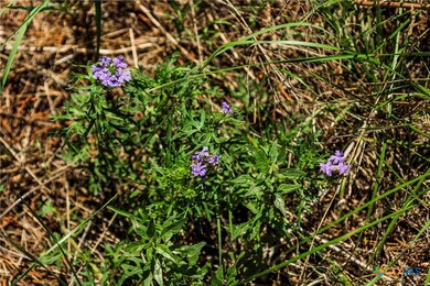
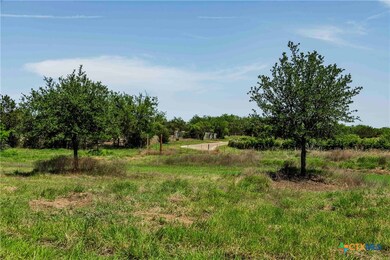
+- 10-acre Hill Country homesite in north central Burnet County. This tract is about 30% wooded with oaks, junipers, mesquites and other native trees. The remaining acreage is part of an active hayfield (WW-B Dahl Bluestem drought resistant grass) with lush improved pasture that will provide ample grazing for horses or other livestock. The Doss silty clay soil will support crops as well as highly improved pasture grasses. Includes an area that was once a stock pond that could easily be rebuilt. Access to the property is easy with over 550 feet of frontage on County Road 203. Electricity is available near the County Road and the property sits on the Trinity Aquifer for ample water supply. Light restrictions will be put in place to protect landowners in the future.Located roughly 12 miles NE of Burnet, 12 miles NW of Bertram, 22 miles to Liberty Hill, 37 miles to Georgetown, and 48 miles to Round Rock and 56 miles to downtown Austin. Currently under 1-D-1 Ag valuation (low property taxes).Seller to reserve mineral rights.
Listing Agent
Keller Williams - Lake Travis Brokerage Phone: 830-265-1239 License #0696749 Listed on: 05/27/2025
Property Details
Property Type
- Land
Est. Annual Taxes
- $3,120
Lot Details
- 10 Acre Lot
- Property fronts a county road
- Barbed Wire
- Partially Wooded Lot
Schools
- Shady Grove Elementary School
- Burnet Middle School
- Burnet High School
Utilities
- Septic Needed
Listing and Financial Details
- Assessor Parcel Number 50629
Map
Create a Home Valuation Report for This Property
The Home Valuation Report is an in-depth analysis detailing your home's value as well as a comparison with similar homes in the area
Home Values in the Area
Average Home Value in this Area
Property History
| Date | Event | Price | Change | Sq Ft Price |
|---|---|---|---|---|
| 07/25/2025 07/25/25 | Sold | -- | -- | -- |
| 05/29/2025 05/29/25 | For Sale | $230,000 | -- | -- |
Source: Central Texas MLS (CTXMLS)
Similar Property in Burnet, TX
Source: Central Texas MLS (CTXMLS)
MLS Number: 581673
Disclaimer: Certain information contained herein is derived from information provided by parties other than Homes.com. All information provided is deemed reliable, but is not guaranteed to be accurate and should be independently verified.
![]() Listing and property data is from an Internet Data Exchange (IDX) provided by the Central Texas MLS.
Listing and property data is from an Internet Data Exchange (IDX) provided by the Central Texas MLS.
Some properties which appear for sale on the website may no longer be available because they are for instance, under contract, sold or are no longer being offered for sale.
IDX information is provided exclusively for personal, non-commercial use, and may not be used for any purpose other than to identify prospective properties consumers may be interested in purchasing.
Information is deemed reliable but not guaranteed.
Copyright 2025 Central Texas MLS, All Rights Reserved.
Nearby Homes
- 1620 County Road 203
- TBD Tract 2 County Road 203
- 3250 County Road 202
- TBD County Road 202
- 2940 County Road 203
- 4220 County Road 202
- 0 Cr 207 Unit 557059
- Lot 5 Cr 207
- Lot 4 Cr 207
- Tract 2 Cr 207
- Lot 1 Cr 207
- Lot 8 Cr 207
- Lot 7 Cr 207
- Lot 3 Cr 207
- Lot 2 Cr 207
- TBD County Road 207
- 0 County Road 207
- Tract 7 County Road 207
- 614 County Road 207
- TBD Fm 2340
- 3528 N Fm 1174
- 1333 Spicewood Dr
- 108 Cinnamon Loop
- 300 E 3rd St
- 105 Northgate Cir
- 452 Hunter Loop
- 719 Co Rd 304
- 719 County Road 304
- 201 S Rhomberg St
- 309 E Pecan St Unit 2
- 205 E Elm St
- 1001 S Main St
- 208 Bunting Ln
- 225 Western Ave
- 310 E Cedar St
- 330 E Cedar St
- 556 E Cedar St
- 502 Willow St Unit 4
- 506 Willow St Unit 6
- 506 Willow St Unit 2