
TBD Ffr 2127k Rd Unit Lat: 46.40901, Lon: Iron River, MI 49935
Estimated payment $1,751/month
Highlights
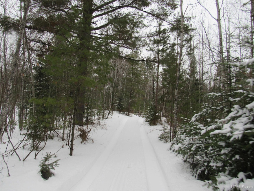
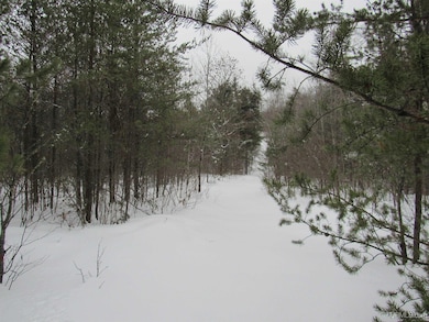
- 240 Acre Lot
- Adjoins Government Land
- Property is near a pond
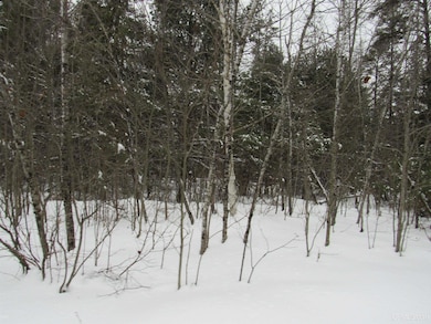
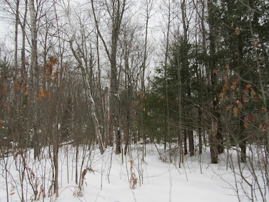
- Wooded Lot
- Lot Has A Rolling Slope
About This Lot
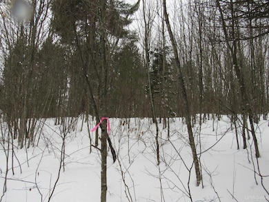
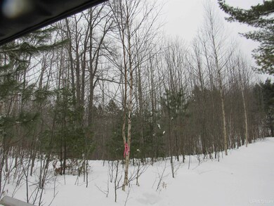
SECLUDED UPPER PENINSULA OF MICHIGAN 240+/- ACRE RECREATIONAL PARCEL! This property is located in the northwestern corner of the northern rectangle of Bates Township in Iron County, in the Upper Peninsula of Michigan. - The property is surrounded by Ottawa National Forest Lands – With its 988,000 acres , it offers recreational opportunities for boating, camping, picnicking, fishing, hiking, hunting, kayaking, skiing, observation of wildlife and native plants, and other outdoor activities! These National Forest Lands have over 300 lakes stocked by the MDNR, and over 1,200 miles of Trout Streams. - The eastern border of the property nearly touches the East Branch of the Ontonagon River which flows northward 54 miles to the confluence with the Middle Branch of the Ontonagon River. Coldwater fish species predominate these river bodies (parts of which are designated trout streams) and are accessible to fish migrating from Lake Superior. There also a few ponds located on the property. - Lake St. Kathryn a mile+/- southwest of the parcel offered for sale, is known for Northern pike, Walleye, Bass and Perch fishing! - Perch Lake, three miles southwest of the property, is the largest water body in the County, with 994 acres. This lake has good numbers of Walleyes, Northern pike, Largemouth bass and Perch. - The Hanna Webb Lake four miles straight south of the property, is one of the Brook Trout "Better Fishing Waters" as designated by the Michigan Department of Natural Resources (DNR). - These water bodies attract wildlife of all kinds! Wildlife species found in the area include large mammals such as white-tailed deer, black bear, coyote, wolf, and bobcat, as well as small mammals such as squirrel, rabbit, chipmunk, racoon, otter, beaver, skunk and fox. Seasonal and year-round bird species are seen in the area including songbirds, shore and water birds, and game birds. - The Porter Lake-Sidnaw Multi-Use State Trail Number 15 runs just to the west of the parcel. This is a state-designated snowmobile trail in winter which is used primarily for an off-road vehicle (ORV)/all-terrain vehicle (ATV) trail in other seasons. This network of trails connects with other trails across the Upper Midwest. - The property is characterized by rolling hills and some 20-foot high peaks. - The most common trees on this parcel are Aspen Stands, with other species like northern hardwoods, oak, spruce, mixed conifers, red pine, jack pine, and some areas of mixed swamp conifers. There are several open areas that are grass and fern covered. This diversity will promote wildlife habitation. - There are about six miles of trails throughout the property. - The parcel is enrolled in the Michigan CFA Program. This Voluntary Program provides a tax incentive to landowners to retain and manage their forestland for long-term timber production and to provide foot access to the public for hunting, trapping and fishing.... For Complete Text See Associated Documents
Property Details
Property Type
- Land
Est. Annual Taxes
- $324
Lot Details
- 240 Acre Lot
- 2,640 Ft Wide Lot
- Adjoins Government Land
- Rural Setting
- Lot Has A Rolling Slope
- Wooded Lot
- Property is zoned Agricultural, Recreational
Outdoor Features
- Property is near a pond
Listing and Financial Details
- Assessor Parcel Number 001-206-010-00
Map
Home Values in the Area
Average Home Value in this Area
Tax History
| Year | Tax Paid | Tax Assessment Tax Assessment Total Assessment is a certain percentage of the fair market value that is determined by local assessors to be the total taxable value of land and additions on the property. | Land | Improvement |
|---|---|---|---|---|
| 2025 | -- | $0 | $0 | $0 |
| 2024 | $3 | $0 | $0 | $0 |
| 2023 | -- | $0 | $0 | $0 |
| 2022 | -- | $0 | $0 | $0 |
| 2021 | $288 | $0 | $0 | $0 |
| 2020 | -- | $0 | $0 | $0 |
| 2019 | -- | $0 | $0 | $0 |
| 2018 | -- | $0 | $0 | $0 |
| 2016 | -- | $0 | $0 | $0 |
| 2015 | -- | $0 | $0 | $0 |
| 2014 | -- | $0 | $0 | $0 |
| 2013 | -- | $0 | $0 | $0 |
| 2012 | -- | $0 | $0 | $0 |
Property History
| Date | Event | Price | List to Sale | Price per Sq Ft |
|---|---|---|---|---|
| 02/07/2025 02/07/25 | For Sale | $328,000 | -- | -- |
Source: Upper Peninsula Association of REALTORS®
MLS Number: 50166193
APN: 001-206-010-00
Disclaimer: Certain information contained herein is derived from information provided by parties other than Homes.com. All information provided is deemed reliable, but is not guaranteed to be accurate and should be independently verified.
![]() IDX information is provided exclusively for personal, non-commercial use, and may not be used for any purpose other than to identify prospective properties consumers may be interested in purchasing. Information is deemed reliable but not guaranteed.
IDX information is provided exclusively for personal, non-commercial use, and may not be used for any purpose other than to identify prospective properties consumers may be interested in purchasing. Information is deemed reliable but not guaranteed.
- 14108 Fire Tower Rd
- 14108 Fire Tower Rd Unit Lat: 46.49372 Lon: -
- TBD85 Sidnaw Rd S
- 13469 Michigan 28
- 527 Usfs Rd 2130 Rd
- 7349 E Old M28 Rd
- 130 Kings Rd
- 130 Kings Rd
- 33.85 Acres E Cable Lake Rd
- 301A-301B Robinson Lake Rd
- 161 Porter Lake Rd
- 2072 Ff Hwy 16 Rd
- 1207 Net River Rd
- 190 Cable Lake Rd
- 33 acres off Net River Rd
- TBD 5 5ac Fishing Site 1 Rd
- TBD Forest 3612 Rd
- Off Forest Rd
- Off Forest Rd 3612 Rd
- U S 141
