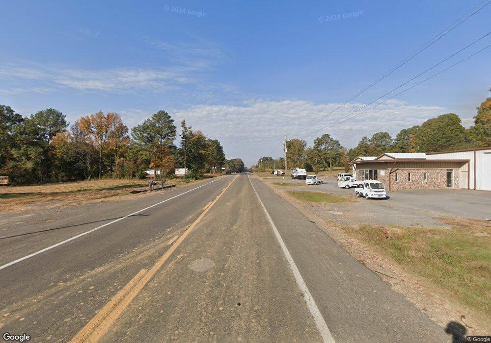
TBD Hwy 59 Gravette, AR 72736
Estimated Value: $663,000
--
Bed
--
Bath
--
Sq Ft
0.75
Acres
About This Home
This home is located at TBD Hwy 59, Gravette, AR 72736 and is currently priced at $663,000. TBD Hwy 59 is a home located in Benton County with nearby schools including Glenn Duffy Elementary School, Gravette Upper Elementary School, and Gravette Middle School.
Ownership History
Date
Name
Owned For
Owner Type
Purchase Details
Closed on
Jun 7, 2005
Sold by
Foster Charles C and Foster Pearl R
Bought by
Mitchell Donald Rex and Mitchell Mary Beth
Current Estimated Value
Home Financials for this Owner
Home Financials are based on the most recent Mortgage that was taken out on this home.
Original Mortgage
$1,700,000
Interest Rate
5.78%
Mortgage Type
FHA
Purchase Details
Closed on
Jun 1, 1998
Bought by
36 Barber 1 and 36 Ac
Create a Home Valuation Report for This Property
The Home Valuation Report is an in-depth analysis detailing your home's value as well as a comparison with similar homes in the area
Home Values in the Area
Average Home Value in this Area
Purchase History
| Date | Buyer | Sale Price | Title Company |
|---|---|---|---|
| Mitchell Donald Rex | $1,506,000 | Waco Title Company | |
| 36 Barber 1 | -- | -- | |
| 36 Barber 1 | $51,000 | -- |
Source: Public Records
Mortgage History
| Date | Status | Borrower | Loan Amount |
|---|---|---|---|
| Closed | Mitchell Donald Rex | $1,700,000 |
Source: Public Records
Tax History Compared to Growth
Tax History
| Year | Tax Paid | Tax Assessment Tax Assessment Total Assessment is a certain percentage of the fair market value that is determined by local assessors to be the total taxable value of land and additions on the property. | Land | Improvement |
|---|---|---|---|---|
| 2025 | $812 | $16,204 | $16,204 | -- |
| 2024 | $795 | $16,204 | $16,204 | $0 |
| 2023 | $795 | $16,204 | $16,204 | $0 |
| 2022 | $874 | $16,970 | $16,200 | $770 |
| 2021 | $452 | $16,580 | $15,810 | $770 |
| 2020 | $405 | $7,860 | $7,110 | $750 |
| 2019 | $405 | $7,860 | $7,110 | $750 |
| 2018 | $405 | $7,860 | $7,110 | $750 |
| 2017 | $386 | $7,860 | $7,110 | $750 |
| 2016 | $386 | $7,860 | $7,110 | $750 |
| 2015 | $486 | $9,850 | $9,120 | $730 |
| 2014 | $486 | $9,850 | $9,120 | $730 |
Source: Public Records
Map
Nearby Homes
- 108 Boston St NE
- 0 Arkansas 72
- 105 4th Ave SE
- 111 5th Ave SW
- 0 SW Dallas St
- 508 2nd Ave SW
- 207 White Oak Dr NE
- 608 Birmingham St SE
- 515 2nd Ave SW
- 802 & 804 NW Baker St
- 806 & 808 NW Baker St
- 704 2nd Ave SW
- 609 6th Ave SW
- 1001 Main St SE
- 802 2nd Ave SE
- 1111 Rocky Dell Rd NE
- 300 Huntington St SW
- 101 Nelson Park Rd SW
- 105 Nelson Park Rd SW
- 408 Lion Dr N
- 102 Boston St NE
- 309 1st Ave NW
- 308 1st Ave NE
- 308 1st Ave SE
- 308 1st Ave SW
- 104 Boston St NE
- Lot 4 Missing Ridge
- 103 Chicago St NE
- 210 1st Ave
- 106 Boston St NE
- 105 Chicago St NE
- 404 1st Ave SE
- 305 2nd Ave NE
- 303 2nd Ave NE
- 107 Chicago St NE
- 307 2nd Ave NE
- 207 2nd Ave NE
- 104 Akron St NE
- 198 1st Ave NE
- 194 1st Ave NE
