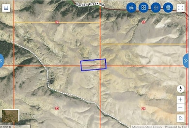
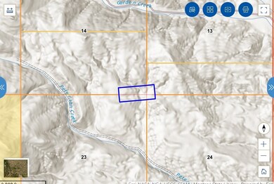
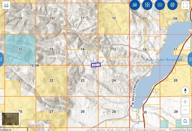
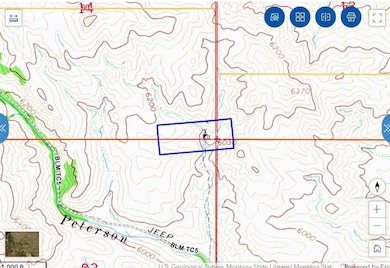
TBD Sheridan, MT 59749
Estimated payment $185/month
Total Views
11,264
21
Acres
$1,612
Price per Acre
899,950
Sq Ft Lot
About This Lot
Welcome to the Bayard Lode. THIS PROPERTY IS FRACTIONAL OWNERSHIP. Here is your chance to own an UNDIVIDED 15% INTEREST, in 20.66 acres. Shared with approximately 5 additional owners, this property sits surrounded private lands. Come play in the dirt and STAKE YOUR CLAIM!!! All information is deemed reliable but not guaranteed. Buyer's and buyers' agent to perform due diligence to buyers' satisfaction.
Property Details
Property Type
- Land
Est. Annual Taxes
- $8
Lot Details
- 20.66 Acre Lot
Community Details
- No Home Owners Association
Listing and Financial Details
- Assessor Parcel Number 25033014401010000
Map
Create a Home Valuation Report for This Property
The Home Valuation Report is an in-depth analysis detailing your home's value as well as a comparison with similar homes in the area
Home Values in the Area
Average Home Value in this Area
Tax History
| Year | Tax Paid | Tax Assessment Tax Assessment Total Assessment is a certain percentage of the fair market value that is determined by local assessors to be the total taxable value of land and additions on the property. | Land | Improvement |
|---|---|---|---|---|
| 2024 | $8 | $1,138 | $0 | $0 |
| 2023 | $8 | $1,138 | $0 | $0 |
| 2022 | $9 | $1,144 | $0 | $0 |
| 2021 | $9 | $1,144 | $0 | $0 |
| 2020 | $8 | $1,064 | $0 | $0 |
| 2019 | $8 | $1,064 | $0 | $0 |
| 2018 | $8 | $994 | $0 | $0 |
| 2017 | $10 | $994 | $0 | $0 |
| 2016 | $9 | $920 | $0 | $0 |
| 2015 | $9 | $920 | $0 | $0 |
| 2014 | $9 | $843 | $0 | $0 |
Source: Public Records
Property History
| Date | Event | Price | Change | Sq Ft Price |
|---|---|---|---|---|
| 08/20/2024 08/20/24 | For Sale | $33,310 | -- | -- |
Source: Montana Regional MLS
Source: Montana Regional MLS
MLS Number: 30032553
APN: 25-0330-14-4-01-01-0000
Nearby Homes
- TBD Bayard Lode Sur No 2169 20 66 Ac - Mining Claim
- Lot 1A Spring Canyon Rd
- 17 Texs Loop
- Lot 1A Spring Creek Rd
- 2325 Mt Hwy 287
- 747 Upper Ruby Rd
- TBD Way Up Lode Sur 7310 15 71 Acres - Mining Claim
- TBD Bell Lode Sur 1320 19 48 Ac - Mining Claim
- TBD Wilson Lode Sur 10360 19 43 Ac
- TBD Wilson Lode Sur 10360 19 43 Ac -Mining Claim
- 1511 Montana 287
- 296 Anderson Ln
- 115 W Cover St
- 209 Madison St
- 105 W Cover St
- 115 E Idaho St
- 209 E Idaho St
- TBD Way Up Lode Sur 7310 15 71 Ac -Mining Claim
- 199 LOTS In Multiple Locations
- 199 LOTS Multiple Locations Within Vc City Limits


