M
Seller's Agent in 2018
Mike McCashland
Silver Peaks Realty


Estimated Value: $714,505
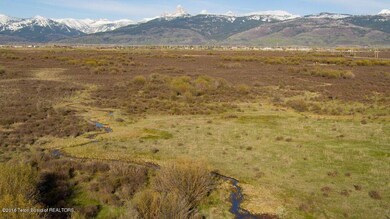
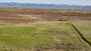
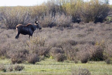
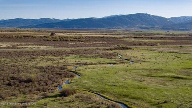
LIVE WATER AND TETON VIEWS!!! Just minutes from Downtown Driggs sits the perfect 20 acre parcel. Close to town yet large enough for privacy. Springs and streams provide fishing opportunities right out your door. Enjoy the Moose, Elk, Deer and waterfowl that also call this property home. 2 golf courses, the Teton River and downtown Driggs are all within 5 minutes of this property.
Last Agent to Sell the Property
Mike McCashland
Silver Peaks Realty License #SP40997 Listed on: 12/15/2017
Last Buyer's Agent
Karin Wertheim
Silver Peaks Realty License #SP30107
| Date | Buyer | Sale Price | Title Company |
|---|---|---|---|
| Cigole Patrick H | -- | First American Title Driggs |
| Date | Status | Borrower | Loan Amount |
|---|---|---|---|
| Open | Cigole Patrick H | $447,300 |
| Date | Event | Price | List to Sale | Price per Sq Ft |
|---|---|---|---|---|
| 10/30/2018 10/30/18 | Sold | -- | -- | -- |
| 09/25/2018 09/25/18 | Pending | -- | -- | -- |
| 05/03/2016 05/03/16 | For Sale | $275,000 | -- | -- |
| Year | Tax Paid | Tax Assessment Tax Assessment Total Assessment is a certain percentage of the fair market value that is determined by local assessors to be the total taxable value of land and additions on the property. | Land | Improvement |
|---|---|---|---|---|
| 2025 | $1,857 | $1,040,000 | $1,040,000 | $0 |
| 2024 | $3,183 | $960,000 | $960,000 | $0 |
| 2023 | $3,183 | $960,000 | $960,000 | $0 |
| 2022 | $3,787 | $950,000 | $950,000 | $0 |
| 2021 | $3,901 | $600,000 | $600,000 | $0 |
| 2020 | $3,977 | $500,000 | $500,000 | $0 |
| 2019 | $3,916 | $500,000 | $500,000 | $0 |
| 2018 | $183 | $25,600 | $25,600 | $0 |
| 2017 | $159 | $24,900 | $24,900 | $0 |
| 2016 | $3,338 | $400,000 | $400,000 | $0 |
| 2015 | $281 | $28,409 | $28,409 | $0 |
| 2011 | -- | $25,853 | $25,853 | $0 |
M
Seller's Agent in 2018
Mike McCashland
Silver Peaks Realty
K
Buyer's Agent in 2018
Karin Wertheim
Silver Peaks Realty
Source: Teton Board of REALTORS®
MLS Number: 16-922
APN: RP05N45E284800
Ask me questions while you tour the home.