
Seller's Agent in 2020
Nicole Rabe
Berkshire Hathaway HomeServices Yost & Little Realty
(336) 689-9988
91 Total Sales
Estimated Value: $428,366
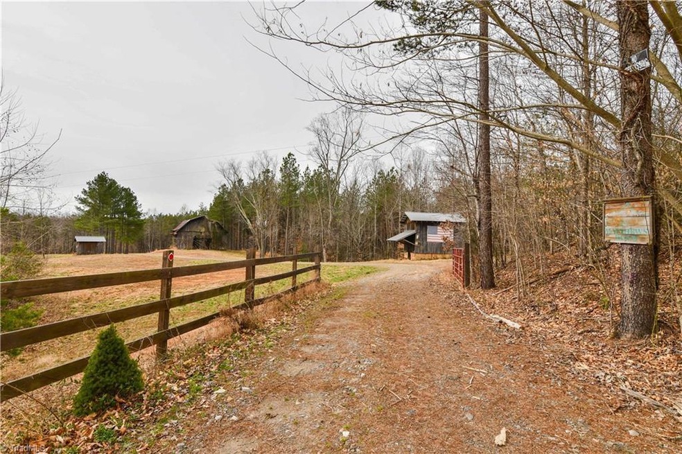
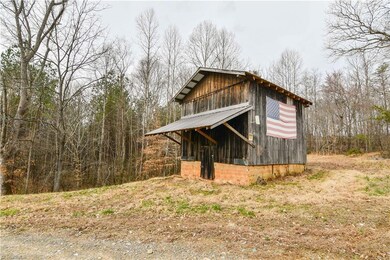
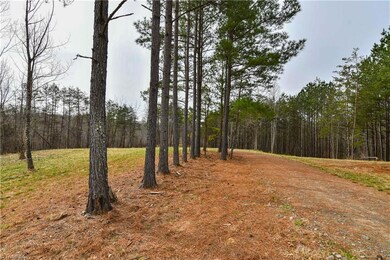
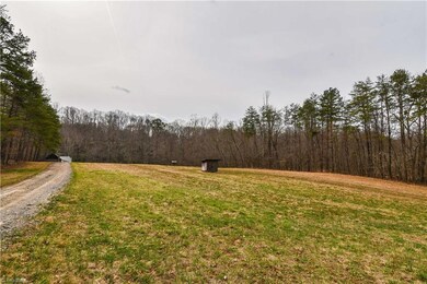
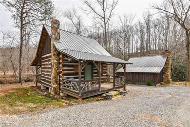
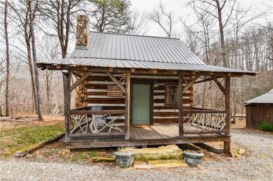
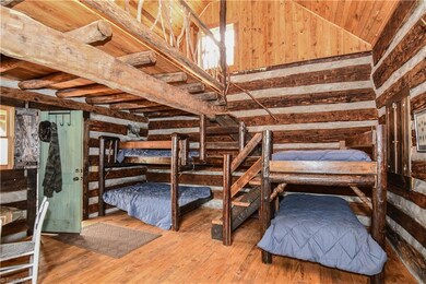
Incredible opportunity to own a truly unique property! 30.03 Acres with tons of Toms Creek frontage! 2 gated entrances, well on site, multiple barns, bunk house and screen house built from materials sourced from the land, gravel road through property, several large areas of cleared land could be used for any numerous purposes! Build your dream home or enjoy your weekend retreat away from it all!
Last Agent to Sell the Property
Berkshire Hathaway HomeServices Yost & Little Realty License #227115 Listed on: 03/02/2019
| Date | Buyer | Sale Price | Title Company |
|---|---|---|---|
| Delong Matthew | $259,500 | None Available |
| Date | Status | Borrower | Loan Amount |
|---|---|---|---|
| Closed | Delong Matthew | $220,575 |
| Date | Event | Price | List to Sale | Price per Sq Ft |
|---|---|---|---|---|
| 11/25/2020 11/25/20 | Sold | $259,500 | -- | -- |
| Year | Tax Paid | Tax Assessment Tax Assessment Total Assessment is a certain percentage of the fair market value that is determined by local assessors to be the total taxable value of land and additions on the property. | Land | Improvement |
|---|---|---|---|---|
| 2025 | $795 | $155,140 | $125,850 | $29,290 |
| 2024 | $802 | $136,230 | $125,850 | $10,380 |
| 2023 | $787 | $136,230 | $125,850 | $10,380 |
| 2022 | $787 | $136,230 | $125,850 | $10,380 |
| 2021 | $802 | $136,230 | $125,850 | $10,380 |
| 2020 | $753 | $121,010 | $121,010 | $0 |
| 2019 | $753 | $121,010 | $121,010 | $0 |
| 2018 | $739 | $121,010 | $0 | $0 |
| 2017 | $753 | $121,010 | $0 | $0 |
| 2016 | $753 | $121,010 | $0 | $0 |
Seller's Agent in 2020
Nicole Rabe
Berkshire Hathaway HomeServices Yost & Little Realty
(336) 689-9988
91 Total Sales
Seller Co-Listing Agent in 2020
Beth Brannan
Berkshire Hathaway HomeServices Yost & Little Realty
(336) 253-4693
105 Total Sales
C
Buyer's Agent in 2020
Charlie Watkins
Leonard Ryden Burr Real Estate
(336) 909-3230
168 Total Sales
Source: Triad MLS
MLS Number: 919261
APN: 5966-02-59-0961
Disclaimer: Certain information contained herein is derived from information provided by parties other than Homes.com. All information provided is deemed reliable, but is not guaranteed to be accurate and should be independently verified.
![]() Copyright 2025 Triad MLS, Inc. All rights reserved. IDX information is provided exclusively for personal, non-commercial use, and may not be used for any purpose other than to identify prospective properties consumers may be interested in purchasing. Information is deemed reliable but not guaranteed. This site will be monitored for ‘scraping’ and any use of search facilities of data on the site other than by potential buyers/sellers is prohibited. All Sale data is for informational purposes only and is not an indication of a market analysis or appraisal. Properties marked with the Triad MLS, Inc. icon are provided courtesy of the Triad MLS, Inc.’s, Internet Data Exchange Database.
Copyright 2025 Triad MLS, Inc. All rights reserved. IDX information is provided exclusively for personal, non-commercial use, and may not be used for any purpose other than to identify prospective properties consumers may be interested in purchasing. Information is deemed reliable but not guaranteed. This site will be monitored for ‘scraping’ and any use of search facilities of data on the site other than by potential buyers/sellers is prohibited. All Sale data is for informational purposes only and is not an indication of a market analysis or appraisal. Properties marked with the Triad MLS, Inc. icon are provided courtesy of the Triad MLS, Inc.’s, Internet Data Exchange Database.