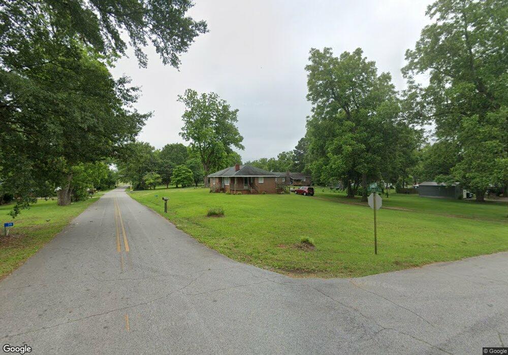
TRACT A-2 Edwards Rd Yatesville, GA 31097
Estimated Value: $145,000 - $282,000
3
Beds
1
Bath
2,400
Sq Ft
$89/Sq Ft
Est. Value
About This Home
This home is located at TRACT A-2 Edwards Rd, Yatesville, GA 31097 and is currently estimated at $213,500, approximately $88 per square foot. TRACT A-2 Edwards Rd is a home located in Upson County with nearby schools including Upson-Lee South Elementary School, Upson-Lee North Elementary School, and Upson-Lee Middle School.
Ownership History
Date
Name
Owned For
Owner Type
Purchase Details
Closed on
Nov 12, 2019
Sold by
Long Denice E Boyt
Bought by
Long John Wesley and Long Lindsay Noelle
Current Estimated Value
Purchase Details
Closed on
May 22, 2015
Sold by
Long Denice Boyt
Bought by
Long Denice Boyt John and Long Denice Boy John W
Purchase Details
Closed on
Feb 23, 2015
Sold by
Herron Karen
Bought by
Long Denice Boyt
Purchase Details
Closed on
Apr 12, 2013
Sold by
Herron Frank
Bought by
Herron Karen
Create a Home Valuation Report for This Property
The Home Valuation Report is an in-depth analysis detailing your home's value as well as a comparison with similar homes in the area
Home Values in the Area
Average Home Value in this Area
Purchase History
| Date | Buyer | Sale Price | Title Company |
|---|---|---|---|
| Long John Wesley | -- | -- | |
| Long Denice Boyt John | -- | -- | |
| Long Denice Boyt | -- | -- | |
| Herron Karen | -- | -- |
Source: Public Records
Tax History Compared to Growth
Tax History
| Year | Tax Paid | Tax Assessment Tax Assessment Total Assessment is a certain percentage of the fair market value that is determined by local assessors to be the total taxable value of land and additions on the property. | Land | Improvement |
|---|---|---|---|---|
| 2024 | $1,143 | $23,640 | $6,721 | $16,919 |
| 2023 | $524 | $20,232 | $6,721 | $13,512 |
| 2022 | $561 | $20,233 | $6,721 | $13,512 |
| 2021 | $533 | $20,233 | $6,721 | $13,512 |
| 2020 | $571 | $20,233 | $6,721 | $13,512 |
| 2019 | $1,531 | $49,954 | $6,721 | $43,233 |
| 2018 | $1,532 | $49,954 | $6,721 | $43,233 |
| 2017 | $1,232 | $36,647 | $6,721 | $29,926 |
| 2016 | $1,201 | $35,127 | $6,000 | $29,127 |
| 2015 | $1,203 | $35,198 | $6,086 | $29,112 |
| 2014 | -- | $35,198 | $6,086 | $29,112 |
Source: Public Records
Map
Nearby Homes
- 1338 Edwards Rd
- 351 Main St
- 305 Zellner Rd
- 0 Rest Haven Rd Unit 10652109
- 2200 Rest Haven Rd
- 0 Ramah Church Rd Unit 10480661
- 0 Ramah Church Rd Unit 7542675
- 832 Jackson Dr
- 3487 Yatesville Hwy
- 0 Jordan Bottoms Rd Unit 25051630
- 1570 the Rock Rd
- 1505 Willis Rd
- 1518 the Rock Rd
- 1972 Rest Haven Rd
- 500 Askin Place
- 144 Means Rd
- 1031 the Rock Rd
- 0 Kendall Dr Unit 10584739
- 235 Rocky Branch Rd
- 1904 U S 341
- 4.4 ACRES Edwards Rd
- LOT 4 Edwards Rd
- LOT 3 Edwards Rd
- LOT 2 Edwards Rd
- 180 Empire St
- 180 Empire St
- 183 Empire St
- 171 College St
- 45 Empire St
- 135 Edwards Rd
- 187 College St
- 195 College St
- 129 Empire St
- 95 Logtown Rd
- 140 Empire St
- 147 Jackson St
- 214 College St
- 121 Edwards Rd
- 151 College St
- 128 Empire St