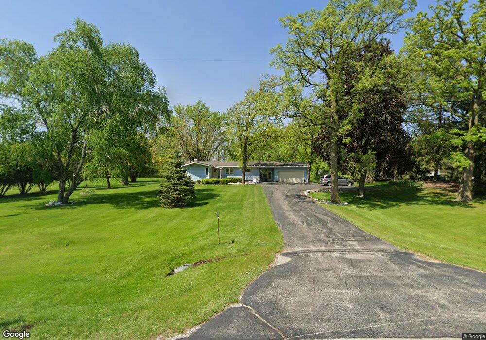
W10359 State Road 49 Waupun, WI 53963
Estimated Value: $409,455 - $466,000
--
Bed
--
Bath
--
Sq Ft
5.39
Acres
About This Home
This home is located at W10359 State Road 49, Waupun, WI 53963 and is currently estimated at $435,152. W10359 State Road 49 is a home located in Fond du Lac County with nearby schools including Meadow View Primary School, Rock River Intermediate School, and Waupun Area Junior High School.
Ownership History
Date
Name
Owned For
Owner Type
Purchase Details
Closed on
Nov 23, 2020
Sold by
Randrup Roger R and Roger R Randruop Trust
Bought by
Elgersma Douglas J and Elgersma Elisabeth J
Current Estimated Value
Home Financials for this Owner
Home Financials are based on the most recent Mortgage that was taken out on this home.
Original Mortgage
$285,000
Outstanding Balance
$253,610
Interest Rate
2.8%
Mortgage Type
New Conventional
Estimated Equity
$181,542
Purchase Details
Closed on
Aug 27, 2019
Sold by
Randrup Roger R
Bought by
Randrup Roger R and Roger R Randrup Trust
Create a Home Valuation Report for This Property
The Home Valuation Report is an in-depth analysis detailing your home's value as well as a comparison with similar homes in the area
Home Values in the Area
Average Home Value in this Area
Purchase History
| Date | Buyer | Sale Price | Title Company |
|---|---|---|---|
| Elgersma Douglas J | $300,000 | Guaranty Title Services Inc | |
| Randrup Roger R | -- | None Available |
Source: Public Records
Mortgage History
| Date | Status | Borrower | Loan Amount |
|---|---|---|---|
| Open | Elgersma Douglas J | $285,000 |
Source: Public Records
Tax History Compared to Growth
Tax History
| Year | Tax Paid | Tax Assessment Tax Assessment Total Assessment is a certain percentage of the fair market value that is determined by local assessors to be the total taxable value of land and additions on the property. | Land | Improvement |
|---|---|---|---|---|
| 2024 | $3,589 | $332,400 | $68,000 | $264,400 |
| 2023 | $3,198 | $188,700 | $41,600 | $147,100 |
| 2022 | $3,033 | $188,700 | $41,600 | $147,100 |
| 2021 | $2,936 | $188,700 | $41,600 | $147,100 |
| 2020 | $2,661 | $170,500 | $41,600 | $128,900 |
| 2019 | $2,689 | $170,500 | $41,600 | $128,900 |
| 2018 | $2,698 | $170,500 | $41,600 | $128,900 |
| 2017 | $2,671 | $170,500 | $41,600 | $128,900 |
| 2016 | $2,903 | $170,200 | $35,500 | $134,700 |
| 2015 | $3,071 | $170,200 | $35,500 | $134,700 |
| 2014 | $3,089 | $170,200 | $35,500 | $134,700 |
| 2013 | $3,237 | $170,200 | $35,500 | $134,700 |
Source: Public Records
Map
Nearby Homes
- 18 Pluim Dr Unit 16
- 18 Pluim Dr Unit 13
- 395 Fond du Lac St
- 380 Fond du Lac St
- 134 N Watertown St
- 516 Doty St
- 516 E Lincoln St
- 327 Carrington St
- 614 Carrington St
- 315 E Main St
- 231 Woodland Dr
- 25 W Franklin St
- 517 W Jefferson St
- 17.92 Ac Pattee Dr
- 295 Harmsen Ave
- 736 Fern St
- 806 Rock River Ave
- W12681 County As
- 109 Filbey St
- 341 Leona Way
- N2511 Banner Rd
- W10359 Wisconsin 49
- W10347 State Road 49
- W10345 State Road 49
- W10345 Wisconsin 49
- N2543 Banner Rd
- W5593 State Road 49
- W5559 Hwy 49
- N2561 Banner Rd
- N2561 Banner Rd
- N2609 Prairie Hill Cir
- N2610 Prairie Hill Cir
- W10388 Prairie Hill Rd
- Lot 11 Prairie Hill Cir
- 0 Prairie Hill Cir
- N2621 Prairie Hill Cir
- W10475 State Road 49
- N2591 Banner Rd
- W10475 Wisconsin 49
- N2639 Prairie Hill Cir