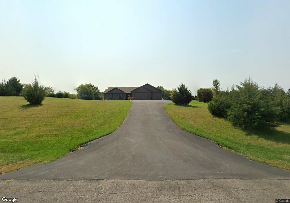
W10863 522nd Ave Prescott, WI 54021
Estimated Value: $432,843 - $1,206,000
--
Bed
--
Bath
--
Sq Ft
3.01
Acres
About This Home
This home is located at W10863 522nd Ave, Prescott, WI 54021 and is currently estimated at $721,948. W10863 522nd Ave is a home with nearby schools including Malone Elementary School, Prescott Middle School, and Prescott High School.
Ownership History
Date
Name
Owned For
Owner Type
Purchase Details
Closed on
Oct 24, 2014
Sold by
Associated Bank N A
Bought by
Diane Mcgee William Mcgee
Current Estimated Value
Home Financials for this Owner
Home Financials are based on the most recent Mortgage that was taken out on this home.
Original Mortgage
$17,910
Outstanding Balance
$14,935
Interest Rate
6.75%
Mortgage Type
Adjustable Rate Mortgage/ARM
Estimated Equity
$707,013
Purchase Details
Closed on
Jun 23, 2014
Sold by
Uttenhove Michael K and Uttenhove Gay L
Bought by
Associated Bank Na
Create a Home Valuation Report for This Property
The Home Valuation Report is an in-depth analysis detailing your home's value as well as a comparison with similar homes in the area
Home Values in the Area
Average Home Value in this Area
Purchase History
| Date | Buyer | Sale Price | Title Company |
|---|---|---|---|
| Diane Mcgee William Mcgee | $19,900 | -- | |
| Associated Bank Na | $19,000 | None Available |
Source: Public Records
Mortgage History
| Date | Status | Borrower | Loan Amount |
|---|---|---|---|
| Open | Diane Mcgee William Mcgee | $17,910 |
Source: Public Records
Tax History Compared to Growth
Tax History
| Year | Tax Paid | Tax Assessment Tax Assessment Total Assessment is a certain percentage of the fair market value that is determined by local assessors to be the total taxable value of land and additions on the property. | Land | Improvement |
|---|---|---|---|---|
| 2024 | $5,323 | $348,600 | $60,100 | $288,500 |
| 2023 | $4,930 | $348,600 | $60,100 | $288,500 |
| 2022 | $4,145 | $348,600 | $60,100 | $288,500 |
| 2021 | $3,930 | $209,000 | $50,000 | $159,000 |
| 2020 | $4,363 | $209,000 | $50,000 | $159,000 |
| 2019 | $4,085 | $209,000 | $50,000 | $159,000 |
| 2018 | $3,946 | $209,000 | $50,000 | $159,000 |
| 2017 | $4,143 | $209,000 | $50,000 | $159,000 |
| 2016 | $2,747 | $142,300 | $50,000 | $92,300 |
| 2015 | $989 | $50,000 | $50,000 | $0 |
| 2014 | $983 | $50,000 | $50,000 | $0 |
| 2013 | $918 | $50,000 | $50,000 | $0 |
Source: Public Records
Map
Nearby Homes
- xxxxx 566th Ave
- W10664 566th Ave
- N5620 1090th St
- W10415 521st Ave
- N4848 1110th St
- W11011 470th Ave
- W10780 468th Ave
- N5887 1110th St
- W11540 504th Ave
- N5449 County Rd E
- N4387 1115th St
- W11980 565th Ave
- N5687 1210th St
- 490 Sea Wing Blvd
- 470 Sea Wing Blvd
- 2117 Pleasant Dr
- 2113 Pleasant Dr
- 452 Delta Queen Ave
- 2100 Pleasant Dr
- 2092 Pleasant Dr
- W10881 522nd Ave
- W10837 522nd Ave
- Lot 16 522nd Ave
- W10850 522nd Ave
- Lot 8 1088th St & Lot 10 522nd Ave
- Lots 8 & 1 1088th & 522nd Ave
- Lot 8 1088th St
- Lot 10 522nd Ave
- W10929 522nd Ave
- W10895 522nd Ave
- W10830 522nd Ave
- W10884 522nd Ave
- XXX Lot 8 1088th St
- N5258 1088th St
- W10834 522nd Ave
- N5256 1088th St
- N5256 1088th St
- WXXXXX 522nd Ave
- W108XX 522nd Ave
- W10XXX 522nd Ave