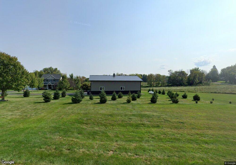
W11457 490th Ave Prescott, WI 54021
Estimated Value: $573,000 - $667,950
3
Beds
4
Baths
--
Sq Ft
6.49
Acres
About This Home
This home is located at W11457 490th Ave, Prescott, WI 54021 and is currently estimated at $619,988. W11457 490th Ave is a home located in Pierce County with nearby schools including Malone Elementary School, Prescott Middle School, and Prescott High School.
Ownership History
Date
Name
Owned For
Owner Type
Purchase Details
Closed on
Apr 28, 2015
Sold by
Stanton Brent John Kenneth and Stanton Faun A
Bought by
Erickson Michael W and Erickson Barbara A
Current Estimated Value
Home Financials for this Owner
Home Financials are based on the most recent Mortgage that was taken out on this home.
Original Mortgage
$237,600
Outstanding Balance
$183,039
Interest Rate
3.68%
Mortgage Type
New Conventional
Estimated Equity
$436,949
Create a Home Valuation Report for This Property
The Home Valuation Report is an in-depth analysis detailing your home's value as well as a comparison with similar homes in the area
Home Values in the Area
Average Home Value in this Area
Purchase History
| Date | Buyer | Sale Price | Title Company |
|---|---|---|---|
| Erickson Michael W | $297,000 | Land Title Inc |
Source: Public Records
Mortgage History
| Date | Status | Borrower | Loan Amount |
|---|---|---|---|
| Open | Erickson Michael W | $237,600 |
Source: Public Records
Tax History Compared to Growth
Tax History
| Year | Tax Paid | Tax Assessment Tax Assessment Total Assessment is a certain percentage of the fair market value that is determined by local assessors to be the total taxable value of land and additions on the property. | Land | Improvement |
|---|---|---|---|---|
| 2024 | $7,703 | $504,500 | $95,700 | $408,800 |
| 2023 | $7,135 | $504,500 | $95,700 | $408,800 |
| 2022 | $6,127 | $504,500 | $95,700 | $408,800 |
| 2021 | $5,646 | $293,300 | $72,000 | $221,300 |
| 2020 | $6,219 | $293,300 | $72,000 | $221,300 |
| 2019 | $5,839 | $293,300 | $72,000 | $221,300 |
| 2018 | $5,634 | $293,300 | $72,000 | $221,300 |
| 2017 | $5,254 | $262,400 | $72,000 | $190,400 |
| 2016 | $4,959 | $262,400 | $72,000 | $190,400 |
| 2015 | $4,982 | $262,400 | $72,000 | $190,400 |
| 2014 | $4,941 | $262,400 | $72,000 | $190,400 |
| 2013 | $4,627 | $262,400 | $72,000 | $190,400 |
Source: Public Records
Map
Nearby Homes
- W11540 504th Ave
- N4848 1110th St
- W11011 470th Ave
- N4387 1115th St
- W10780 468th Ave
- xxxxx 566th Ave
- N5620 1090th St
- W11980 565th Ave
- W10664 566th Ave
- N5687 1210th St
- N5887 1110th St
- W10415 521st Ave
- TBD Ravenna Trail
- N5449 County Rd E
- 490 Sea Wing Blvd
- 2117 Pleasant Dr
- 2113 Pleasant Dr
- 470 Sea Wing Blvd
- 2100 Pleasant Dr
- 452 Delta Queen Ave
- N4828 1150th St
- Lot 20 1150th St
- N4899 1150th St
- W11455 490th Ave
- N4798 1150th St
- W11470 478th Ave
- xxx 1150 St
- XXXXX 478th Ave
- 0 Unassigned Address Unit 3814130
- 0 Unassigned Address Unit 3875766
- 0 Unassigned Address Unit 4137160
- N4791 1150th St
- N4894 1165th St
- N4764 1150th St
- W11465 478th Ave
- N4967 1150th St
- N4983 1150th St
- N4858 1165th St
- W11521 478th Ave
- Lot 10 478th Ave