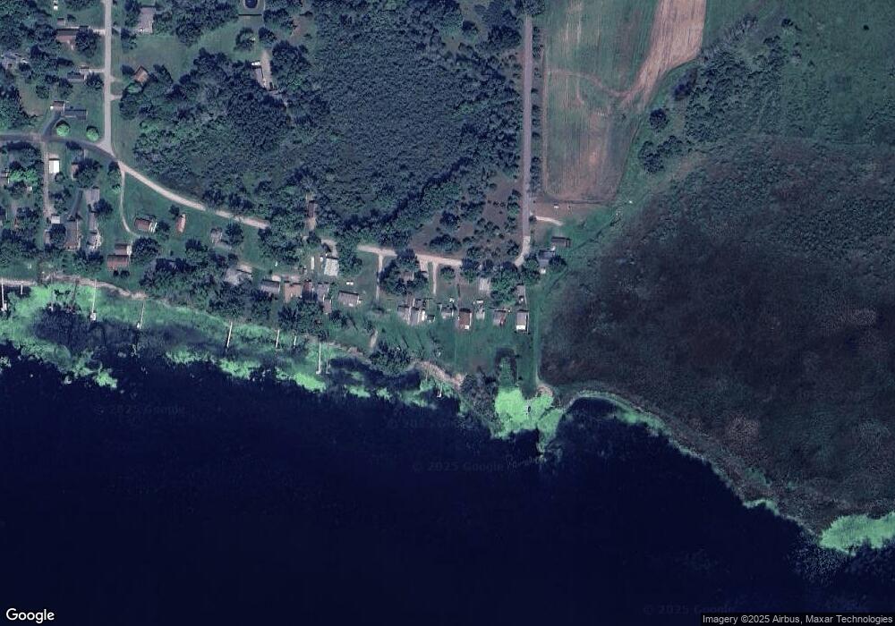
W117 N Shore Dr Montello, WI 53949
Estimated Value: $172,000 - $226,000
Studio
--
Bath
--
Sq Ft
0.38
Acres
About This Home
This home is located at W117 N Shore Dr, Montello, WI 53949 and is currently estimated at $198,331. W117 N Shore Dr is a home located in Marquette County with nearby schools including Forest Lane Community School and Montello Junior/Senior High School.
Ownership History
Date
Name
Owned For
Owner Type
Purchase Details
Closed on
Apr 29, 2021
Sold by
Rogal Dennis and Rogal Loretta Ski
Bought by
Barrett Jeffrey B
Current Estimated Value
Purchase Details
Closed on
Jul 28, 2008
Sold by
Rogalski Dennis C and Rogalski Loretta
Bought by
Rogalski Dennis C and Rogalski Loretta 7-28-2008
Create a Home Valuation Report for This Property
The Home Valuation Report is an in-depth analysis detailing your home's value as well as a comparison with similar homes in the area
Purchase History
| Date | Buyer | Sale Price | Title Company |
|---|---|---|---|
| Barrett Jeffrey B | $124,500 | -- | |
| Rogalski Dennis C | -- | -- |
Source: Public Records
Mortgage History
| Date | Status | Borrower | Loan Amount |
|---|---|---|---|
| Closed | Rogalski Dennis C | $0 |
Source: Public Records
Tax History
| Year | Tax Paid | Tax Assessment Tax Assessment Total Assessment is a certain percentage of the fair market value that is determined by local assessors to be the total taxable value of land and additions on the property. | Land | Improvement |
|---|---|---|---|---|
| 2024 | $2,020 | $107,600 | $47,500 | $60,100 |
| 2023 | $1,833 | $107,600 | $47,500 | $60,100 |
| 2022 | $1,690 | $107,600 | $47,500 | $60,100 |
| 2021 | $1,623 | $107,600 | $47,500 | $60,100 |
| 2020 | $1,790 | $107,600 | $47,500 | $60,100 |
| 2019 | $1,829 | $107,600 | $47,500 | $60,100 |
| 2018 | $1,895 | $107,600 | $47,500 | $60,100 |
| 2017 | $1,876 | $106,500 | $47,500 | $59,000 |
| 2016 | $1,905 | $106,500 | $47,500 | $59,000 |
| 2015 | $203,543 | $106,500 | $47,500 | $59,000 |
| 2014 | -- | $106,500 | $47,500 | $59,000 |
| 2013 | -- | $106,500 | $47,500 | $59,000 |
| 2012 | -- | $111,700 | $47,500 | $64,200 |
Source: Public Records
Map
Nearby Homes
- N3571 E Tomahawk Trail
- W642 Northern Pike
- 320 W 2nd St
- 0.58 Ac 4th St
- W913 W North Shore Dr
- 178 E Front St Unit 14
- W1026 Laurie Ln
- N3190 Oak Rd
- L17 Oak Rd
- L18 Oak Rd
- L14 Oak Rd
- L16 Oak Rd
- W278 Riverview Dr
- N4580 Elm St
- 111 Acres
- W5492 Bend Rd
- W5488 Bend Rd
- W6191 Lueck Ln
- W5653 Grand Marsh Rd
- Lot 35 Peacock Ln
- W113 N Shore Dr
- W123 N Shore Dr
- W125 N Shore Dr
- W121 N Shore Dr
- W127 N Shore Dr
- W129 N Shore Dr
- W105 N Shore Dr
- W109 N Shore Dr
- W131 N Shore Dr Unit 135
- W101 N Shore Dr
- W139 N Shore Dr Unit 137
- W143 N Shore Dr
- W147 N Shore Dr
- W155 Laun Dr
- W155 Laun Dr
- N3796 22nd Dr
- W165 Laun Dr
- W171 N Shore Dr
- W173 Laun Dr
- W175 N Shore Dr
Your Personal Tour Guide
Ask me questions while you tour the home.
