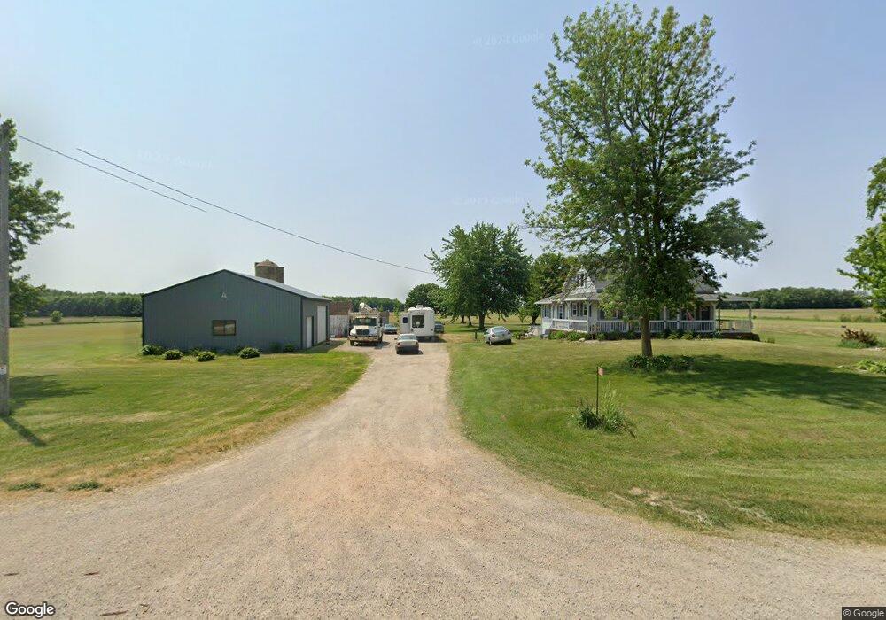
W1221 State Highway 160 Pulaski, WI 54162
Estimated Value: $376,051 - $409,000
--
Bed
--
Bath
--
Sq Ft
4.95
Acres
About This Home
This home is located at W1221 State Highway 160, Pulaski, WI 54162 and is currently estimated at $389,513. W1221 State Highway 160 is a home located in Shawano County with nearby schools including Glenbrook Elementary School, Pulaski Community Middle School, and Pulaski High School.
Ownership History
Date
Name
Owned For
Owner Type
Purchase Details
Closed on
Feb 16, 2011
Sold by
Sibilsky Aaron M and Sibilsky Robin J
Bought by
Ladowski Kyle P
Current Estimated Value
Home Financials for this Owner
Home Financials are based on the most recent Mortgage that was taken out on this home.
Original Mortgage
$158,031
Outstanding Balance
$108,137
Interest Rate
4.78%
Estimated Equity
$281,376
Purchase Details
Closed on
Feb 22, 2007
Sold by
Frank Curtis J
Bought by
Sibilsky Aaron M
Create a Home Valuation Report for This Property
The Home Valuation Report is an in-depth analysis detailing your home's value as well as a comparison with similar homes in the area
Home Values in the Area
Average Home Value in this Area
Purchase History
| Date | Buyer | Sale Price | Title Company |
|---|---|---|---|
| Ladowski Kyle P | $150,000 | -- | |
| Sibilsky Aaron M | $168,900 | -- |
Source: Public Records
Mortgage History
| Date | Status | Borrower | Loan Amount |
|---|---|---|---|
| Open | Ladowski Kyle P | $158,031 |
Source: Public Records
Tax History Compared to Growth
Tax History
| Year | Tax Paid | Tax Assessment Tax Assessment Total Assessment is a certain percentage of the fair market value that is determined by local assessors to be the total taxable value of land and additions on the property. | Land | Improvement |
|---|---|---|---|---|
| 2024 | $2,631 | $182,700 | $38,700 | $144,000 |
| 2023 | $2,607 | $182,700 | $38,700 | $144,000 |
| 2022 | $1,996 | $140,100 | $21,900 | $118,200 |
| 2021 | $1,905 | $140,100 | $21,900 | $118,200 |
| 2020 | $2,105 | $140,100 | $21,900 | $118,200 |
| 2019 | $2,343 | $140,100 | $21,900 | $118,200 |
| 2018 | $2,268 | $140,100 | $21,900 | $118,200 |
| 2017 | $2,226 | $140,100 | $21,900 | $118,200 |
| 2016 | $2,193 | $140,100 | $21,900 | $118,200 |
| 2015 | $2,140 | $140,100 | $21,900 | $118,200 |
Source: Public Records
Map
Nearby Homes
- Lt0 Deer Dr
- W1878 Hillside Dr
- W2008 St 29 Hwy
- 142 Chicago St
- 123 Chicago St
- 139 Memorial Dr
- 0 S Saint Augustine St
- 192 Whimbrel Ct
- 0 E Pulaski St
- 233 S Wisconsin St
- W2227 Redwood Dr
- N3879 Wisconsin 32
- 380 Wisconsin 32
- 1026 Pelican Dr
- 1018 Pelican Dr
- 1010 Pelican Dr
- 1002 Pelican Dr
- 843 Redhawk Dr
- 1235 Putnam Dr
- 1240 Putnam Dr
- W1221 Wisconsin 160
- W1230 State Highway 160
- W1162 State Highway 160
- N2511 Maple Rd
- W1123 State Highway 160
- W1367 State Highway 160
- W1367 State Highway 160
- W1071 State Highway 160
- N2374 Main Laney Dr
- n 2621 Maple Rd
- N2621 Maple Rd
- N2373 Main Laney Dr
- N2653 Maple Rd
- N2669 Maple Rd
- N2703 Maple Rd
- 0 Maple Rd Unit 10902411
- 0 Maple Rd Unit 10805108
- 0 Maple Rd Unit 10900492
- 0 Maple Rd Unit 50148160
- N2636 Sumac Rd