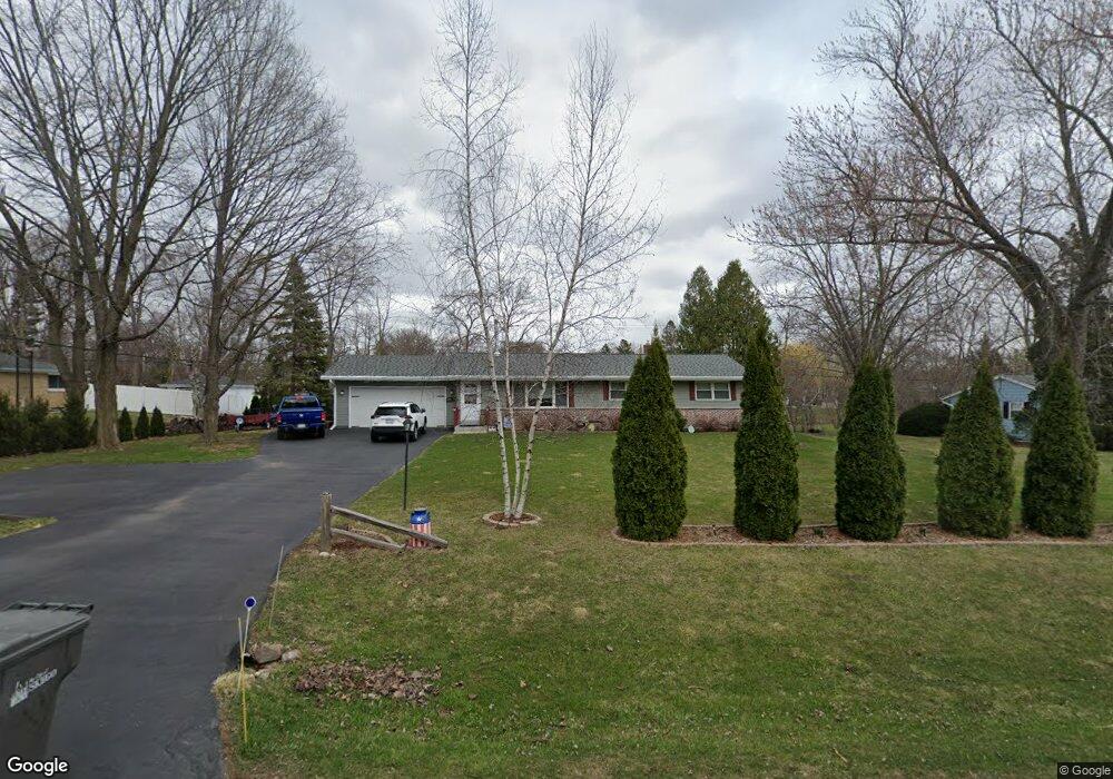
W124S6566 Hawthorne Rd Muskego, WI 53150
Estimated Value: $403,000 - $477,000
3
Beds
2
Baths
1,220
Sq Ft
$367/Sq Ft
Est. Value
About This Home
This home is located at W124S6566 Hawthorne Rd, Muskego, WI 53150 and is currently estimated at $447,201, approximately $366 per square foot. W124S6566 Hawthorne Rd is a home located in Waukesha County with nearby schools including Bay Lane Elementary School, Lake Denoon Middle School, and Creative and Performing Arts.
Ownership History
Date
Name
Owned For
Owner Type
Purchase Details
Closed on
Oct 14, 2015
Sold by
Rombey Ryan and Rodzisewski Tomasz
Bought by
Bichanich Michael K
Current Estimated Value
Home Financials for this Owner
Home Financials are based on the most recent Mortgage that was taken out on this home.
Original Mortgage
$217,600
Outstanding Balance
$171,380
Interest Rate
3.91%
Mortgage Type
New Conventional
Estimated Equity
$275,821
Purchase Details
Closed on
Apr 14, 2015
Sold by
Holschuh Robert and Bradford Mildred C
Bought by
Romboy Ryan and Rodzisewski Tomasz
Create a Home Valuation Report for This Property
The Home Valuation Report is an in-depth analysis detailing your home's value as well as a comparison with similar homes in the area
Home Values in the Area
Average Home Value in this Area
Purchase History
| Date | Buyer | Sale Price | Title Company |
|---|---|---|---|
| Bichanich Michael K | $272,000 | None Available | |
| Romboy Ryan | $130,000 | None Available |
Source: Public Records
Mortgage History
| Date | Status | Borrower | Loan Amount |
|---|---|---|---|
| Open | Bichanich Michael K | $217,600 |
Source: Public Records
Tax History Compared to Growth
Tax History
| Year | Tax Paid | Tax Assessment Tax Assessment Total Assessment is a certain percentage of the fair market value that is determined by local assessors to be the total taxable value of land and additions on the property. | Land | Improvement |
|---|---|---|---|---|
| 2024 | $3,432 | $303,400 | $73,900 | $229,500 |
| 2023 | $3,384 | $303,400 | $73,900 | $229,500 |
| 2022 | $3,308 | $303,400 | $73,900 | $229,500 |
| 2021 | $3,277 | $303,400 | $73,900 | $229,500 |
| 2020 | $3,349 | $243,500 | $64,600 | $178,900 |
| 2019 | $3,318 | $243,500 | $64,600 | $178,900 |
| 2018 | $3,359 | $243,500 | $64,600 | $178,900 |
| 2017 | $3,331 | $241,700 | $64,600 | $177,100 |
| 2016 | $2,560 | $168,100 | $61,900 | $106,200 |
| 2015 | $2,653 | $165,200 | $61,900 | $103,300 |
| 2014 | $3,207 | $165,200 | $61,900 | $103,300 |
| 2013 | $3,207 | $189,600 | $61,900 | $127,700 |
Source: Public Records
Map
Nearby Homes
- 6180 Preston Ln
- 11931 W Janesville Rd
- W137S6834 Dunstan Ct
- 11310 Haleco Ln
- 11216 Bridget Ln
- 5701 S 121st St
- Lt17 W Old Farm Rd
- Lt8 Twin Silos Ct
- W140S6982 Twin Silos Ct
- 6749 S Prairie Wood Ln
- 6741 S Prairie Wood Ln
- 7084 S Fieldstone Ct Unit 43
- 10464 W Whitnall Edge Dr Unit 203
- 13615 W Deer Park Dr
- 11470 W Tess Creek St
- 12230 W Grange Ave
- 11532 W Tess Creek St
- 11415 W Tess Creek St
- 11388 W Tess Creek St
- 10152 W Whitnall Edge Dr Unit E
- W124S6592 Hawthorne Rd
- W124S6540 Hawthorne Rd
- S65W12512 Byron Rd
- W124S6541 Hawthorne Rd
- W124S6516 Hawthorne Rd
- W124S6624 Hawthorne Rd
- S65W12511 Byron Rd
- W124S6519 Hawthorne Rd
- S65W12558 Byron Rd
- W124S6629 Hawthorne Rd
- W125S6538 Whittier Terrace
- 6551 S 123rd St
- 6537 S 123rd St
- W124S6491 Hawthorne Rd
- 6534 S 123rd St
- 6521 S 123rd St
- S65W12551 Byron Rd
- W124S6488 Hawthorne Rd
- 6567 S 123rd St
- W125S6518 Whittier Terrace