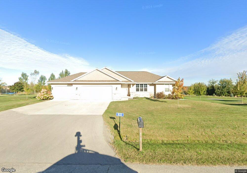
W130 Meadowridge Trail Kaukauna, WI 54130
Estimated Value: $440,000 - $476,000
--
Bed
2
Baths
--
Sq Ft
1.48
Acres
About This Home
This home is located at W130 Meadowridge Trail, Kaukauna, WI 54130 and is currently estimated at $458,406. W130 Meadowridge Trail is a home located in Outagamie County with nearby schools including River View School, Kaukauna High School, and Park Community Charter School.
Ownership History
Date
Name
Owned For
Owner Type
Purchase Details
Closed on
Aug 9, 2019
Sold by
Hetzel Sara
Bought by
Scheffler Margaret C
Current Estimated Value
Purchase Details
Closed on
May 6, 2015
Sold by
Meacham Development Inc
Bought by
Weber Sara J and Weber Matthew T
Home Financials for this Owner
Home Financials are based on the most recent Mortgage that was taken out on this home.
Original Mortgage
$198,900
Interest Rate
3.68%
Mortgage Type
New Conventional
Purchase Details
Closed on
May 1, 2015
Sold by
Meacham Development Inc
Bought by
Weber Matthew T and Weber Sara J
Home Financials for this Owner
Home Financials are based on the most recent Mortgage that was taken out on this home.
Original Mortgage
$198,900
Interest Rate
3.68%
Mortgage Type
New Conventional
Purchase Details
Closed on
Jan 30, 2015
Sold by
Rrbw Llc
Bought by
Meacham Development Inc
Create a Home Valuation Report for This Property
The Home Valuation Report is an in-depth analysis detailing your home's value as well as a comparison with similar homes in the area
Home Values in the Area
Average Home Value in this Area
Purchase History
| Date | Buyer | Sale Price | Title Company |
|---|---|---|---|
| Scheffler Margaret C | $285,000 | -- | |
| Weber Sara J | $209,400 | -- | |
| Weber Sara J | $209,400 | -- | |
| Weber Matthew T | $209,400 | -- | |
| Meacham Development Inc | $42,900 | -- |
Source: Public Records
Mortgage History
| Date | Status | Borrower | Loan Amount |
|---|---|---|---|
| Previous Owner | Weber Sara J | $198,900 |
Source: Public Records
Tax History Compared to Growth
Tax History
| Year | Tax Paid | Tax Assessment Tax Assessment Total Assessment is a certain percentage of the fair market value that is determined by local assessors to be the total taxable value of land and additions on the property. | Land | Improvement |
|---|---|---|---|---|
| 2024 | $5,307 | $447,100 | $54,500 | $392,600 |
| 2023 | $4,464 | $406,700 | $54,500 | $352,200 |
| 2022 | $4,006 | $339,000 | $54,500 | $284,500 |
| 2021 | $4,407 | $304,000 | $41,900 | $262,100 |
| 2020 | $4,584 | $285,000 | $41,900 | $243,100 |
| 2019 | $4,442 | $269,700 | $41,900 | $227,800 |
| 2018 | $4,126 | $249,000 | $41,900 | $207,100 |
| 2017 | $3,785 | $209,300 | $36,600 | $172,700 |
| 2016 | $3,674 | $209,300 | $36,600 | $172,700 |
| 2015 | $755 | $36,600 | $36,600 | $0 |
| 2014 | $630 | $36,600 | $36,600 | $0 |
| 2013 | $617 | $36,600 | $36,600 | $0 |
Source: Public Records
Map
Nearby Homes
- N884 County Road Gg
- 260 Lamers Clancy Rd
- 2326 Olde Country Cir
- 2221 White Wolf Ln
- 2170 White Wolf Ln
- 2450 Manchester Dr
- 3400 Beckett Ln
- 2080 Meadowview St
- 1990 Greengrove St
- 2081 Antelope Trail
- 2070 Bear Paw Trail
- 2060 Bear Paw Trail
- 2041 Bear Paw Trail
- 2010 White Dove Ln
- 2040 White Dove Ln
- 2018 White Dove Ln
- 3016 White Birch St
- 2014 White Dove Ln
- 2030 Red Fox Ln
- 2034 Red Fox Ln
- W130 Meadow Ridge Trail
- W138 Meadow Ridge Trail
- W118 Meadowridge Trail
- W150 Meadowridge Trail
- W123 Meadowridge Trail
- Lot 43 Meadow Ridge Trail
- 150 N Meadow Ridge
- 150 Meadow Ridge
- 0 Meadow Ridge Trail Unit 50291909
- 0 Meadow Ridge Trail Unit 50291907
- 0 Meadow Ridge Trail Unit 50291875
- 0 Meadow Ridge Trail Unit 50253785
- 0 Meadow Ridge Trail Unit 50091510
- 0 Meadow Ridge Trail Unit 50177275
- 0 Meadow Ridge Trail Unit 50177268
- 0 Meadow Ridge Trail Unit 50253789
- 0 Meadow Ridge Trail Unit 50253787
- 0 Meadow Ridge Trail Unit 50268912
- 0 Meadow Ridge Trail Unit 50268913
- 0 Meadow Ridge Trail Unit 50268889