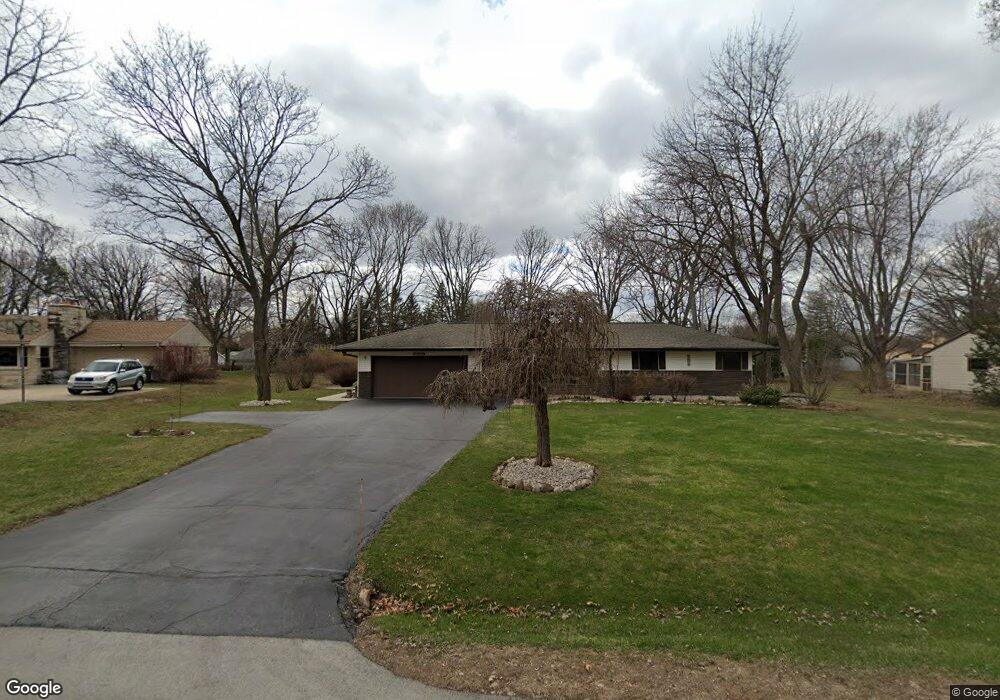
W131S6803 Kipling Dr Muskego, WI 53150
Estimated Value: $362,000 - $413,000
3
Beds
2
Baths
1,213
Sq Ft
$317/Sq Ft
Est. Value
About This Home
This home is located at W131S6803 Kipling Dr, Muskego, WI 53150 and is currently estimated at $384,953, approximately $317 per square foot. W131S6803 Kipling Dr is a home located in Waukesha County with nearby schools including Bay Lane Elementary School, Lake Denoon Middle School, and Creative and Performing Arts.
Ownership History
Date
Name
Owned For
Owner Type
Purchase Details
Closed on
Jun 17, 2009
Sold by
Janca Marlene
Bought by
Simmons Cynthia A
Current Estimated Value
Home Financials for this Owner
Home Financials are based on the most recent Mortgage that was taken out on this home.
Original Mortgage
$157,500
Outstanding Balance
$99,566
Interest Rate
4.86%
Mortgage Type
Purchase Money Mortgage
Estimated Equity
$285,387
Create a Home Valuation Report for This Property
The Home Valuation Report is an in-depth analysis detailing your home's value as well as a comparison with similar homes in the area
Home Values in the Area
Average Home Value in this Area
Purchase History
| Date | Buyer | Sale Price | Title Company |
|---|---|---|---|
| Simmons Cynthia A | $175,000 | None Available |
Source: Public Records
Mortgage History
| Date | Status | Borrower | Loan Amount |
|---|---|---|---|
| Open | Simmons Cynthia A | $157,500 |
Source: Public Records
Tax History Compared to Growth
Tax History
| Year | Tax Paid | Tax Assessment Tax Assessment Total Assessment is a certain percentage of the fair market value that is determined by local assessors to be the total taxable value of land and additions on the property. | Land | Improvement |
|---|---|---|---|---|
| 2024 | $2,868 | $256,600 | $72,900 | $183,700 |
| 2023 | $2,822 | $256,600 | $72,900 | $183,700 |
| 2022 | $2,763 | $256,600 | $72,900 | $183,700 |
| 2021 | $2,734 | $256,600 | $72,900 | $183,700 |
| 2020 | $2,873 | $210,800 | $63,800 | $147,000 |
| 2019 | $2,842 | $210,800 | $63,800 | $147,000 |
| 2018 | $2,878 | $210,800 | $63,800 | $147,000 |
| 2017 | $2,882 | $210,800 | $63,800 | $147,000 |
| 2016 | $2,968 | $193,000 | $61,200 | $131,800 |
| 2015 | $3,002 | $193,000 | $61,200 | $131,800 |
| 2014 | $3,268 | $193,000 | $61,200 | $131,800 |
| 2013 | $3,268 | $193,000 | $61,200 | $131,800 |
Source: Public Records
Map
Nearby Homes
- W137S6834 Dunstan Ct
- Lt8 Twin Silos Ct
- W140S6982 Twin Silos Ct
- 6180 Preston Ln
- Lt17 W Old Farm Rd
- S70W14872 Dartmouth Cir
- W142S7571 Freedom Ave
- 11931 W Janesville Rd
- Lt10 Norbert Ct
- 13615 W Deer Park Dr
- W145S7644 Durham Dr
- 11532 W Tess Creek St
- S73W15032 Cherrywood Dr
- 11470 W Tess Creek St
- 11310 Haleco Ln
- 11415 W Tess Creek St
- 7084 S Fieldstone Ct Unit 43
- 11388 W Tess Creek St
- 5701 S 121st St
- 5622 S Fox Tail Ct
- W131S6817 Kipling Dr
- W131S6781 Kipling Dr
- W131S6802 Kipling Dr
- W131S6769 Kipling Dr
- W132S6794 Fennimore Ln
- W131S6829 Kipling Dr
- W132S6782 Fennimore Ln
- S67W13109 Larkspur Rd
- W131S6828 Kipling Dr
- W132S6812 Fennimore Ln
- W132S6768 Fennimore Ln
- W132S6826 Fennimore Ln
- W132S6838 Fennimore Ln
- W131S6855 Kipling Dr
- S68W13048 Camilla Dr
- W131S6743 Kipling Dr
- W133S6587 Fennimore Ln
- W132S6850 Fennimore Ln
- S67W13073 Larkspur Rd
- W132S6793 Fennimore Ln