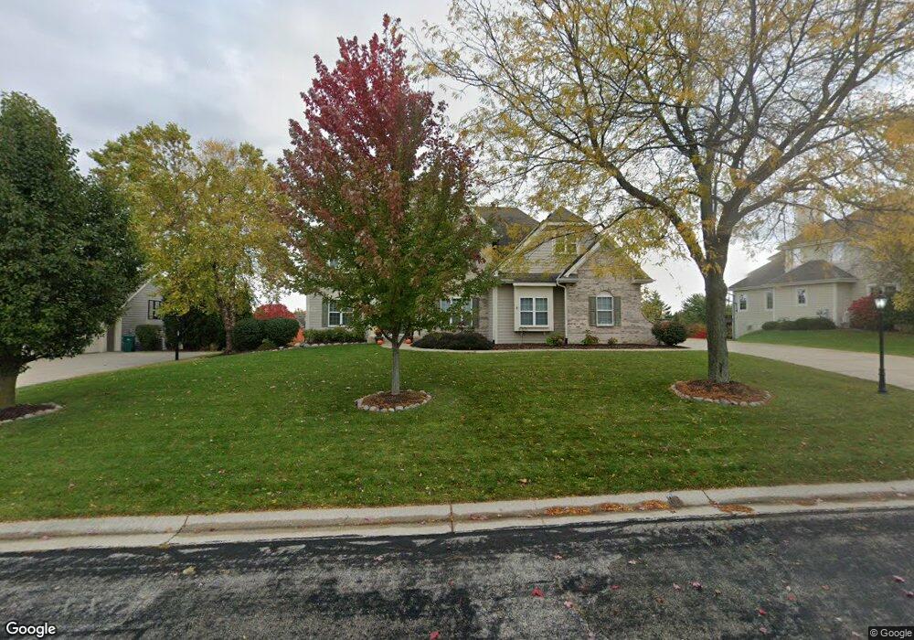
W132N6572 Westview Dr Menomonee Falls, WI 53051
Estimated Value: $796,000 - $968,000
4
Beds
4
Baths
4,832
Sq Ft
$185/Sq Ft
Est. Value
About This Home
This home is located at W132N6572 Westview Dr, Menomonee Falls, WI 53051 and is currently estimated at $891,574, approximately $184 per square foot. W132N6572 Westview Dr is a home located in Waukesha County with nearby schools including Riverside Elementary School, North Middle School, and Menomonee Falls High School.
Ownership History
Date
Name
Owned For
Owner Type
Purchase Details
Closed on
Jun 3, 2003
Sold by
Westridge Realty Inc
Bought by
Nordness Mark E and Nordness Angela K
Current Estimated Value
Home Financials for this Owner
Home Financials are based on the most recent Mortgage that was taken out on this home.
Original Mortgage
$414,600
Outstanding Balance
$158,425
Interest Rate
4.25%
Mortgage Type
Unknown
Estimated Equity
$733,149
Create a Home Valuation Report for This Property
The Home Valuation Report is an in-depth analysis detailing your home's value as well as a comparison with similar homes in the area
Home Values in the Area
Average Home Value in this Area
Purchase History
| Date | Buyer | Sale Price | Title Company |
|---|---|---|---|
| Nordness Mark E | $105,900 | -- |
Source: Public Records
Mortgage History
| Date | Status | Borrower | Loan Amount |
|---|---|---|---|
| Open | Nordness Mark E | $414,600 |
Source: Public Records
Tax History Compared to Growth
Tax History
| Year | Tax Paid | Tax Assessment Tax Assessment Total Assessment is a certain percentage of the fair market value that is determined by local assessors to be the total taxable value of land and additions on the property. | Land | Improvement |
|---|---|---|---|---|
| 2024 | $8,961 | $786,200 | $158,800 | $627,400 |
| 2023 | $8,651 | $786,200 | $158,800 | $627,400 |
| 2022 | $9,270 | $568,300 | $109,500 | $458,800 |
| 2021 | $8,880 | $568,300 | $109,500 | $458,800 |
| 2020 | $9,280 | $568,300 | $109,500 | $458,800 |
| 2019 | $8,907 | $568,300 | $109,500 | $458,800 |
| 2018 | $9,421 | $568,300 | $109,500 | $458,800 |
| 2017 | $9,688 | $568,300 | $109,500 | $458,800 |
| 2016 | $9,875 | $568,300 | $109,500 | $458,800 |
| 2015 | $9,860 | $568,300 | $109,500 | $458,800 |
| 2014 | $10,470 | $568,300 | $109,500 | $458,800 |
| 2013 | $10,470 | $568,300 | $109,500 | $458,800 |
Source: Public Records
Map
Nearby Homes
- N63W13412 Hummingbird Way
- W134N6759 Wild Rose Ct
- N66W12812 Corryton Ct
- W137N6161 Weyer Farm Ct
- N64W14282 Mill Rd
- 11958 W Mill Rd Unit 24
- W139N6995 Bay Ridge Ln
- 11917 W Appleton Ave Unit 6
- 11957 W Appleton Ave Unit 4
- 11927 W Appleton Ave Unit 6
- 11910 W Mill Rd Unit 6
- 11937 W Appleton Ave Unit 14
- 11937 W Appleton Ave Unit 20
- W142N6966 Oakwood Dr
- N72W13429 Good Hope Rd
- N65W14542 Redwood Dr
- 7118 N 124th St
- 6241 N 118th St
- 6183 N 118th St
- 5861 N 121st St
- W132N6550 Westview Dr
- W132N6550 W View Dr
- W132N6588 Westview Dr
- W132N6588 W View Dr
- W131N6573 Crestwood Dr
- W131N6589 Crestwood Dr
- N65W13276 Westview Dr
- W132N6616 Westview Dr
- W132N6575 Westview Dr
- W132N6545 W View Dr
- W132N6561 Westview Dr
- W131N6605 Crestwood Dr
- W132N6597 Westview Dr
- W131N6565 Crestwood Dr
- N65W13236 Westview Dr
- W132N6545 Westview Dr
- W132N6611 Westview Dr
- W132N6622 Westview Dr
- W131N6625 Crestwood Dr
- W132N6517 Westview Ct