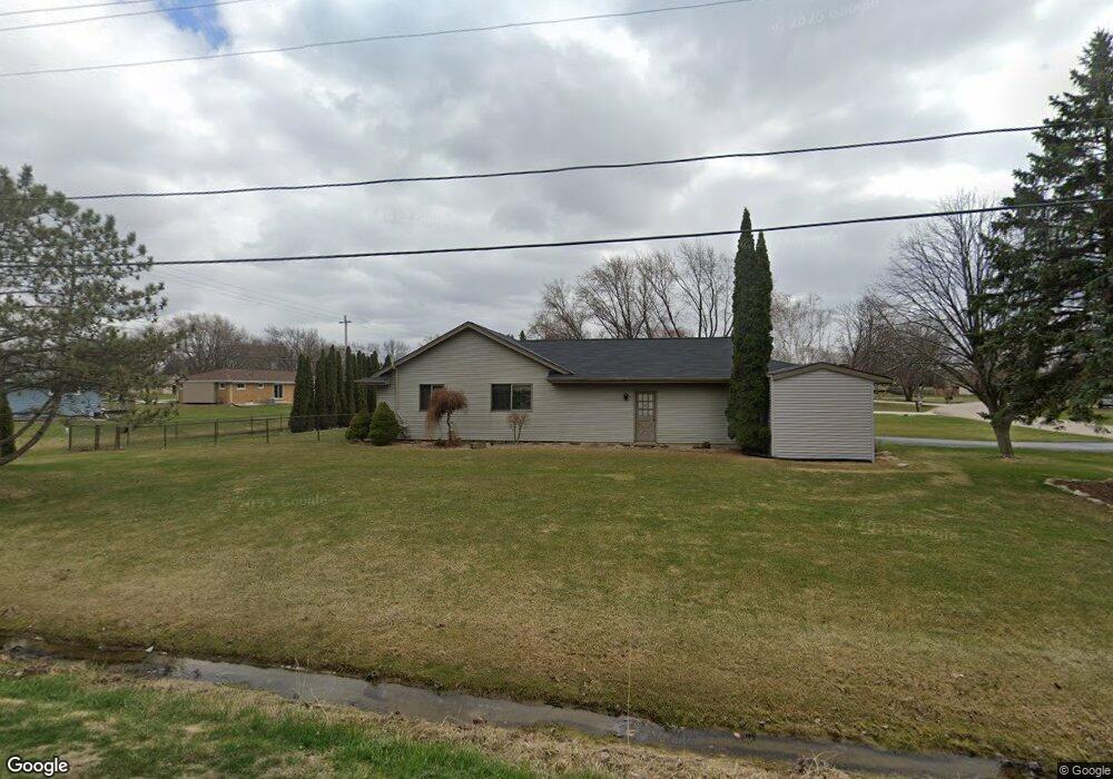
W132S6578 Saroyan Rd Muskego, WI 53150
Estimated Value: $431,000 - $502,000
3
Beds
2
Baths
1,839
Sq Ft
$251/Sq Ft
Est. Value
About This Home
This home is located at W132S6578 Saroyan Rd, Muskego, WI 53150 and is currently estimated at $461,818, approximately $251 per square foot. W132S6578 Saroyan Rd is a home located in Waukesha County with nearby schools including Bay Lane Elementary School, Lake Denoon Middle School, and Creative and Performing Arts.
Ownership History
Date
Name
Owned For
Owner Type
Purchase Details
Closed on
Aug 11, 2011
Sold by
Blum Gary W and Blum Dawn M
Bought by
Levasseur Brandon M and Mernitz Heather L
Current Estimated Value
Home Financials for this Owner
Home Financials are based on the most recent Mortgage that was taken out on this home.
Original Mortgage
$190,000
Outstanding Balance
$131,370
Interest Rate
4.54%
Mortgage Type
New Conventional
Estimated Equity
$330,448
Purchase Details
Closed on
Sep 28, 2009
Sold by
Botterud Thomas D and Botterud Marilyn G
Bought by
Blum Gary W and Blum Dawn M
Purchase Details
Closed on
Jul 10, 1998
Sold by
Migliaccio Anthony P and Adams Migliaccio Linda
Bought by
Botterud Thomas D and Botterud Marilyn G
Home Financials for this Owner
Home Financials are based on the most recent Mortgage that was taken out on this home.
Original Mortgage
$105,000
Interest Rate
7.13%
Create a Home Valuation Report for This Property
The Home Valuation Report is an in-depth analysis detailing your home's value as well as a comparison with similar homes in the area
Home Values in the Area
Average Home Value in this Area
Purchase History
| Date | Buyer | Sale Price | Title Company |
|---|---|---|---|
| Levasseur Brandon M | $250,000 | None Available | |
| Blum Gary W | $264,900 | None Available | |
| Botterud Thomas D | $175,000 | -- |
Source: Public Records
Mortgage History
| Date | Status | Borrower | Loan Amount |
|---|---|---|---|
| Open | Levasseur Brandon M | $190,000 | |
| Previous Owner | Botterud Thomas D | $105,000 |
Source: Public Records
Tax History Compared to Growth
Tax History
| Year | Tax Paid | Tax Assessment Tax Assessment Total Assessment is a certain percentage of the fair market value that is determined by local assessors to be the total taxable value of land and additions on the property. | Land | Improvement |
|---|---|---|---|---|
| 2024 | $3,691 | $324,900 | $74,400 | $250,500 |
| 2023 | $3,641 | $324,900 | $74,400 | $250,500 |
| 2022 | $3,559 | $324,900 | $74,400 | $250,500 |
| 2021 | $4,202 | $324,900 | $74,400 | $250,500 |
| 2020 | $3,816 | $275,500 | $65,100 | $210,400 |
| 2019 | $3,757 | $273,600 | $65,100 | $208,500 |
| 2018 | $3,801 | $273,600 | $65,100 | $208,500 |
| 2017 | $4,466 | $273,600 | $65,100 | $208,500 |
| 2016 | $3,834 | $245,800 | $62,300 | $183,500 |
| 2015 | $3,872 | $245,800 | $62,300 | $183,500 |
| 2014 | $4,215 | $245,800 | $62,300 | $183,500 |
| 2013 | $4,215 | $245,800 | $62,300 | $183,500 |
Source: Public Records
Map
Nearby Homes
- 6180 Preston Ln
- W137S6834 Dunstan Ct
- Lt17 W Old Farm Rd
- Lt8 Twin Silos Ct
- W140S6982 Twin Silos Ct
- 11931 W Janesville Rd
- 13615 W Deer Park Dr
- Lt10 Norbert Ct
- S70W14872 Dartmouth Cir
- 5622 S Fox Tail Ct
- 5701 S 121st St
- 11310 Haleco Ln
- W142S7571 Freedom Ave
- 12230 W Grange Ave
- 11216 Bridget Ln
- S73W15032 Cherrywood Dr
- 5315 S Maryknoll Dr
- W145S7644 Durham Dr
- 7084 S Fieldstone Ct Unit 43
- 11532 W Tess Creek St
- W132S6598 Saroyan Rd
- S65W13173 Longfellow Ln
- S65W13234 Longfellow Ln
- W132S6585 Saroyan Rd
- W131S6541 Kipling Dr
- W131S6599 Kipling Dr
- W132S6557 Saroyan Rd
- S66W13216 Saroyan Rd
- W131S6621 Kipling Dr
- W133S6620 Saroyan Rd
- W132S6529 Saroyan Rd
- W131S6519 Kipling Dr
- W131S6578 Longfellow Ln
- W132S6514 Saroyan Rd
- S66W13220 Saroyan Rd
- W133S6582 Fennimore Ln
- W131S6602 Kipling Dr
- W131S6645 Kipling Dr
- W132S6511 Saroyan Rd
- W131S6536 Kipling Dr