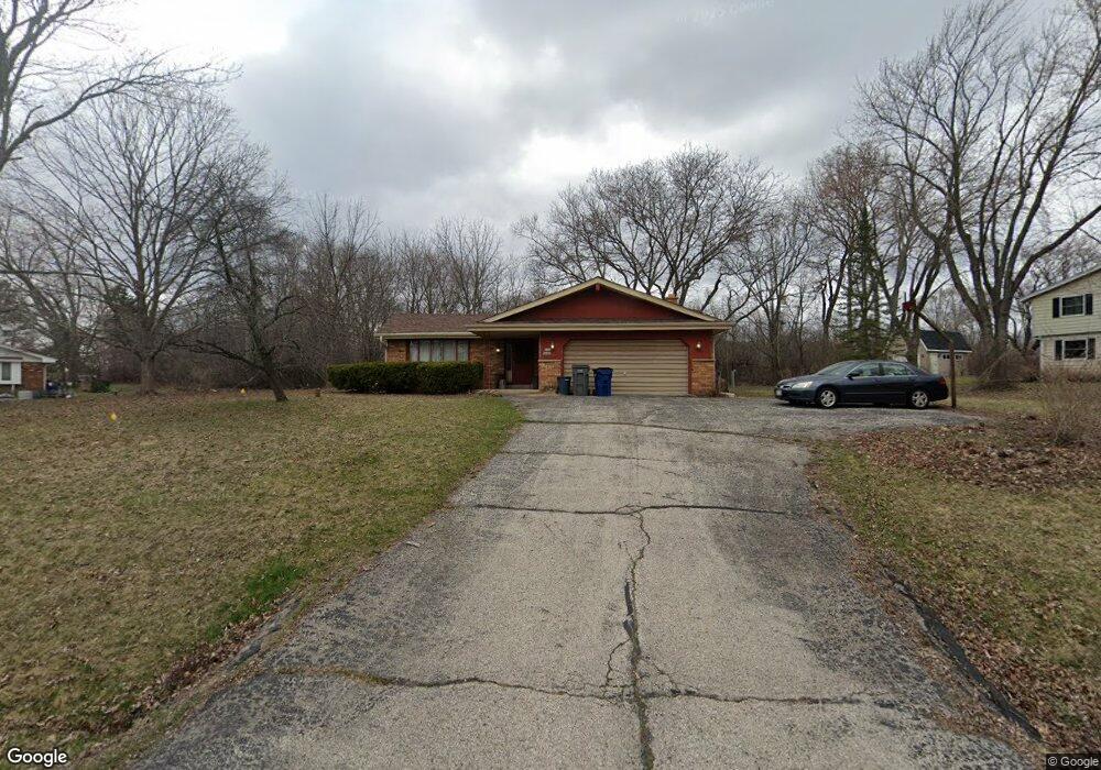
W135S6493 Windsor Rd Muskego, WI 53150
Estimated Value: $408,000 - $496,000
3
Beds
2
Baths
1,571
Sq Ft
$280/Sq Ft
Est. Value
About This Home
This home is located at W135S6493 Windsor Rd, Muskego, WI 53150 and is currently estimated at $439,649, approximately $279 per square foot. W135S6493 Windsor Rd is a home located in Waukesha County with nearby schools including Bay Lane Elementary School, Lake Denoon Middle School, and Creative and Performing Arts.
Ownership History
Date
Name
Owned For
Owner Type
Purchase Details
Closed on
Jan 28, 2025
Sold by
Ball Charlotte Elaine
Bought by
Madriaga Jessica
Current Estimated Value
Create a Home Valuation Report for This Property
The Home Valuation Report is an in-depth analysis detailing your home's value as well as a comparison with similar homes in the area
Home Values in the Area
Average Home Value in this Area
Purchase History
| Date | Buyer | Sale Price | Title Company |
|---|---|---|---|
| Madriaga Jessica | -- | None Listed On Document |
Source: Public Records
Tax History Compared to Growth
Tax History
| Year | Tax Paid | Tax Assessment Tax Assessment Total Assessment is a certain percentage of the fair market value that is determined by local assessors to be the total taxable value of land and additions on the property. | Land | Improvement |
|---|---|---|---|---|
| 2024 | $3,492 | $308,400 | $71,100 | $237,300 |
| 2023 | $3,444 | $308,400 | $71,100 | $237,300 |
| 2022 | $3,366 | $308,400 | $71,100 | $237,300 |
| 2021 | $3,335 | $308,400 | $71,100 | $237,300 |
| 2020 | $3,512 | $240,000 | $62,200 | $177,800 |
| 2019 | $3,267 | $240,000 | $62,200 | $177,800 |
| 2018 | $3,307 | $240,000 | $62,200 | $177,800 |
| 2017 | $3,306 | $240,000 | $62,200 | $177,800 |
| 2016 | $3,355 | $216,600 | $59,400 | $157,200 |
| 2015 | $3,391 | $216,600 | $59,400 | $157,200 |
| 2014 | $3,691 | $216,600 | $59,400 | $157,200 |
| 2013 | $3,691 | $216,600 | $59,400 | $157,200 |
Source: Public Records
Map
Nearby Homes
- 6180 Preston Ln
- W137S6834 Dunstan Ct
- Lt17 W Old Farm Rd
- Lt8 Twin Silos Ct
- W140S6982 Twin Silos Ct
- Lt10 Norbert Ct
- 13615 W Deer Park Dr
- S70W14872 Dartmouth Cir
- 5622 S Fox Tail Ct
- 11931 W Janesville Rd
- 5701 S 121st St
- W142S7571 Freedom Ave
- 5315 S Maryknoll Dr
- S73W15032 Cherrywood Dr
- 12230 W Grange Ave
- 11310 Haleco Ln
- W145S7644 Durham Dr
- S70W15770 Sandalwood Dr
- 5310 S Nicolet Dr
- W150S7586 Dorothy Dr
- W135S6511 Windsor Rd
- W134S6465 Windsor Rd
- W134S6501 Fennimore Ln
- W134S6435 Windsor Rd
- W134S6362 Fennimore Ln
- W136S6468 Sherwood Ct
- W135S6522 Sherwood Cir
- W136S6490 Sherwood Ct
- W134S6436 Windsor Rd
- W134S6523 Fennimore Ln
- S65W13575 Sherwood Cir
- W134S6554 Sherwood Cir
- S65W13539 Sherwood Cir
- W134S6419 Windsor Rd
- S65W13837 Sherwood Ct
- W134S6418 Windsor Rd
- W134S6508 Fennimore Ln
- W136S6515 Hemming Way
- W134S6535 Fennimore Ln
- W136S6485 Sherwood Ct