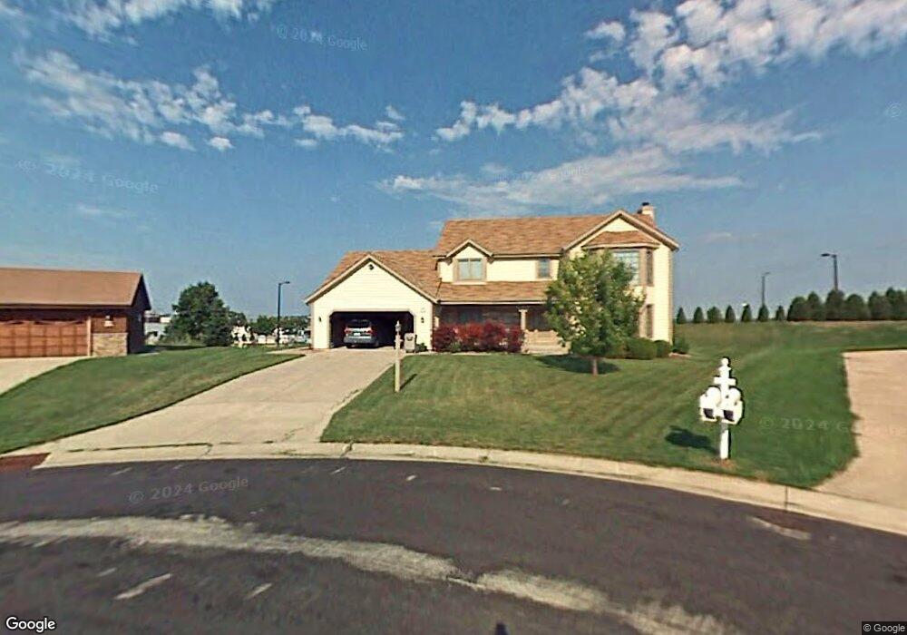
W140N5344 Saint Andrews Cir Menomonee Falls, WI 53051
Estimated Value: $537,000 - $597,000
3
Beds
3
Baths
2,458
Sq Ft
$229/Sq Ft
Est. Value
About This Home
This home is located at W140N5344 Saint Andrews Cir, Menomonee Falls, WI 53051 and is currently estimated at $562,140, approximately $228 per square foot. W140N5344 Saint Andrews Cir is a home located in Waukesha County with nearby schools including Valley View Elementary School, North Middle School, and Menomonee Falls High School.
Ownership History
Date
Name
Owned For
Owner Type
Purchase Details
Closed on
Oct 24, 2000
Sold by
Fassbender Craig S and Fassbender Jacqueline M
Bought by
Hendley James G and Hendley Melanie
Current Estimated Value
Home Financials for this Owner
Home Financials are based on the most recent Mortgage that was taken out on this home.
Original Mortgage
$186,400
Outstanding Balance
$67,735
Interest Rate
7.87%
Estimated Equity
$494,405
Create a Home Valuation Report for This Property
The Home Valuation Report is an in-depth analysis detailing your home's value as well as a comparison with similar homes in the area
Home Values in the Area
Average Home Value in this Area
Purchase History
| Date | Buyer | Sale Price | Title Company |
|---|---|---|---|
| Hendley James G | $233,000 | -- |
Source: Public Records
Mortgage History
| Date | Status | Borrower | Loan Amount |
|---|---|---|---|
| Open | Hendley James G | $186,400 |
Source: Public Records
Tax History Compared to Growth
Tax History
| Year | Tax Paid | Tax Assessment Tax Assessment Total Assessment is a certain percentage of the fair market value that is determined by local assessors to be the total taxable value of land and additions on the property. | Land | Improvement |
|---|---|---|---|---|
| 2024 | $5,385 | $475,900 | $134,000 | $341,900 |
| 2023 | $5,187 | $475,900 | $134,000 | $341,900 |
| 2022 | $5,232 | $323,900 | $92,300 | $231,600 |
| 2021 | $5,009 | $323,900 | $92,300 | $231,600 |
| 2020 | $5,256 | $323,900 | $92,300 | $231,600 |
| 2019 | $5,034 | $323,900 | $92,300 | $231,600 |
| 2018 | $5,303 | $323,900 | $92,300 | $231,600 |
| 2017 | $5,474 | $323,900 | $92,300 | $231,600 |
| 2016 | $5,574 | $323,900 | $92,300 | $231,600 |
| 2015 | $5,578 | $323,900 | $92,300 | $231,600 |
| 2014 | $5,820 | $317,800 | $92,300 | $225,500 |
| 2013 | $5,820 | $317,800 | $92,300 | $225,500 |
Source: Public Records
Map
Nearby Homes
- N52W14491 Aryshire Ct
- Lt7-8 Lucille Ln
- N48W14336 Hampton Rd
- W144N4822 Stone Dr Unit C
- N60W13464 Tall Oak Ct
- W156N5364 Bette Dr
- 4685 N 150th St
- 4540 N 148th St
- N64W14282 Mill Rd
- N63W13412 Hummingbird Way
- N64W14182 Mill Rd
- W162N5492 Westwind Dr Unit 2
- 4685 Pilgrim Rd
- 5861 N 121st St
- 12012 W Florist Ave
- W130N6462 Crestwood Dr
- N65W14542 Redwood Dr
- 11708 W Bobolink Ave
- W140N6628 Florence Ave
- 4465 Pilgrim Rd
- W140N5350 Saint Andrews Cir
- W140N5331 Saint Andrews Cir
- W140N5323 Saint Andrews Cir
- W140N5376 Saint Andrews Dr
- N53W14023 Invery Dr
- W140N5341 Saint Andrews Dr
- W140N5317 Lilly Rd
- N53W14111 Saint Andrews Dr
- W140N5305 Lilly Rd
- N53W14138 Saint Andrews Dr
- N53W14106 Invery Dr
- N53W14147 Invery Dr
- W140N5301 Lilly Rd
- W140N5301 Lilly Rd
- N53W14139 Saint Andrews Dr
- N53W14142 Invery Dr
- W140N5408 Van Buren Dr
- W141N5286 Thornhill Ct
- W140N5291 Lilly Rd
- W141N5275 Thornhill Ct