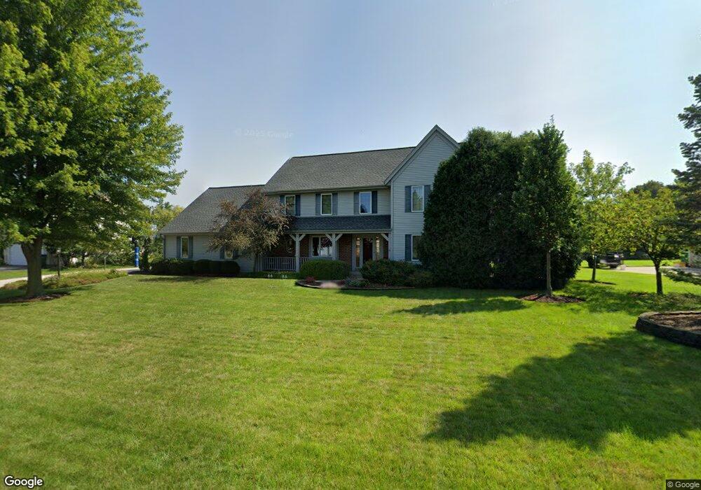
W142N6364 Mill Ridge Dr Menomonee Falls, WI 53051
Estimated Value: $552,000 - $640,000
4
Beds
3
Baths
2,614
Sq Ft
$232/Sq Ft
Est. Value
About This Home
This home is located at W142N6364 Mill Ridge Dr, Menomonee Falls, WI 53051 and is currently estimated at $607,548, approximately $232 per square foot. W142N6364 Mill Ridge Dr is a home located in Waukesha County with nearby schools including North Middle School, Menomonee Falls High School, and Calvary Baptist School.
Ownership History
Date
Name
Owned For
Owner Type
Purchase Details
Closed on
Feb 22, 1999
Sold by
R F Reed & Associates Inc
Bought by
Hanrahan James J and Hanrahan Nicole L
Current Estimated Value
Home Financials for this Owner
Home Financials are based on the most recent Mortgage that was taken out on this home.
Original Mortgage
$202,700
Interest Rate
6.87%
Purchase Details
Closed on
Apr 29, 1996
Sold by
Tom Knoebel Builders Inc
Bought by
Ash Anthony M and Ash Mary F
Home Financials for this Owner
Home Financials are based on the most recent Mortgage that was taken out on this home.
Original Mortgage
$175,000
Interest Rate
7%
Create a Home Valuation Report for This Property
The Home Valuation Report is an in-depth analysis detailing your home's value as well as a comparison with similar homes in the area
Home Values in the Area
Average Home Value in this Area
Purchase History
| Date | Buyer | Sale Price | Title Company |
|---|---|---|---|
| Hanrahan James J | $58,500 | -- | |
| Ash Anthony M | $235,000 | -- |
Source: Public Records
Mortgage History
| Date | Status | Borrower | Loan Amount |
|---|---|---|---|
| Previous Owner | Hanrahan James J | $202,700 | |
| Previous Owner | Ash Anthony M | $175,000 |
Source: Public Records
Tax History Compared to Growth
Tax History
| Year | Tax Paid | Tax Assessment Tax Assessment Total Assessment is a certain percentage of the fair market value that is determined by local assessors to be the total taxable value of land and additions on the property. | Land | Improvement |
|---|---|---|---|---|
| 2024 | $5,790 | $511,000 | $166,400 | $344,600 |
| 2023 | $5,579 | $511,000 | $166,400 | $344,600 |
| 2022 | $6,593 | $362,600 | $114,500 | $248,100 |
| 2021 | $5,622 | $362,600 | $114,500 | $248,100 |
| 2020 | $5,893 | $362,600 | $114,500 | $248,100 |
| 2019 | $5,648 | $362,600 | $114,500 | $248,100 |
| 2018 | $5,955 | $362,600 | $114,500 | $248,100 |
| 2017 | $6,141 | $362,600 | $114,500 | $248,100 |
| 2016 | $6,255 | $362,600 | $114,500 | $248,100 |
| 2015 | $6,256 | $362,600 | $114,500 | $248,100 |
| 2014 | $6,652 | $362,600 | $114,500 | $248,100 |
| 2013 | $6,652 | $362,600 | $114,500 | $248,100 |
Source: Public Records
Map
Nearby Homes
- N64W14282 Mill Rd
- N64W14182 Mill Rd
- N65W14542 Redwood Dr
- W140N6628 Florence Ave
- W136N6291 Hummingbird Way
- N66W14402 Ash Dr
- N63W13412 Hummingbird Way
- N68W14031 Oakwood Dr
- N60W13464 Tall Oak Ct
- W130N6462 Crestwood Dr
- W148N6937 Terriwood Dr
- W144N7085 Terrace Dr
- N69W13211 Harding Dr
- N66W12812 Corryton Ct
- N70W13269 Brentwood Dr
- W155N6995 Amberleigh Cir
- N67W15832 Tamarack Trail
- W155N7081 Amberleigh Cir
- N72W13429 Good Hope Rd
- W157N7069 Mayflower Ct Unit A
- W142N6344 Mill Ridge Dr
- W142N6384 Mill Ridge Dr
- W142N6328 Mill Ridge Dr
- W142N6349 Mill Ridge Dr
- N64W14321 Mill Rd
- N63W14294 Ash Dr
- W142N6312 Mill Ridge Dr
- N64W14379 Mill Rd
- N63W14340 Ash Dr
- W142N6292 Mill Ridge Dr
- N64W14282 N Mill Road North Rd N
- W143N6424 Aspen Dr
- N63W14376 Ash Dr
- W142N6289 Mill Ridge Dr
- N64W14415 Mill Rd
- N63W14339 Ash Dr
- W143N6440 Aspen Dr
- N64W14379 Poplar Dr
- N63W14416 Ash Dr
- N63W14373 Ash Dr