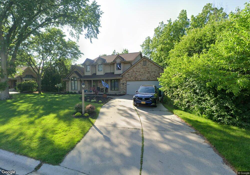
W143N5294 Saint Andrews Ct Menomonee Falls, WI 53051
Estimated Value: $567,000 - $651,000
3
Beds
3
Baths
2,723
Sq Ft
$224/Sq Ft
Est. Value
About This Home
This home is located at W143N5294 Saint Andrews Ct, Menomonee Falls, WI 53051 and is currently estimated at $609,997, approximately $224 per square foot. W143N5294 Saint Andrews Ct is a home located in Waukesha County with nearby schools including Valley View Elementary School, North Middle School, and Menomonee Falls High School.
Ownership History
Date
Name
Owned For
Owner Type
Purchase Details
Closed on
Dec 28, 2018
Sold by
Anderson Marvin R and Linda L Anderson O
Bought by
Cappaert Kevin J and Willkomm Sara J
Current Estimated Value
Home Financials for this Owner
Home Financials are based on the most recent Mortgage that was taken out on this home.
Original Mortgage
$342,000
Outstanding Balance
$301,896
Interest Rate
4.8%
Mortgage Type
New Conventional
Estimated Equity
$308,101
Purchase Details
Closed on
Sep 1, 1999
Sold by
Cartwright Gary A and Cartwright Bonnie J
Bought by
Anderson Marvin R and Anderson Olinda
Create a Home Valuation Report for This Property
The Home Valuation Report is an in-depth analysis detailing your home's value as well as a comparison with similar homes in the area
Home Values in the Area
Average Home Value in this Area
Purchase History
| Date | Buyer | Sale Price | Title Company |
|---|---|---|---|
| Cappaert Kevin J | $360,000 | None Available | |
| Anderson Marvin R | $273,500 | -- |
Source: Public Records
Mortgage History
| Date | Status | Borrower | Loan Amount |
|---|---|---|---|
| Open | Cappaert Kevin J | $342,000 |
Source: Public Records
Tax History Compared to Growth
Tax History
| Year | Tax Paid | Tax Assessment Tax Assessment Total Assessment is a certain percentage of the fair market value that is determined by local assessors to be the total taxable value of land and additions on the property. | Land | Improvement |
|---|---|---|---|---|
| 2024 | $5,495 | $485,400 | $128,500 | $356,900 |
| 2023 | $5,293 | $485,400 | $128,500 | $356,900 |
| 2022 | $5,434 | $336,100 | $88,400 | $247,700 |
| 2021 | $5,203 | $336,100 | $88,400 | $247,700 |
| 2020 | $5,457 | $336,100 | $88,400 | $247,700 |
| 2019 | $5,228 | $336,100 | $88,400 | $247,700 |
| 2018 | $5,508 | $336,100 | $88,400 | $247,700 |
| 2017 | $6,448 | $336,100 | $88,400 | $247,700 |
| 2016 | $5,789 | $336,100 | $88,400 | $247,700 |
| 2015 | $5,792 | $336,100 | $88,400 | $247,700 |
| 2014 | $6,160 | $336,100 | $88,400 | $247,700 |
| 2013 | $6,160 | $336,100 | $88,400 | $247,700 |
Source: Public Records
Map
Nearby Homes
- N52W14491 Aryshire Ct
- W144N4822 Stone Dr Unit C
- N48W14336 Hampton Rd
- Lt7-8 Lucille Ln
- W156N5364 Bette Dr
- 4685 N 150th St
- N60W13464 Tall Oak Ct
- 4685 Pilgrim Rd
- W162N5492 Westwind Dr Unit 2
- W136N6291 Hummingbird Way
- N64W14282 Mill Rd
- N64W14182 Mill Rd
- 4465 Pilgrim Rd
- N63W13412 Hummingbird Way
- 4460 N 158th St
- 4560 N 161st St
- N65W14542 Redwood Dr
- 5861 N 121st St
- 16225 Elderlawn Pkwy
- 12012 W Florist Ave
- N53W14315 Aberdeen Dr
- W143N5284 Saint Andrews Ct
- N53W14345 Aberdeen Dr
- N53W14373 Aberdeen Dr
- W142N5285 Saint Andrews Ct
- W143N5270 Saint Andrews Ct
- W143N5277 Saint Andrews Ct
- N52W14410 Aryshire Ct
- W143N5265 Saint Andrews Ct
- N53W14403 Aberdeen Dr
- N52W14418 Aryshire Ct
- N53W14326 Aberdeen Dr
- N53W14300 Aberdeen Dr
- N53W14354 Aberdeen Dr
- N52W14225 Aberdeen Dr
- N53W14376 Aberdeen Dr
- N52W14413 Aryshire Ct
- N52W14236 Aberdeen Dr
- N53W14433 Aberdeen Dr
- N53W14404 Aberdeen Dr