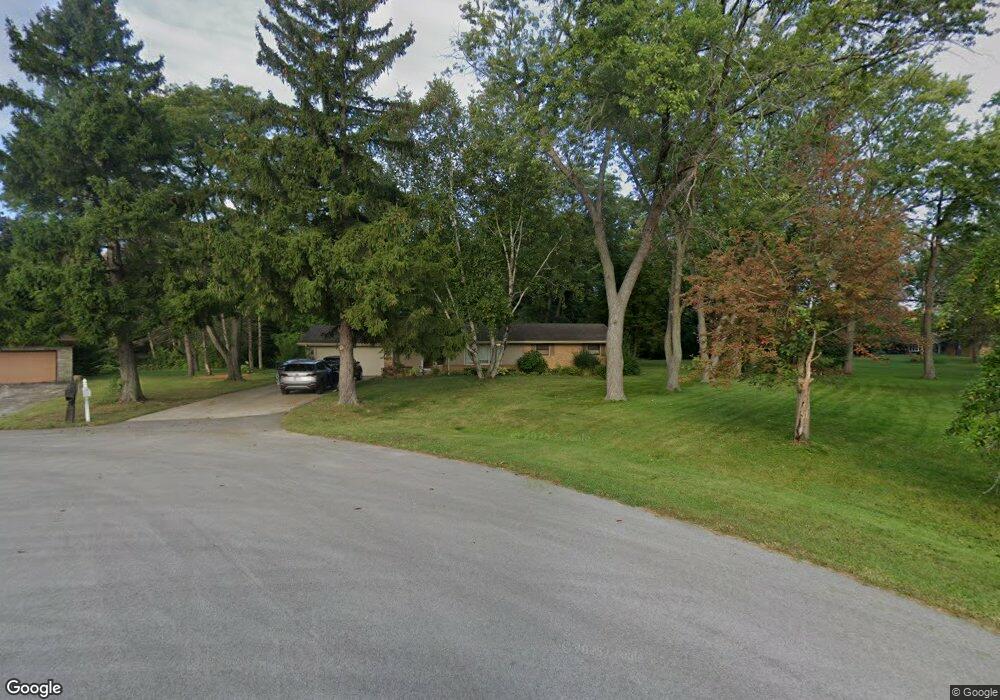
W143N7561 Circle Ct Menomonee Falls, WI 53051
Estimated Value: $385,000 - $403,122
3
Beds
2
Baths
1,385
Sq Ft
$284/Sq Ft
Est. Value
About This Home
This home is located at W143N7561 Circle Ct, Menomonee Falls, WI 53051 and is currently estimated at $394,031, approximately $284 per square foot. W143N7561 Circle Ct is a home located in Waukesha County with nearby schools including North Middle School, Menomonee Falls High School, and Bethlehem Evangelical Lutheran School.
Ownership History
Date
Name
Owned For
Owner Type
Purchase Details
Closed on
Apr 28, 2008
Sold by
Strege Keith D
Bought by
Sell Louis R and Sell Kim M
Current Estimated Value
Home Financials for this Owner
Home Financials are based on the most recent Mortgage that was taken out on this home.
Original Mortgage
$144,000
Outstanding Balance
$87,508
Interest Rate
5.12%
Mortgage Type
Purchase Money Mortgage
Estimated Equity
$306,523
Purchase Details
Closed on
Aug 26, 1998
Sold by
Strege Keith D
Bought by
Strege Deloris E
Purchase Details
Closed on
Nov 21, 1996
Sold by
Strege Deloris E
Bought by
Strege Deloris E and Strege Keith D
Create a Home Valuation Report for This Property
The Home Valuation Report is an in-depth analysis detailing your home's value as well as a comparison with similar homes in the area
Home Values in the Area
Average Home Value in this Area
Purchase History
| Date | Buyer | Sale Price | Title Company |
|---|---|---|---|
| Sell Louis R | $207,000 | None Available | |
| Strege Deloris E | -- | -- | |
| Strege Deloris E | -- | -- |
Source: Public Records
Mortgage History
| Date | Status | Borrower | Loan Amount |
|---|---|---|---|
| Open | Sell Louis R | $144,000 |
Source: Public Records
Tax History Compared to Growth
Tax History
| Year | Tax Paid | Tax Assessment Tax Assessment Total Assessment is a certain percentage of the fair market value that is determined by local assessors to be the total taxable value of land and additions on the property. | Land | Improvement |
|---|---|---|---|---|
| 2024 | $3,864 | $343,900 | $127,300 | $216,600 |
| 2023 | $4,836 | $343,900 | $127,300 | $216,600 |
| 2022 | $4,104 | $224,300 | $87,600 | $136,700 |
| 2021 | $3,712 | $224,300 | $87,600 | $136,700 |
| 2020 | $3,616 | $224,300 | $87,600 | $136,700 |
| 2019 | $3,456 | $224,300 | $87,600 | $136,700 |
| 2018 | $3,624 | $224,300 | $87,600 | $136,700 |
| 2017 | $3,757 | $224,300 | $87,600 | $136,700 |
| 2016 | $3,822 | $224,300 | $87,600 | $136,700 |
| 2015 | $3,833 | $224,300 | $87,600 | $136,700 |
| 2014 | $4,085 | $224,300 | $87,600 | $136,700 |
| 2013 | $4,085 | $224,300 | $87,600 | $136,700 |
Source: Public Records
Map
Nearby Homes
- N76W14595 N Point Ct
- W148N7497 Woodland Dr
- W147N7725 Northpoint Dr
- N74W13737 Appleton Ave Unit 107
- W148N7311 Woodland Dr
- N77W15302 Crossway Dr
- W139N6995 Bay Ridge Ln
- W155N7481 Pebble Ct
- W142N6966 Oakwood Dr
- N72W13429 Good Hope Rd
- N81W14117 Titan Ct
- N77W15736 Crossway Dr
- N80W13299 River Park Dr
- N81W13567 Golfway Dr
- N80W12960 Fond du Lac Ave
- W131N8112 Country Terrace Ln Unit 1A
- W157N7069 Mayflower Ct Unit A
- N53W19764 Kingair Dr
- N53W19776 Kingair Dr
- W134N6759 Wild Rose Ct
- W143N7553 Circle Ct
- W143N7571 Circle Ct
- N76W14335 Northpoint Dr
- W145N7560 Northwood Dr
- W145N7580 Northwood Dr
- N76W14369 Northpoint Dr
- W143N7552 Circle Ct
- W145N7532 Northwood Dr
- N76W14415 Northpoint Dr
- W143N7562 Circle Ct
- N76W14427 Northpoint Ct Unit C
- N76W14524 Northpoint Ct Unit C
- N76W14419 Northpoint Ct Unit F
- N76W14435 Northpoint Ct Unit B
- N76W14525 Northpoint Ct Unit A
- N76W14520 Northpoint Ct Unit B
- N76W14411 Northpoint Ct Unit G
- N76W14431 Northpoint Ct Unit D
- N76W14423 Northpoint Ct
- N76W14415 Northpoint Ct