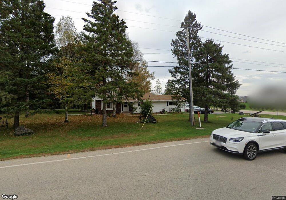
W145S7676 Durham Dr Muskego, WI 53150
Estimated Value: $441,000 - $502,432
4
Beds
2
Baths
1,620
Sq Ft
$289/Sq Ft
Est. Value
About This Home
This home is located at W145S7676 Durham Dr, Muskego, WI 53150 and is currently estimated at $467,858, approximately $288 per square foot. W145S7676 Durham Dr is a home located in Waukesha County with nearby schools including Bay Lane Elementary School, Lake Denoon Middle School, and Muskego High School.
Ownership History
Date
Name
Owned For
Owner Type
Purchase Details
Closed on
Jan 23, 2017
Sold by
Atkinson Amy M
Bought by
Atkinson Allan W
Current Estimated Value
Purchase Details
Closed on
Oct 16, 2015
Sold by
Vieira Nie
Bought by
Atkinson Amy M and Atkinson Allan W
Home Financials for this Owner
Home Financials are based on the most recent Mortgage that was taken out on this home.
Original Mortgage
$201,000
Outstanding Balance
$158,306
Interest Rate
3.91%
Mortgage Type
New Conventional
Estimated Equity
$309,552
Purchase Details
Closed on
Mar 27, 2015
Sold by
Srof 2013 S3 Reo Llc
Bought by
Vieira Nic
Purchase Details
Closed on
Sep 6, 2001
Sold by
Beier Lawrence G and Beier Marilyn R
Bought by
Vandoren Greg and Vandoren Lynn
Home Financials for this Owner
Home Financials are based on the most recent Mortgage that was taken out on this home.
Original Mortgage
$144,000
Interest Rate
7.12%
Create a Home Valuation Report for This Property
The Home Valuation Report is an in-depth analysis detailing your home's value as well as a comparison with similar homes in the area
Home Values in the Area
Average Home Value in this Area
Purchase History
| Date | Buyer | Sale Price | Title Company |
|---|---|---|---|
| Atkinson Allan W | -- | None Available | |
| Atkinson Amy M | $212,000 | Knight Barry Title Inc | |
| Vieira Nic | $161,000 | None Available | |
| Vandoren Greg | $180,000 | -- |
Source: Public Records
Mortgage History
| Date | Status | Borrower | Loan Amount |
|---|---|---|---|
| Open | Atkinson Amy M | $201,000 | |
| Previous Owner | Vandoren Greg | $144,000 |
Source: Public Records
Tax History Compared to Growth
Tax History
| Year | Tax Paid | Tax Assessment Tax Assessment Total Assessment is a certain percentage of the fair market value that is determined by local assessors to be the total taxable value of land and additions on the property. | Land | Improvement |
|---|---|---|---|---|
| 2024 | $3,821 | $335,700 | $88,700 | $247,000 |
| 2023 | $3,771 | $335,700 | $88,700 | $247,000 |
| 2022 | $3,685 | $335,700 | $88,700 | $247,000 |
| 2021 | $3,651 | $335,700 | $88,700 | $247,000 |
| 2020 | $3,944 | $284,300 | $77,500 | $206,800 |
| 2019 | $3,913 | $284,300 | $77,500 | $206,800 |
| 2018 | $3,717 | $267,900 | $77,500 | $190,400 |
| 2017 | $3,711 | $267,900 | $77,500 | $190,400 |
| 2016 | $3,724 | $239,100 | $73,900 | $165,200 |
| 2015 | $3,761 | $239,100 | $73,900 | $165,200 |
| 2014 | $4,095 | $239,100 | $73,900 | $165,200 |
| 2013 | $4,095 | $239,100 | $73,900 | $165,200 |
Source: Public Records
Map
Nearby Homes
- W145S7644 Durham Dr
- S70W14845 Dartmouth Cir
- S70W14872 Dartmouth Cir
- N51W19119 Quietwood Dr
- Lt8 Twin Silos Ct
- S67W14570 Gaulke Ct
- S76W12788 Cambridge Ct E
- S76W12739 Cambridge Ct E
- S68W13611 Hale Park Cir
- W163S7358 Bay Lane Dr
- W162S7043 Olive Cir Unit 22
- S78W16730 Spinnaker Dr
- S75W16788 Jacob Ct Unit 12
- Wilshire Prairie Plan at Mallard Reserve
- Winfield II Plan at Mallard Reserve
- Wilshire Prairie Signature Series Plan at Mallard Reserve
- Wilshire III Plan at Mallard Reserve
- Wilshire Manor III Plan at Mallard Reserve
- Wilshire IV Plan at Mallard Reserve
- Wilshire II Plan at Mallard Reserve
- Lt2 Mcshane Dr Unit Lt2
- W146S7732 Stags Leap Ct
- W145S7628 Durham Dr
- S77W14434 Independence Ct
- W146S7723 Stags Leap Ct
- W146S7740 Stags Leap Ct
- S76W14707 Velva Dr
- W146S7729 Stags Leap Ct
- W143S7693 Independence Dr
- S76W14501 Easy St
- W143S7667 Independence Dr
- S77W14350 Independence Ct
- S76W14457 Easy St
- W146S7758 Stags Leap Ct
- S76W14708 Velva Dr
- W146S7737 Stags Leap Ct
- W146S7776 Stags Leap Ct
- S75W14496 Easy St
- S76W14572 Easy St
- W146S7753 Stags Leap Ct