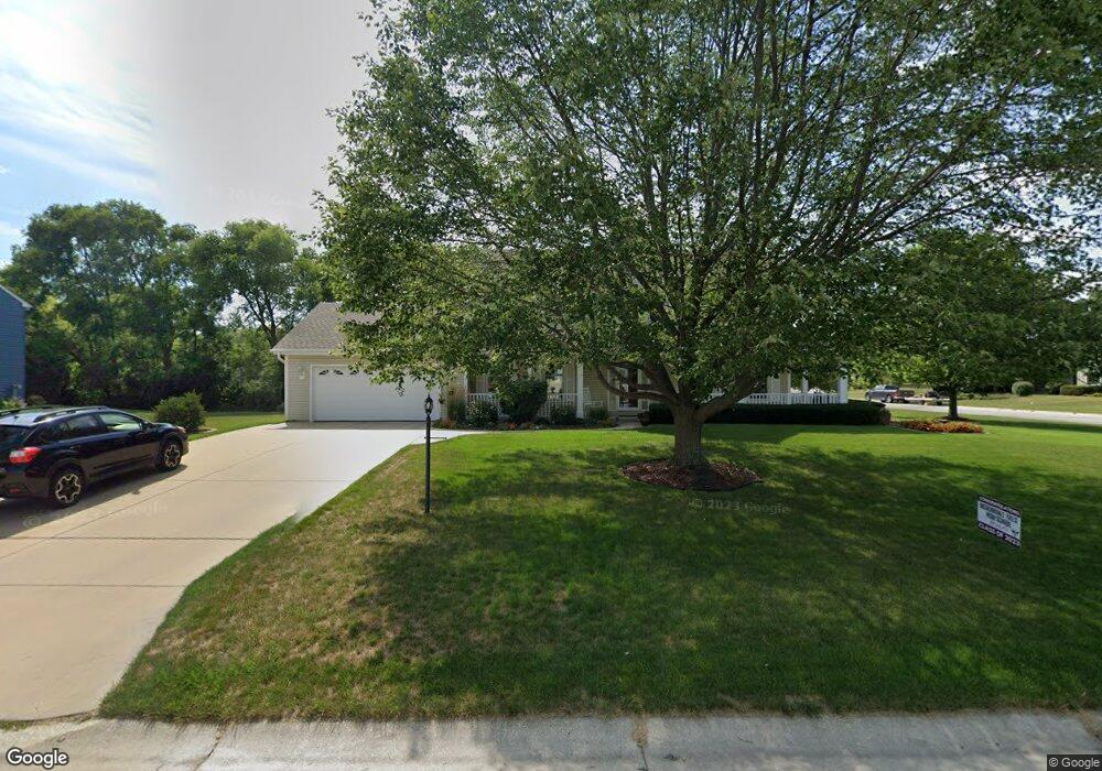
W146N6289 Wigwam Dr Menomonee Falls, WI 53051
Estimated Value: $556,000 - $596,000
3
Beds
3
Baths
2,300
Sq Ft
$250/Sq Ft
Est. Value
About This Home
This home is located at W146N6289 Wigwam Dr, Menomonee Falls, WI 53051 and is currently estimated at $575,904, approximately $250 per square foot. W146N6289 Wigwam Dr is a home located in Waukesha County with nearby schools including North Middle School, Menomonee Falls High School, and Calvary Baptist School.
Ownership History
Date
Name
Owned For
Owner Type
Purchase Details
Closed on
Apr 6, 2016
Sold by
Mangum David G and Mangum Jacqueline M
Bought by
Marzinski Trust
Current Estimated Value
Purchase Details
Closed on
May 14, 2015
Sold by
Wilson John I and Wilson Jane T
Bought by
Mangum David G and Mangum Jacqueline M
Home Financials for this Owner
Home Financials are based on the most recent Mortgage that was taken out on this home.
Original Mortgage
$320,000
Interest Rate
3.68%
Mortgage Type
VA
Purchase Details
Closed on
Mar 22, 1996
Sold by
R J Mueller Enterprises Inc
Bought by
Wilson John I and Wilson Jane T
Home Financials for this Owner
Home Financials are based on the most recent Mortgage that was taken out on this home.
Original Mortgage
$75,000
Interest Rate
6.98%
Create a Home Valuation Report for This Property
The Home Valuation Report is an in-depth analysis detailing your home's value as well as a comparison with similar homes in the area
Home Values in the Area
Average Home Value in this Area
Purchase History
| Date | Buyer | Sale Price | Title Company |
|---|---|---|---|
| Marzinski Trust | $340,500 | None Available | |
| Mangum David G | $320,000 | Entrust Title Group | |
| Wilson John I | $192,000 | -- |
Source: Public Records
Mortgage History
| Date | Status | Borrower | Loan Amount |
|---|---|---|---|
| Previous Owner | Mangum David G | $320,000 | |
| Previous Owner | Wilson John I | $75,000 |
Source: Public Records
Tax History Compared to Growth
Tax History
| Year | Tax Paid | Tax Assessment Tax Assessment Total Assessment is a certain percentage of the fair market value that is determined by local assessors to be the total taxable value of land and additions on the property. | Land | Improvement |
|---|---|---|---|---|
| 2024 | $5,390 | $476,300 | $148,600 | $327,700 |
| 2023 | $5,192 | $476,300 | $148,600 | $327,700 |
| 2022 | $5,094 | $315,500 | $102,300 | $213,200 |
| 2021 | $4,876 | $315,500 | $102,300 | $213,200 |
| 2020 | $5,117 | $315,500 | $102,300 | $213,200 |
| 2019 | $4,901 | $315,500 | $102,300 | $213,200 |
| 2018 | $5,161 | $315,500 | $102,300 | $213,200 |
| 2017 | $5,329 | $315,500 | $102,300 | $213,200 |
| 2016 | $5,426 | $315,500 | $102,300 | $213,200 |
| 2015 | $5,431 | $315,500 | $102,300 | $213,200 |
| 2014 | $5,778 | $315,500 | $102,300 | $213,200 |
| 2013 | $5,778 | $315,500 | $102,300 | $213,200 |
Source: Public Records
Map
Nearby Homes
- N64W14282 Mill Rd
- N64W14182 Mill Rd
- N65W14542 Redwood Dr
- N66W14402 Ash Dr
- W140N6628 Florence Ave
- W136N6291 Hummingbird Way
- N68W14031 Oakwood Dr
- N63W13412 Hummingbird Way
- N60W13464 Tall Oak Ct
- W148N6937 Terriwood Dr
- W155N6995 Amberleigh Cir
- N67W15832 Tamarack Trail
- W144N7085 Terrace Dr
- W130N6462 Crestwood Dr
- W155N7081 Amberleigh Cir
- N69W15889 Eileen Ave
- W157N7069 Mayflower Ct Unit A
- N69W13211 Harding Dr
- N66W12812 Corryton Ct
- N70W13269 Brentwood Dr
- N63W14675 Ash Dr
- W146N6263 Wigwam Dr
- N63W14577 Ash Dr
- N63W14638 Ash Dr
- N63W14672 Ash Dr
- N63W14614 Ash Dr
- W146N6255 Wigwam Dr
- N63W14705 Ash Dr
- W146N6270 Wigwam Dr
- N63W14576 Ash Dr
- W146N6238 Wigwam Dr
- W147N6322 Ash Dr
- N63W14539 Ash Dr
- W147N6311 Ash Dr
- W146N6235 Wigwam Dr
- N62W14694 Mill Creek Ct
- W146N6234 Wigwam Dr
- W145N6249 Auburn Ct
- N62W14724 Mill Creek Ct
- N63W14505 Ash Dr