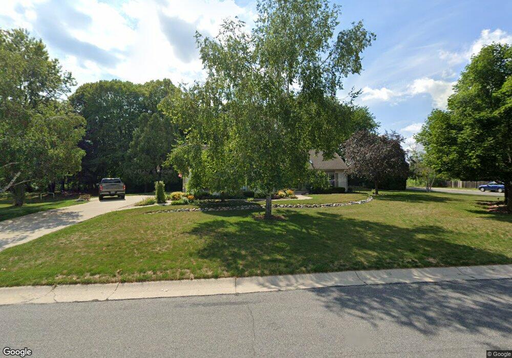
W147N6579 Ash Dr Menomonee Falls, WI 53051
Estimated Value: $532,606 - $648,000
3
Beds
2
Baths
1,972
Sq Ft
$294/Sq Ft
Est. Value
About This Home
This home is located at W147N6579 Ash Dr, Menomonee Falls, WI 53051 and is currently estimated at $579,402, approximately $293 per square foot. W147N6579 Ash Dr is a home located in Waukesha County with nearby schools including North Middle School, Menomonee Falls High School, and Calvary Baptist School.
Ownership History
Date
Name
Owned For
Owner Type
Purchase Details
Closed on
Jun 9, 2003
Sold by
Kivisto Mark D
Bought by
Kivisto Rondalyn M
Current Estimated Value
Home Financials for this Owner
Home Financials are based on the most recent Mortgage that was taken out on this home.
Original Mortgage
$209,125
Outstanding Balance
$88,877
Interest Rate
5.37%
Mortgage Type
Purchase Money Mortgage
Estimated Equity
$490,525
Purchase Details
Closed on
Apr 22, 2002
Sold by
Doxtater Richard J and Anderson Doxtater Wendy M
Bought by
Kivisto Mark D and Kivisto Rondalyn M
Create a Home Valuation Report for This Property
The Home Valuation Report is an in-depth analysis detailing your home's value as well as a comparison with similar homes in the area
Home Values in the Area
Average Home Value in this Area
Purchase History
| Date | Buyer | Sale Price | Title Company |
|---|---|---|---|
| Kivisto Rondalyn M | -- | -- | |
| Kivisto Mark D | $260,000 | -- |
Source: Public Records
Mortgage History
| Date | Status | Borrower | Loan Amount |
|---|---|---|---|
| Open | Kivisto Rondalyn M | $209,125 |
Source: Public Records
Tax History Compared to Growth
Tax History
| Year | Tax Paid | Tax Assessment Tax Assessment Total Assessment is a certain percentage of the fair market value that is determined by local assessors to be the total taxable value of land and additions on the property. | Land | Improvement |
|---|---|---|---|---|
| 2024 | $5,313 | $469,600 | $154,800 | $314,800 |
| 2023 | $5,117 | $469,600 | $154,800 | $314,800 |
| 2022 | $4,975 | $308,300 | $106,900 | $201,400 |
| 2021 | $4,762 | $308,300 | $106,900 | $201,400 |
| 2020 | $4,999 | $308,300 | $106,900 | $201,400 |
| 2019 | $4,787 | $308,300 | $106,900 | $201,400 |
| 2018 | $5,040 | $308,300 | $106,900 | $201,400 |
| 2017 | $5,205 | $308,300 | $106,900 | $201,400 |
| 2016 | $5,300 | $308,300 | $106,900 | $201,400 |
| 2015 | $4,909 | $285,700 | $106,900 | $178,800 |
| 2014 | $5,225 | $285,700 | $106,900 | $178,800 |
| 2013 | $5,225 | $285,700 | $106,900 | $178,800 |
Source: Public Records
Map
Nearby Homes
- N65W14542 Redwood Dr
- N66W14402 Ash Dr
- N64W14282 Mill Rd
- N64W14182 Mill Rd
- W140N6628 Florence Ave
- W148N6937 Terriwood Dr
- N68W14031 Oakwood Dr
- W155N6995 Amberleigh Cir
- W144N7085 Terrace Dr
- N67W15832 Tamarack Trail
- W155N7081 Amberleigh Cir
- W136N6291 Hummingbird Way
- W157N7069 Mayflower Ct Unit A
- N69W15889 Eileen Ave
- N63W13412 Hummingbird Way
- N69W13211 Harding Dr
- N60W13464 Tall Oak Ct
- N70W13269 Brentwood Dr
- W130N6462 Crestwood Dr
- N72W13429 Good Hope Rd
- W147N6557 Ash Dr
- W147N6594 Ash Dr
- W147N6576 Ash Dr
- W147N6611 Ash Dr
- W147N6614 Ash Dr
- W147N6537 Ash Dr
- W147N6538 Ash Dr
- W147N6635 Ash Dr
- W147N6636 Ash Dr
- N66W14651 Linden Ct
- N65W14654 Redwood Dr
- W147N6513 Ash Dr
- W147N6659 Ash Dr
- N66W14648 Linden Ct
- W146N6587 Cedar Ridge Ln
- W147N6664 Ash Dr
- W146N6565 Cedar Ridge Ln
- W146N6551 Cedar Ridge Ln
- N65W14693 Redwood Dr
- N66W14679 White Birch Dr