W151S6561 Glenbrook Dr Muskego, WI 53150
Estimated Value: $377,000 - $448,000
4
Beds
2
Baths
1,585
Sq Ft
$262/Sq Ft
Est. Value
About This Home
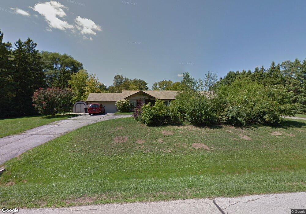
This home is located at W151S6561 Glenbrook Dr, Muskego, WI 53150 and is currently estimated at $416,047, approximately $262 per square foot. W151S6561 Glenbrook Dr is a home located in Waukesha County with nearby schools including Bay Lane Elementary School, Lake Denoon Middle School, and Muskego High School.
Ownership History
Date
Name
Owned For
Owner Type
Purchase Details
Closed on
Jun 26, 2003
Sold by
Neuman Peter A and Neuman Mary A
Bought by
Schepp Michael J and Niessing Schepp Karol A
Current Estimated Value
Home Financials for this Owner
Home Financials are based on the most recent Mortgage that was taken out on this home.
Original Mortgage
$159,900
Outstanding Balance
$68,545
Interest Rate
5.37%
Mortgage Type
Purchase Money Mortgage
Estimated Equity
$347,502
Purchase Details
Closed on
Dec 29, 2000
Sold by
Neuman Mary A and Spiegel Mary A
Bought by
Neuman Peter A and Neuman Mary A
Home Financials for this Owner
Home Financials are based on the most recent Mortgage that was taken out on this home.
Original Mortgage
$198,000
Interest Rate
12%
Purchase Details
Closed on
May 22, 1997
Sold by
Roth Randy A and Roth Mary A
Bought by
Spiegel Mary A
Home Financials for this Owner
Home Financials are based on the most recent Mortgage that was taken out on this home.
Original Mortgage
$119,000
Interest Rate
10.59%
Create a Home Valuation Report for This Property
The Home Valuation Report is an in-depth analysis detailing your home's value as well as a comparison with similar homes in the area
Home Values in the Area
Average Home Value in this Area
Purchase History
| Date | Buyer | Sale Price | Title Company |
|---|---|---|---|
| Schepp Michael J | $199,900 | -- | |
| Neuman Peter A | -- | -- | |
| Spiegel Mary A | -- | -- |
Source: Public Records
Mortgage History
| Date | Status | Borrower | Loan Amount |
|---|---|---|---|
| Open | Schepp Michael J | $159,900 | |
| Previous Owner | Neuman Peter A | $198,000 | |
| Previous Owner | Spiegel Mary A | $119,000 |
Source: Public Records
Tax History Compared to Growth
Tax History
| Year | Tax Paid | Tax Assessment Tax Assessment Total Assessment is a certain percentage of the fair market value that is determined by local assessors to be the total taxable value of land and additions on the property. | Land | Improvement |
|---|---|---|---|---|
| 2024 | $3,138 | $279,000 | $83,100 | $195,900 |
| 2023 | $3,091 | $279,000 | $83,100 | $195,900 |
| 2022 | $3,024 | $279,000 | $83,100 | $195,900 |
| 2021 | $2,994 | $279,000 | $83,100 | $195,900 |
| 2020 | $3,271 | $238,100 | $72,900 | $165,200 |
| 2019 | $3,240 | $238,100 | $72,900 | $165,200 |
| 2018 | $3,279 | $238,100 | $72,900 | $165,200 |
| 2017 | $3,723 | $238,100 | $72,900 | $165,200 |
| 2016 | $3,197 | $207,000 | $69,500 | $137,500 |
| 2015 | $4,152 | $207,000 | $69,500 | $137,500 |
| 2014 | $3,519 | $207,000 | $69,500 | $137,500 |
| 2013 | $3,519 | $207,000 | $69,500 | $137,500 |
Source: Public Records
Map
Nearby Homes
- S67W14570 Gaulke Ct
- S70W14845 Dartmouth Cir
- S66W16256 Chestnut Ridge Ct
- Lt17 W Old Farm Rd
- Lt1 College Ave
- Lt8 Twin Silos Ct
- Lt0 College Ave
- W162S7043 Olive Cir Unit 22
- S68W13611 Hale Park Cir
- Lt10 Norbert Ct
- 6180 Preston Ln
- W163S7358 Bay Lane Dr
- S63W13178 Windsor Rd
- N51W19119 Quietwood Dr
- S76W15088 Roger Dr
- 6060 S Conservancy Dr
- 5622 S Fox Tail Ct
- 16970 W Small Rd
- The Wicklow Plan at Kirkland Crossing
- The Walnut Plan at Kirkland Crossing
- W151S6587 Glenbrook Dr
- W151S6535 Glenbrook Dr
- W151S6560 Glenbrook Dr
- W151S6588 Glenbrook Dr
- W151S6528 Glenbrook Dr
- W152S6562 Lawndale Place
- W151S6507 Glenbrook Dr
- W152S6534 Lawndale Place
- W152S6586 Lawndale Place
- S66W15174 Woodland Place
- W151S6498 Glenbrook Dr
- S66W15106 Woodland Place
- S66W15224 Woodland Place
- W152S6506 Lawndale Place
- W150S6559 Spring Ln
- W151S6477 Glenbrook Dr
- W150S6587 Spring Ln
- W153S6553 Lawndale Place
- W153S6577 Lawndale Place
- W152S6478 Lawndale Place