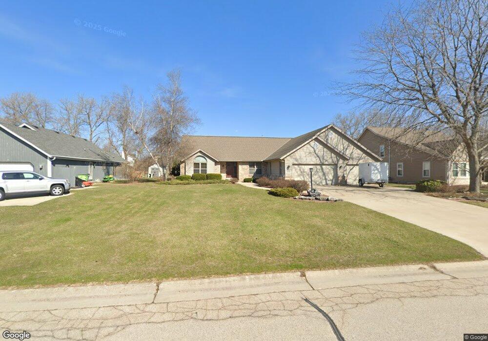
W156S7958 Audrey Ct Muskego, WI 53150
Estimated Value: $554,000 - $602,000
3
Beds
2
Baths
2,163
Sq Ft
$268/Sq Ft
Est. Value
About This Home
This home is located at W156S7958 Audrey Ct, Muskego, WI 53150 and is currently estimated at $579,541, approximately $267 per square foot. W156S7958 Audrey Ct is a home located in Waukesha County with nearby schools including Bay Lane Elementary School, Lake Denoon Middle School, and Muskego High School.
Ownership History
Date
Name
Owned For
Owner Type
Purchase Details
Closed on
Jun 26, 2019
Sold by
Burdette Kathleen
Bought by
Storm Dean R
Current Estimated Value
Home Financials for this Owner
Home Financials are based on the most recent Mortgage that was taken out on this home.
Original Mortgage
$284,900
Outstanding Balance
$250,007
Interest Rate
3.9%
Mortgage Type
New Conventional
Estimated Equity
$329,534
Create a Home Valuation Report for This Property
The Home Valuation Report is an in-depth analysis detailing your home's value as well as a comparison with similar homes in the area
Home Values in the Area
Average Home Value in this Area
Purchase History
| Date | Buyer | Sale Price | Title Company |
|---|---|---|---|
| Storm Dean R | $359,900 | None Available |
Source: Public Records
Mortgage History
| Date | Status | Borrower | Loan Amount |
|---|---|---|---|
| Open | Storm Dean R | $284,900 |
Source: Public Records
Tax History Compared to Growth
Tax History
| Year | Tax Paid | Tax Assessment Tax Assessment Total Assessment is a certain percentage of the fair market value that is determined by local assessors to be the total taxable value of land and additions on the property. | Land | Improvement |
|---|---|---|---|---|
| 2024 | $4,468 | $386,500 | $72,000 | $314,500 |
| 2023 | $4,415 | $386,500 | $72,000 | $314,500 |
| 2022 | $4,312 | $386,500 | $72,000 | $314,500 |
| 2021 | $4,276 | $386,500 | $72,000 | $314,500 |
| 2020 | $4,218 | $300,700 | $63,000 | $237,700 |
| 2019 | $4,152 | $300,700 | $63,000 | $237,700 |
| 2018 | $4,199 | $300,700 | $63,000 | $237,700 |
| 2017 | $4,908 | $300,700 | $63,000 | $237,700 |
| 2016 | $4,107 | $262,500 | $60,000 | $202,500 |
| 2015 | $4,147 | $262,500 | $60,000 | $202,500 |
| 2014 | $4,514 | $262,500 | $60,000 | $202,500 |
| 2013 | $4,514 | $262,500 | $60,000 | $202,500 |
Source: Public Records
Map
Nearby Homes
- S76W15088 Roger Dr
- N51W19119 Quietwood Dr
- S78W16730 Spinnaker Dr
- W145S7644 Durham Dr
- W163S7358 Bay Lane Dr
- S75W16788 Jacob Ct Unit 12
- W169S7647 Gregory Dr Unit D
- W170S7361 Parkland Dr Unit 13
- Lt4 Lannon Dr
- W162S7043 Olive Cir Unit 22
- W171S7452 Lannon Dr
- W169S7219 Avon Ct
- S70W14845 Dartmouth Cir
- S73W17268 Lake Dr
- S75W17553 Harbor Cir Unit 1B
- S83W17591 Cedarcrest Ln
- W177S7495 Harbor Cir Unit 6D
- W179S7953 Scenic Dr
- Lt8 Twin Silos Ct
- S67W14570 Gaulke Ct
- W156S7926 Ladwig Dr
- S79W15551 Foxboro Place
- S79W15553 Foxboro Place
- W156S7968 Audrey Ct
- W156S7912 Ladwig Dr
- S79W15683 Aud Mar Dr
- W156S7919 Ladwig Dr
- S79W15575 Foxboro Place
- S79W15547 Foxboro Place
- W156S7976 Audrey Ct
- S79W15725 Aud Mar Dr
- S79W15722 Aud Mar Dr
- W156S7890 Ladwig Dr
- W155S7991 Foxboro Cir
- S79W15532 Foxboro Place
- S79W15516 Foxboro Place
- S79W15520 Foxboro Place
- W156S7891 Ladwig Dr
- S79W15753 Aud Mar Dr
- W156S7886 Ladwig Dr