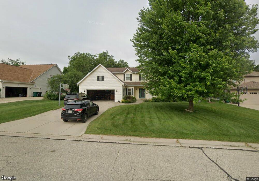
W161N5846 Cheryln Dr Menomonee Falls, WI 53051
Estimated Value: $546,981 - $605,000
4
Beds
3
Baths
2,100
Sq Ft
$274/Sq Ft
Est. Value
About This Home
This home is located at W161N5846 Cheryln Dr, Menomonee Falls, WI 53051 and is currently estimated at $575,745, approximately $274 per square foot. W161N5846 Cheryln Dr is a home located in Waukesha County with nearby schools including Lannon Elementary School, Templeton Middle School, and Hamilton High School.
Ownership History
Date
Name
Owned For
Owner Type
Purchase Details
Closed on
Jun 22, 2010
Sold by
Warnke Timothy O and Warnke Susan R
Bought by
Ehrhardt Jeffrey T and Ehrhardt Jennifer A
Current Estimated Value
Home Financials for this Owner
Home Financials are based on the most recent Mortgage that was taken out on this home.
Original Mortgage
$256,500
Outstanding Balance
$170,976
Interest Rate
4.86%
Mortgage Type
New Conventional
Estimated Equity
$404,769
Purchase Details
Closed on
May 5, 1997
Sold by
Lemanczyk Robert F and Lemanczyk Barbara A
Bought by
Warnke Timothy O and Warnke Susan R
Home Financials for this Owner
Home Financials are based on the most recent Mortgage that was taken out on this home.
Original Mortgage
$34,400
Interest Rate
8.17%
Create a Home Valuation Report for This Property
The Home Valuation Report is an in-depth analysis detailing your home's value as well as a comparison with similar homes in the area
Home Values in the Area
Average Home Value in this Area
Purchase History
| Date | Buyer | Sale Price | Title Company |
|---|---|---|---|
| Ehrhardt Jeffrey T | $285,000 | Priority Title Corporation | |
| Warnke Timothy O | $43,000 | -- |
Source: Public Records
Mortgage History
| Date | Status | Borrower | Loan Amount |
|---|---|---|---|
| Open | Ehrhardt Jeffrey T | $256,500 | |
| Previous Owner | Warnke Timothy O | $34,400 |
Source: Public Records
Tax History Compared to Growth
Tax History
| Year | Tax Paid | Tax Assessment Tax Assessment Total Assessment is a certain percentage of the fair market value that is determined by local assessors to be the total taxable value of land and additions on the property. | Land | Improvement |
|---|---|---|---|---|
| 2024 | $5,407 | $479,900 | $146,600 | $333,300 |
| 2023 | $5,205 | $479,900 | $146,600 | $333,300 |
| 2022 | $5,408 | $336,000 | $100,900 | $235,100 |
| 2021 | $5,093 | $336,000 | $100,900 | $235,100 |
| 2020 | $5,094 | $336,000 | $100,900 | $235,100 |
| 2019 | $5,131 | $336,000 | $100,900 | $235,100 |
| 2018 | $4,943 | $336,000 | $100,900 | $235,100 |
| 2017 | $4,801 | $336,000 | $100,900 | $235,100 |
| 2016 | $4,912 | $336,000 | $100,900 | $235,100 |
| 2015 | $5,153 | $336,000 | $100,900 | $235,100 |
| 2014 | $5,437 | $336,000 | $100,900 | $235,100 |
| 2013 | $5,437 | $336,000 | $100,900 | $235,100 |
Source: Public Records
Map
Nearby Homes
- N61W16085 Hawthorne Dr
- N54W16349 Westwind Dr
- W170N5582 Ridgewood Dr Unit 5582
- N59W17728 Meadow Ct Unit 15
- W164N4951 Lilac Ct
- N67W15832 Tamarack Trail
- N54W14225 Van Buren Dr
- N65W14542 Redwood Dr
- N69W15889 Eileen Ave
- N58W18335 Juniper Ln
- W183N6023 Lost Pond Ct
- W137N6161 Weyer Farm Ct
- 4685 Pilgrim Rd
- W144N4821 Stone Dr
- N51W18938 Quietwood Dr
- W208N6659 Sweet Clover Dr
- N48W14336 Hampton Rd
- 4620 N Calhoun Rd
- N70W17357 Fawn Ave
- N69W17762 Morning Star Ct
- W161N5830 Cheryln Dr
- W161N5860 Cheryln Dr
- W161N5818 Cheryln Dr
- W161N5876 Cheryln Dr
- W161N5804 Cheryln Dr
- W161N5896 Cheryln Dr
- W161N5851 Cheryln Dr
- W161N5841 Cheryln Dr
- W161N5867 Cheryln Dr
- W161N5827 Cheryln Dr
- W160N5790 Cheryln Dr
- N59W16077 Cheryln Dr
- W161N5881 Cheryln Dr
- W161N5801 Cheryln Dr
- W161N5815 Cheryln Dr
- N59W16041 Cheryln Dr
- W161N5785 Cheryln Dr
- W160N5776 Cheryln Dr
- N59W16015 Cheryln Dr
- W161N5891 Cheryln Dr