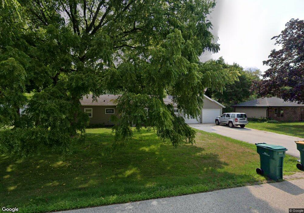
W162N9796 Mayflower Dr Germantown, WI 53022
Estimated Value: $306,000 - $328,281
3
Beds
1
Bath
1,200
Sq Ft
$266/Sq Ft
Est. Value
About This Home
This home is located at W162N9796 Mayflower Dr, Germantown, WI 53022 and is currently estimated at $319,570, approximately $266 per square foot. W162N9796 Mayflower Dr is a home located in Washington County with nearby schools including County Line Elementary School, Kennedy Middle School, and Germantown High School.
Ownership History
Date
Name
Owned For
Owner Type
Purchase Details
Closed on
Nov 19, 2009
Sold by
Alioto Linda F
Bought by
Towers Scott J
Current Estimated Value
Home Financials for this Owner
Home Financials are based on the most recent Mortgage that was taken out on this home.
Original Mortgage
$143,109
Interest Rate
5.05%
Mortgage Type
FHA
Create a Home Valuation Report for This Property
The Home Valuation Report is an in-depth analysis detailing your home's value as well as a comparison with similar homes in the area
Home Values in the Area
Average Home Value in this Area
Purchase History
| Date | Buyer | Sale Price | Title Company |
|---|---|---|---|
| Towers Scott J | $145,800 | None Available |
Source: Public Records
Mortgage History
| Date | Status | Borrower | Loan Amount |
|---|---|---|---|
| Previous Owner | Towers Scott J | $143,109 |
Source: Public Records
Tax History Compared to Growth
Tax History
| Year | Tax Paid | Tax Assessment Tax Assessment Total Assessment is a certain percentage of the fair market value that is determined by local assessors to be the total taxable value of land and additions on the property. | Land | Improvement |
|---|---|---|---|---|
| 2024 | $3,276 | $266,500 | $90,000 | $176,500 |
| 2023 | $2,737 | $178,300 | $69,900 | $108,400 |
| 2022 | $2,747 | $178,300 | $69,900 | $108,400 |
| 2021 | $2,627 | $178,300 | $69,900 | $108,400 |
| 2020 | $2,768 | $178,300 | $69,900 | $108,400 |
| 2019 | $2,642 | $178,300 | $69,900 | $108,400 |
| 2018 | $3,210 | $181,400 | $62,900 | $118,500 |
| 2017 | $3,077 | $181,400 | $62,900 | $118,500 |
| 2016 | $2,703 | $168,300 | $62,900 | $105,400 |
| 2015 | $2,808 | $159,600 | $62,900 | $96,700 |
| 2014 | $2,759 | $159,600 | $62,900 | $96,700 |
| 2013 | $2,751 | $168,800 | $59,000 | $109,800 |
Source: Public Records
Map
Nearby Homes
- W158N9751 Broadleaf Ln
- W163N9517 Cheyenne Dr
- W156N9895 Pilgrim Rd
- N97W16763 Chippewa Dr
- N94W16667 Cumberland Rd
- N94W15652 Ridgeview Dr
- N101W16765 Gunflint Trail
- N101W16795 Gunflint Trail
- The Neenah Plan at Heritage Park North
- The Madison Plan at Heritage Park North
- The Prescott Plan at Heritage Park North
- The Geneva Plan at Heritage Park North
- The Rosebud Plan at Heritage Park North
- The Isabella Plan at Heritage Park North
- The Celina Plan at Heritage Park North
- The Julia Plan at Heritage Park North
- The Charlotte Plan at Heritage Park North
- The Aubrey Plan at Heritage Park North
- The Elsa Plan at Heritage Park North
- W170N9945 Oriole Ct
- W162N9782 Mayflower Dr
- W162N9804 Mayflower Dr
- W162N9762 Mayflower Dr
- N98W16135 Concord Rd
- W161N9807 Colonial Dr
- W162N9795 Mayflower Dr
- W162N9805 Mayflower Dr
- W162N9779 Mayflower Dr
- W162N9761 Mayflower Dr
- W162N9748 Mayflower Dr
- W160N9795 Colonial Dr
- W160N9775 Colonial Dr
- W162N9813 Mayflower Dr
- W160N9757 Colonial Dr
- W162N9732 Mayflower Dr
- W160N9798 Colonial Dr
- W162N9749 Mayflower Dr
- N98W16202 Concord Rd
- W160N9770 Colonial Dr
- W160N9737 Colonial Dr