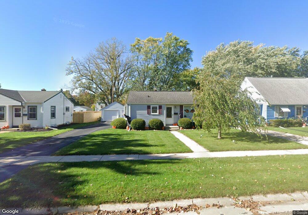
W166N8435 Dardis Ave Menomonee Falls, WI 53051
Estimated Value: $255,000 - $279,331
2
Beds
1
Bath
734
Sq Ft
$363/Sq Ft
Est. Value
About This Home
This home is located at W166N8435 Dardis Ave, Menomonee Falls, WI 53051 and is currently estimated at $266,583, approximately $363 per square foot. W166N8435 Dardis Ave is a home located in Waukesha County with nearby schools including Shady Lane Elementary School, North Middle School, and Menomonee Falls High School.
Ownership History
Date
Name
Owned For
Owner Type
Purchase Details
Closed on
May 22, 2000
Sold by
Schwister Jeffrey S and Schwister Kim M
Bought by
Donohone Maureen
Current Estimated Value
Home Financials for this Owner
Home Financials are based on the most recent Mortgage that was taken out on this home.
Original Mortgage
$82,000
Outstanding Balance
$28,410
Interest Rate
8.18%
Estimated Equity
$238,173
Create a Home Valuation Report for This Property
The Home Valuation Report is an in-depth analysis detailing your home's value as well as a comparison with similar homes in the area
Home Values in the Area
Average Home Value in this Area
Purchase History
| Date | Buyer | Sale Price | Title Company |
|---|---|---|---|
| Donohone Maureen | $112,500 | -- |
Source: Public Records
Mortgage History
| Date | Status | Borrower | Loan Amount |
|---|---|---|---|
| Open | Donohone Maureen | $82,000 |
Source: Public Records
Tax History Compared to Growth
Tax History
| Year | Tax Paid | Tax Assessment Tax Assessment Total Assessment is a certain percentage of the fair market value that is determined by local assessors to be the total taxable value of land and additions on the property. | Land | Improvement |
|---|---|---|---|---|
| 2024 | $2,386 | $215,600 | $89,400 | $126,200 |
| 2023 | $2,282 | $215,600 | $89,400 | $126,200 |
| 2022 | $2,373 | $150,800 | $61,700 | $89,100 |
| 2021 | $2,268 | $150,800 | $61,700 | $89,100 |
| 2020 | $2,406 | $150,800 | $61,700 | $89,100 |
| 2019 | $2,292 | $150,800 | $61,700 | $89,100 |
| 2018 | $2,386 | $150,800 | $61,700 | $89,100 |
| 2017 | $2,490 | $150,800 | $61,700 | $89,100 |
| 2016 | $2,528 | $150,800 | $61,700 | $89,100 |
| 2015 | $2,545 | $150,800 | $61,700 | $89,100 |
| 2014 | $2,721 | $150,800 | $61,700 | $89,100 |
| 2013 | $2,721 | $150,800 | $61,700 | $89,100 |
Source: Public Records
Map
Nearby Homes
- N84W16544 Ann Ave
- W163N8459 Arthur Ave
- N86W16564 Jacobson Dr
- N86W16387 Appleton Ave
- N86W16193 Arthur Ave
- N84W15750 Ridge Rd Unit 204
- W174N8125 Shady Ln Unit 1
- N89W16328 Cleveland Ave
- W175N8080 Robin Cir Unit 1
- W177N8635 Lynwood Dr
- N90W16995 Appleton Ave
- Lt101 Main St
- Lt54 Main St
- Lt8 Main St
- Lt53 Main St
- Lt57 Main St
- Lt13 Main St
- Lt87 Main St
- Lt45 Main St
- Lt38 Main St
- W166N8445 Dardis Ave
- W166N8425 Dardis Ave
- W166N8455 Dardis Ave
- W166N8417 Dardis Ave
- W167N8436 Theodore Ave
- W167N8426 Theodore Ave
- W167N8446 Theodore Ave
- W167N8420 Theodore Ave
- W167N8456 Theodore Ave
- W166N8463 Dardis Ave
- N84W16650 Menomonee Ave
- W166N8440 Dardis Ave
- W166N8430 Dardis Ave
- W166N8450 Dardis Ave
- W167N8464 Theodore Ave
- W167N8410 Theodore Ave
- W166N8460 Dardis Ave
- W166N8471 Dardis Ave
- W166N8410 Dardis Ave
- W167N8472 Theodore Ave