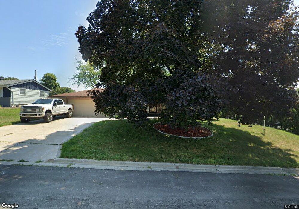
W166N9520 Richmond Dr Menomonee Falls, WI 53051
Estimated Value: $343,000 - $397,000
3
Beds
2
Baths
1,532
Sq Ft
$238/Sq Ft
Est. Value
About This Home
This home is located at W166N9520 Richmond Dr, Menomonee Falls, WI 53051 and is currently estimated at $365,127, approximately $238 per square foot. W166N9520 Richmond Dr is a home located in Waukesha County with nearby schools including Shady Lane Elementary School, North Middle School, and Menomonee Falls High School.
Ownership History
Date
Name
Owned For
Owner Type
Purchase Details
Closed on
Mar 14, 2022
Sold by
Cain Louise R
Bought by
Koziczkowski Jenna
Current Estimated Value
Home Financials for this Owner
Home Financials are based on the most recent Mortgage that was taken out on this home.
Original Mortgage
$237,500
Outstanding Balance
$221,902
Interest Rate
3.92%
Mortgage Type
New Conventional
Estimated Equity
$143,225
Purchase Details
Closed on
Jul 7, 2021
Sold by
Koziczkowski Chester A
Bought by
Koziczkowski Chester A and Cain Louise R
Create a Home Valuation Report for This Property
The Home Valuation Report is an in-depth analysis detailing your home's value as well as a comparison with similar homes in the area
Home Values in the Area
Average Home Value in this Area
Purchase History
| Date | Buyer | Sale Price | Title Company |
|---|---|---|---|
| Koziczkowski Jenna | $250,000 | None Listed On Document | |
| Koziczkowski Chester A | -- | None Listed On Document |
Source: Public Records
Mortgage History
| Date | Status | Borrower | Loan Amount |
|---|---|---|---|
| Open | Koziczkowski Jenna | $237,500 |
Source: Public Records
Tax History Compared to Growth
Tax History
| Year | Tax Paid | Tax Assessment Tax Assessment Total Assessment is a certain percentage of the fair market value that is determined by local assessors to be the total taxable value of land and additions on the property. | Land | Improvement |
|---|---|---|---|---|
| 2024 | $3,491 | $311,500 | $95,100 | $216,400 |
| 2023 | $3,352 | $311,500 | $95,100 | $216,400 |
| 2022 | $3,232 | $202,800 | $65,500 | $137,300 |
| 2021 | $3,091 | $202,800 | $65,500 | $137,300 |
| 2020 | $3,262 | $202,800 | $65,500 | $137,300 |
| 2019 | $3,116 | $202,800 | $65,500 | $137,300 |
| 2018 | $3,262 | $202,800 | $65,500 | $137,300 |
| 2017 | $3,386 | $202,800 | $65,500 | $137,300 |
| 2016 | $3,443 | $202,800 | $65,500 | $137,300 |
| 2015 | $3,456 | $202,800 | $65,500 | $137,300 |
| 2014 | $3,686 | $202,800 | $65,500 | $137,300 |
| 2013 | $3,686 | $202,800 | $65,500 | $137,300 |
Source: Public Records
Map
Nearby Homes
- N92W17274 Forest Dr
- N99W16701 Woodcock Rd
- W174N9287 Joper Rd
- N98W15894 Concord Rd
- N90W16995 Appleton Ave
- N89W16328 Cleveland Ave
- W176N9734 Riversbend Cir E
- W176N9746 Riversbend Cir E Unit E
- N94W17842 Appleton Ave
- N55W20134 Magnolia Ln
- N101W16795 Gunflint Trail
- N100W17560 Whitetail Run
- W179N9765 Riversbend Cir W
- W168N10125 Bittersweet Trail
- Lt101 Main St
- Lt54 Main St
- Lt8 Main St
- Lt53 Main St
- Lt57 Main St
- Lt13 Main St
- W166N9530 Richmond Dr
- W165N9487 Lexington Dr
- W166N9504 Richmond Dr
- W165N9495 Lexington Dr
- N94W16646 Cumberland Rd
- N95W16613 Richmond Dr
- W166N9519 Richmond Dr
- W165N9481 Lexington Dr
- N95W16669 Roanoke Ct
- W165N9505 Lexington Dr
- N94W16687 Cumberland Rd
- N95W16710 Cumberland Rd
- N95W16587 Richmond Dr
- N94W16645 Cumberland Rd
- N95W16648 Roanoke Ct
- N94W16707 Cumberland Rd
- N95W16687 Roanoke Ct
- N95W16732 Cumberland Rd
- W165N9513 Lexington Dr
- W165N9490 Lexington Dr