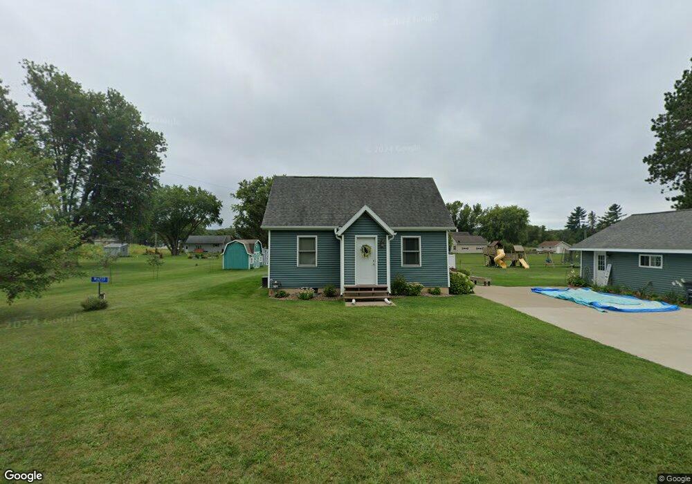
W16733 Brittani Ln Whitehall, WI 54773
Estimated Value: $156,000 - $206,571
--
Bed
--
Bath
--
Sq Ft
0.5
Acres
About This Home
This home is located at W16733 Brittani Ln, Whitehall, WI 54773 and is currently estimated at $182,893. W16733 Brittani Ln is a home located in Trempealeau County with nearby schools including Whitehall Memorial Elementary School, Whitehall Memorial Jr./Sr. High School, and Fly Creek Amish School.
Ownership History
Date
Name
Owned For
Owner Type
Purchase Details
Closed on
Mar 30, 2012
Sold by
Engen Michael A and Engen Kelli
Bought by
Mcanallen Derrek W
Current Estimated Value
Home Financials for this Owner
Home Financials are based on the most recent Mortgage that was taken out on this home.
Original Mortgage
$110,326
Outstanding Balance
$76,167
Interest Rate
3.9%
Mortgage Type
New Conventional
Estimated Equity
$106,726
Purchase Details
Closed on
Mar 7, 2007
Sold by
Engen Andrew and Engen Sharon
Bought by
Engen Michael A
Home Financials for this Owner
Home Financials are based on the most recent Mortgage that was taken out on this home.
Original Mortgage
$2,000
Interest Rate
6.28%
Mortgage Type
Purchase Money Mortgage
Create a Home Valuation Report for This Property
The Home Valuation Report is an in-depth analysis detailing your home's value as well as a comparison with similar homes in the area
Home Values in the Area
Average Home Value in this Area
Purchase History
| Date | Buyer | Sale Price | Title Company |
|---|---|---|---|
| Mcanallen Derrek W | $106,000 | None Available | |
| Engen Michael A | $81,000 | None Available |
Source: Public Records
Mortgage History
| Date | Status | Borrower | Loan Amount |
|---|---|---|---|
| Open | Mcanallen Derrek W | $110,326 | |
| Previous Owner | Engen Michael A | $2,000 |
Source: Public Records
Tax History Compared to Growth
Tax History
| Year | Tax Paid | Tax Assessment Tax Assessment Total Assessment is a certain percentage of the fair market value that is determined by local assessors to be the total taxable value of land and additions on the property. | Land | Improvement |
|---|---|---|---|---|
| 2024 | $1,892 | $122,400 | $10,000 | $112,400 |
| 2023 | $1,723 | $122,400 | $10,000 | $112,400 |
| 2022 | $1,540 | $122,400 | $10,000 | $112,400 |
| 2021 | $1,605 | $90,100 | $3,400 | $86,700 |
| 2020 | $1,799 | $12,070 | $3,400 | $8,670 |
| 2019 | $1,777 | $90,100 | $3,400 | $86,700 |
| 2018 | $1,616 | $90,100 | $3,400 | $86,700 |
| 2017 | $1,598 | $90,100 | $3,400 | $86,700 |
| 2016 | $1,579 | $90,100 | $3,400 | $86,700 |
| 2015 | $1,469 | $90,100 | $3,400 | $86,700 |
| 2014 | $1,461 | $90,100 | $3,400 | $86,700 |
| 2011 | $1,392 | $90,100 | $3,400 | $86,700 |
Source: Public Records
Map
Nearby Homes
- N36836 Us Highway 53 121
- 36290 Camp St
- 18144 Anderson St
- 18124 Fredrickson St
- 36015 Main St
- 18430 Hillside Dr
- N34855 County Rd S
- N34701 County Rd N
- 39971 Anderson St
- N32838 Briten Rd
- 39885 Winsand Dr
- 40257 Olson St
- W12198 County Road P
- XX Vold Rd
- N34701 County Rd S
- 517 W Broadway St
- 102 S Peterson Ave
- 127 E Broadway St
- 328 S Urberg Ave
- 612 E Broadway St
- 16773 Brittani Ln
- W16703 Brittani Ln
- W16728 Brittani Ln
- W16724 Brittani Ln
- N37021 Us Highway 53 121
- W16853 Brittani Ln
- 16724 Brittani Ln
- W16688 Brittani Ln
- W16687 Brittani Ln
- 16687 Brittani Ln
- W16684 Brittani Ln
- W16633 Brittani Ln
- N37077 Us Highway 53 121
- N36953 Hwy 53 121
- N36976 Us Highway 53 121
- N37048 Us Highway 53 121
- n 37048 Us Highway 53 121
- N37048 U S 53
- W16773 Brittani Ln
- W16614 Brittani Ln