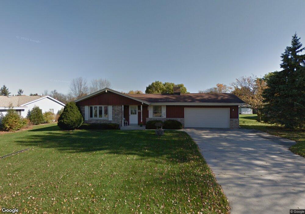
W167N10544 Bridle Path Germantown, WI 53022
Estimated Value: $403,493 - $433,000
3
Beds
2
Baths
1,667
Sq Ft
$252/Sq Ft
Est. Value
About This Home
This home is located at W167N10544 Bridle Path, Germantown, WI 53022 and is currently estimated at $420,123, approximately $252 per square foot. W167N10544 Bridle Path is a home located in Washington County with nearby schools including County Line Elementary School, Kennedy Middle School, and Germantown High School.
Ownership History
Date
Name
Owned For
Owner Type
Purchase Details
Closed on
Aug 20, 2020
Sold by
Smith Angela M
Bought by
Cottrill Richard and Cottrill Katie
Current Estimated Value
Home Financials for this Owner
Home Financials are based on the most recent Mortgage that was taken out on this home.
Original Mortgage
$274,950
Outstanding Balance
$243,900
Interest Rate
3%
Mortgage Type
New Conventional
Estimated Equity
$176,223
Purchase Details
Closed on
Sep 20, 2017
Sold by
Dostalek Linda M
Bought by
Smith Angela M
Home Financials for this Owner
Home Financials are based on the most recent Mortgage that was taken out on this home.
Original Mortgage
$238,500
Interest Rate
3.06%
Mortgage Type
Adjustable Rate Mortgage/ARM
Create a Home Valuation Report for This Property
The Home Valuation Report is an in-depth analysis detailing your home's value as well as a comparison with similar homes in the area
Home Values in the Area
Average Home Value in this Area
Purchase History
| Date | Buyer | Sale Price | Title Company |
|---|---|---|---|
| Cottrill Richard | $305,500 | None Available | |
| Smith Angela M | $265,000 | None Available |
Source: Public Records
Mortgage History
| Date | Status | Borrower | Loan Amount |
|---|---|---|---|
| Open | Cottrill Richard | $274,950 | |
| Previous Owner | Smith Angela M | $238,500 |
Source: Public Records
Tax History Compared to Growth
Tax History
| Year | Tax Paid | Tax Assessment Tax Assessment Total Assessment is a certain percentage of the fair market value that is determined by local assessors to be the total taxable value of land and additions on the property. | Land | Improvement |
|---|---|---|---|---|
| 2024 | $4,475 | $355,500 | $81,500 | $274,000 |
| 2023 | $4,006 | $251,600 | $67,400 | $184,200 |
| 2022 | $4,000 | $251,600 | $67,400 | $184,200 |
| 2021 | $3,834 | $251,600 | $67,400 | $184,200 |
| 2020 | $4,005 | $251,600 | $67,400 | $184,200 |
| 2019 | $3,834 | $251,600 | $67,400 | $184,200 |
| 2018 | $3,450 | $211,100 | $61,400 | $149,700 |
| 2017 | $3,291 | $211,100 | $61,400 | $149,700 |
| 2016 | $3,266 | $211,100 | $61,400 | $149,700 |
| 2015 | $3,201 | $200,400 | $61,400 | $139,000 |
| 2014 | $3,329 | $200,400 | $61,400 | $139,000 |
| 2013 | $3,756 | $229,100 | $74,000 | $155,100 |
Source: Public Records
Map
Nearby Homes
- W165N10401 Wagon Trail
- N106W16321 Old Farm Rd
- W168N10125 Bittersweet Trail
- N101W16795 Gunflint Trail
- N108W17282 Lilac Ln
- N110W16867 Ashbury Cir Unit 3
- N119W14982 Ivy Ln
- N99W16701 Woodcock Rd
- N100W17560 Whitetail Run
- W156N10904 Catskill Ln
- Lot 2 Stonewood Dr
- W158N11175 Legend Ave Unit 2
- N99W17909 Appletree Ct Unit D-102
- N98W15894 Concord Rd
- N114W16680 Crown Dr Unit 7
- W180N9890 Riversbend Cir W
- W176N9746 Riversbend Cir E Unit E
- W176N9734 Riversbend Cir E
- W153N9883 Neptune Dr
- N114W16721 Royal Ct
- W167N10532 Bridle Path
- W167N10547 Bridle Path
- W167N10533 Bridle Path
- W167N10558 Bridle Path
- W167N10519 Bridle Path
- W167N10524 Bridle Path
- W166N10539 Surrey Dr
- W166N10521 Surrey Dr
- N105W16775 Old Farm Rd
- N106W16741 Old Farm Rd
- W166N10555 Surrey Dr
- W167N10505 Bridle Path
- W167N10454 Bridle Path
- W168N10520 Deer Crossing
- W168N10534 Deer Crossing
- W166N10563 Surrey Dr
- W168N10512 Deer Crossing
- W168N10546 Deer Crossing
- W167N10449 Bridle Path
- W166N10443 Surrey Dr