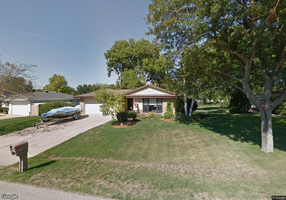
W167S7265 Briargate Ln Muskego, WI 53150
Estimated Value: $376,000 - $444,000
3
Beds
2
Baths
1,246
Sq Ft
$339/Sq Ft
Est. Value
About This Home
This home is located at W167S7265 Briargate Ln, Muskego, WI 53150 and is currently estimated at $421,985, approximately $338 per square foot. W167S7265 Briargate Ln is a home located in Waukesha County with nearby schools including Muskego Lakes Middle School, Muskego High School, and St. Leonard School.
Ownership History
Date
Name
Owned For
Owner Type
Purchase Details
Closed on
Dec 5, 2002
Sold by
Kopka Jason W and Kopka Rebecca A
Bought by
Clark Charles E and Clark Diane E
Current Estimated Value
Home Financials for this Owner
Home Financials are based on the most recent Mortgage that was taken out on this home.
Original Mortgage
$131,750
Outstanding Balance
$56,552
Interest Rate
6.23%
Estimated Equity
$365,433
Purchase Details
Closed on
Oct 29, 1999
Sold by
Ayers Susan Joan
Bought by
Kopka Jason W and Kopka Rebecca A
Home Financials for this Owner
Home Financials are based on the most recent Mortgage that was taken out on this home.
Original Mortgage
$154,700
Interest Rate
7.78%
Create a Home Valuation Report for This Property
The Home Valuation Report is an in-depth analysis detailing your home's value as well as a comparison with similar homes in the area
Home Values in the Area
Average Home Value in this Area
Purchase History
| Date | Buyer | Sale Price | Title Company |
|---|---|---|---|
| Clark Charles E | $189,900 | -- | |
| Kopka Jason W | $162,900 | -- |
Source: Public Records
Mortgage History
| Date | Status | Borrower | Loan Amount |
|---|---|---|---|
| Open | Clark Charles E | $131,750 | |
| Previous Owner | Kopka Jason W | $154,700 |
Source: Public Records
Tax History Compared to Growth
Tax History
| Year | Tax Paid | Tax Assessment Tax Assessment Total Assessment is a certain percentage of the fair market value that is determined by local assessors to be the total taxable value of land and additions on the property. | Land | Improvement |
|---|---|---|---|---|
| 2024 | $3,332 | $295,100 | $62,400 | $232,700 |
| 2023 | $3,284 | $295,100 | $62,400 | $232,700 |
| 2022 | $3,211 | $295,100 | $62,400 | $232,700 |
| 2021 | $3,180 | $295,100 | $62,400 | $232,700 |
| 2020 | $3,240 | $236,000 | $54,600 | $181,400 |
| 2019 | $3,209 | $236,000 | $54,600 | $181,400 |
| 2018 | $3,248 | $236,000 | $54,600 | $181,400 |
| 2017 | $3,248 | $236,000 | $54,600 | $181,400 |
| 2016 | $3,294 | $212,900 | $52,000 | $160,900 |
| 2015 | $3,330 | $212,900 | $52,000 | $160,900 |
| 2014 | $3,625 | $212,900 | $52,000 | $160,900 |
| 2013 | $3,625 | $212,900 | $52,000 | $160,900 |
Source: Public Records
Map
Nearby Homes
- W170S7361 Parkland Dr Unit 13
- W171S7452 Lannon Dr
- S75W16788 Jacob Ct Unit 12
- W163S7358 Bay Lane Dr
- S73W17268 Lake Dr
- Lt4 Lannon Dr
- W162S7043 Olive Cir Unit 22
- N51W19119 Quietwood Dr
- W177S7495 Harbor Cir Unit 6D
- S66W16256 Chestnut Ridge Ct
- Lt0 College Ave
- Brookhaven Plan at Kirkland Crossing
- The Sycamore Plan at Kirkland Crossing
- The Maple Plan at Kirkland Crossing
- Essex Plan at Kirkland Crossing
- Harlow Plan at Kirkland Crossing
- The Lavender Plan at Kirkland Crossing
- The Savannah Plan at Kirkland Crossing
- Danbury Plan at Kirkland Crossing
- Hawthorne Plan at Kirkland Crossing
- W167S7277 Briargate Ln
- W167S7253 Briargate Ln
- W167S7272 Briargate Ln
- W167S7293 Briargate Ln
- W167S7284 Briargate Ln
- W167S7264 Briargate Ln
- W167S7294 Briargate Ln
- S73W16802 Briargate Ln
- W167S7241 Briargate Ln
- W167S7252 Briargate Ln
- S73W16797 Briargate Ln
- W167S7225 Briargate Ln
- S73W16834 Briargate Ln
- W167S7238 Briargate Ln
- W168S7262 Parkland Dr
- S73W16825 Briargate Ln
- W167S7228 Briargate Ln
- W168S7284 Parkland Dr
- W167S7215 Briargate Ln
- W168S7278 Parkland Dr