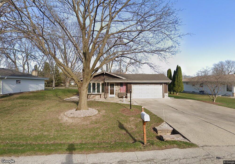
W170S6996 Southern Dr Muskego, WI 53150
Estimated Value: $407,000 - $437,438
3
Beds
2
Baths
1,280
Sq Ft
$327/Sq Ft
Est. Value
About This Home
This home is located at W170S6996 Southern Dr, Muskego, WI 53150 and is currently estimated at $418,860, approximately $327 per square foot. W170S6996 Southern Dr is a home located in Waukesha County with nearby schools including Muskego Lakes Middle School, Muskego High School, and St. Leonard School.
Ownership History
Date
Name
Owned For
Owner Type
Purchase Details
Closed on
Dec 18, 2015
Sold by
Stanfield David and Stanfield Karie
Bought by
Sisel Dawn
Current Estimated Value
Purchase Details
Closed on
Sep 20, 2006
Sold by
Heidger Robert and Heidger Celia
Bought by
Stanfield David and Stanfield Karie
Home Financials for this Owner
Home Financials are based on the most recent Mortgage that was taken out on this home.
Original Mortgage
$182,320
Interest Rate
6.49%
Mortgage Type
New Conventional
Create a Home Valuation Report for This Property
The Home Valuation Report is an in-depth analysis detailing your home's value as well as a comparison with similar homes in the area
Home Values in the Area
Average Home Value in this Area
Purchase History
| Date | Buyer | Sale Price | Title Company |
|---|---|---|---|
| Sisel Dawn | $220,900 | None Available | |
| Stanfield David | $227,900 | Land Title Services Inc |
Source: Public Records
Mortgage History
| Date | Status | Borrower | Loan Amount |
|---|---|---|---|
| Previous Owner | Stanfield David | $182,320 |
Source: Public Records
Tax History Compared to Growth
Tax History
| Year | Tax Paid | Tax Assessment Tax Assessment Total Assessment is a certain percentage of the fair market value that is determined by local assessors to be the total taxable value of land and additions on the property. | Land | Improvement |
|---|---|---|---|---|
| 2024 | $3,107 | $276,400 | $59,600 | $216,800 |
| 2023 | $3,060 | $276,400 | $59,600 | $216,800 |
| 2022 | $3,571 | $276,400 | $59,600 | $216,800 |
| 2021 | $3,575 | $276,400 | $59,600 | $216,800 |
| 2020 | $2,947 | $215,900 | $51,700 | $164,200 |
| 2019 | $2,916 | $215,900 | $51,700 | $164,200 |
| 2018 | $2,953 | $215,900 | $51,700 | $164,200 |
| 2017 | $3,524 | $215,900 | $51,700 | $164,200 |
| 2016 | $3,025 | $196,500 | $49,300 | $147,200 |
| 2015 | $3,060 | $196,500 | $49,300 | $147,200 |
| 2014 | $3,331 | $196,500 | $49,300 | $147,200 |
| 2013 | $3,331 | $196,500 | $49,300 | $147,200 |
Source: Public Records
Map
Nearby Homes
- S73W16773 Briargate Ln
- W170S7361 Parkland Dr Unit 13
- W162S7043 Olive Cir Unit 22
- S73W17268 Lake Dr
- W171S7452 Lannon Dr
- W163S7358 Bay Lane Dr
- Lt4 Lannon Dr
- S66W16256 Chestnut Ridge Ct
- S75W16788 Jacob Ct Unit 12
- Lt0 College Ave
- S70W15770 Sandalwood Dr
- Brookhaven Plan at Kirkland Crossing
- The Sycamore Plan at Kirkland Crossing
- The Maple Plan at Kirkland Crossing
- Essex Plan at Kirkland Crossing
- Harlow Plan at Kirkland Crossing
- The Lavender Plan at Kirkland Crossing
- The Savannah Plan at Kirkland Crossing
- Danbury Plan at Kirkland Crossing
- Hawthorne Plan at Kirkland Crossing
- W170S6978 Southern Dr
- W170S7006 Southern Dr
- W170S6966 Southern Dr
- W170S7020 Southern Dr
- W170S6956 Southern Dr
- W170S7032 Southern Dr
- W170S6967 Southern Dr
- W170S6971 Southern Dr
- W170S7011 Southern Dr
- S69W16887 Parkland Dr
- W170S6944 Southern Dr
- W169S6951 Parkland Dr
- S70W16920 York Ct
- W168S6983 Parkland Dr
- W168S6967 Parkland Dr
- W170S6951 Southern Dr
- W168S6995 Parkland Dr
- W168S7007 Parkland Dr
- W169S7047 York Ct
- W170S7025 Southern Dr