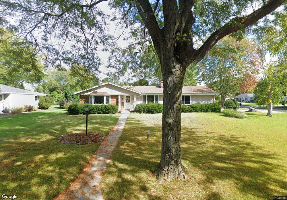
W171N10424 Harvest Ln Germantown, WI 53022
Estimated Value: $393,000 - $420,000
3
Beds
2
Baths
1,675
Sq Ft
$242/Sq Ft
Est. Value
About This Home
This home is located at W171N10424 Harvest Ln, Germantown, WI 53022 and is currently estimated at $404,616, approximately $241 per square foot. W171N10424 Harvest Ln is a home located in Washington County with nearby schools including County Line Elementary School, Kennedy Middle School, and Germantown High School.
Ownership History
Date
Name
Owned For
Owner Type
Purchase Details
Closed on
Oct 16, 2019
Sold by
Edith M Bardele Heebner Revocable Trust
Bought by
Henke Matthew T and Hneke Heidi K
Current Estimated Value
Home Financials for this Owner
Home Financials are based on the most recent Mortgage that was taken out on this home.
Original Mortgage
$231,750
Outstanding Balance
$202,607
Interest Rate
3.4%
Mortgage Type
New Conventional
Estimated Equity
$202,009
Create a Home Valuation Report for This Property
The Home Valuation Report is an in-depth analysis detailing your home's value as well as a comparison with similar homes in the area
Home Values in the Area
Average Home Value in this Area
Purchase History
| Date | Buyer | Sale Price | Title Company |
|---|---|---|---|
| Henke Matthew T | $257,500 | Lakefront Title Llc |
Source: Public Records
Mortgage History
| Date | Status | Borrower | Loan Amount |
|---|---|---|---|
| Open | Henke Matthew T | $231,750 |
Source: Public Records
Tax History Compared to Growth
Tax History
| Year | Tax Paid | Tax Assessment Tax Assessment Total Assessment is a certain percentage of the fair market value that is determined by local assessors to be the total taxable value of land and additions on the property. | Land | Improvement |
|---|---|---|---|---|
| 2024 | $4,387 | $349,000 | $83,000 | $266,000 |
| 2023 | $4,024 | $242,800 | $67,800 | $175,000 |
| 2022 | $3,850 | $242,800 | $67,800 | $175,000 |
| 2021 | $3,689 | $242,800 | $67,800 | $175,000 |
| 2020 | $3,857 | $242,800 | $67,800 | $175,000 |
| 2019 | $3,691 | $242,800 | $67,800 | $175,000 |
| 2018 | $3,542 | $216,400 | $61,600 | $154,800 |
| 2017 | $3,378 | $216,400 | $61,600 | $154,800 |
| 2016 | $3,353 | $216,400 | $61,600 | $154,800 |
| 2015 | $3,291 | $205,800 | $61,600 | $144,200 |
| 2014 | $3,421 | $205,800 | $61,600 | $144,200 |
| 2013 | $3,839 | $234,100 | $74,000 | $160,100 |
Source: Public Records
Map
Nearby Homes
- W168N10125 Bittersweet Trail
- W165N10401 Wagon Trail
- N101W16795 Gunflint Trail
- N108W17282 Lilac Ln
- N106W16321 Old Farm Rd
- N100W17560 Whitetail Run
- N99W16701 Woodcock Rd
- N110W16867 Ashbury Cir Unit 3
- N119W14982 Ivy Ln
- N99W17909 Appletree Ct Unit D-102
- Lt2 Stonewood Dr
- W180N9890 Riversbend Cir W
- W176N9746 Riversbend Cir E Unit E
- W176N9734 Riversbend Cir E
- W179N9765 Riversbend Cir W
- W156N10904 Catskill Ln
- W154N10077 Moonlite Dr
- N98W15894 Concord Rd
- W158N11175 Legend Ave Unit 2
- N114W16680 Crown Dr Unit 7
- N104W16970 Thornapple Row
- W171N10440 Harvest Ln
- W171N10411 Harvest Ln
- N104W17037 Thornapple Row
- N104W17019 Thornapple Row
- W171N10452 Harvest Ln
- W169N10427 Pheasant Run
- N104W17075 Thornapple Row
- W171N10403 Harvest Ln
- W169N10439 Pheasant Run
- W171N10429 Harvest Ln
- N104W16953 Thornapple Row
- W171N10466 Harvest Ln
- W169N10420 Pheasant Run
- W169N10432 Pheasant Run
- W169N10444 Pheasant Run
- W169N10451 Pheasant Run
- W171N10447 Harvest Ln
- N104W16939 Thornapple Row
- W171N10510 Harvest Ln