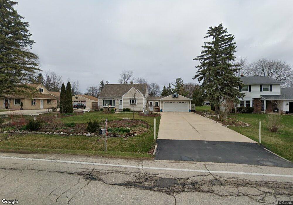
W171S7200 Lannon Dr Muskego, WI 53150
Estimated Value: $349,000 - $397,000
3
Beds
2
Baths
1,208
Sq Ft
$305/Sq Ft
Est. Value
About This Home
This home is located at W171S7200 Lannon Dr, Muskego, WI 53150 and is currently estimated at $368,916, approximately $305 per square foot. W171S7200 Lannon Dr is a home located in Waukesha County with nearby schools including Muskego Lakes Middle School, Muskego High School, and St. Leonard School.
Ownership History
Date
Name
Owned For
Owner Type
Purchase Details
Closed on
Sep 25, 1997
Sold by
Wessel George F and Wessel George F
Bought by
Roy Michael A and Roy Sharon L
Current Estimated Value
Home Financials for this Owner
Home Financials are based on the most recent Mortgage that was taken out on this home.
Original Mortgage
$79,200
Outstanding Balance
$12,825
Interest Rate
7.54%
Estimated Equity
$356,091
Create a Home Valuation Report for This Property
The Home Valuation Report is an in-depth analysis detailing your home's value as well as a comparison with similar homes in the area
Home Values in the Area
Average Home Value in this Area
Purchase History
| Date | Buyer | Sale Price | Title Company |
|---|---|---|---|
| Roy Michael A | $99,000 | -- |
Source: Public Records
Mortgage History
| Date | Status | Borrower | Loan Amount |
|---|---|---|---|
| Open | Roy Michael A | $79,200 |
Source: Public Records
Tax History Compared to Growth
Tax History
| Year | Tax Paid | Tax Assessment Tax Assessment Total Assessment is a certain percentage of the fair market value that is determined by local assessors to be the total taxable value of land and additions on the property. | Land | Improvement |
|---|---|---|---|---|
| 2024 | $2,354 | $213,900 | $54,600 | $159,300 |
| 2023 | $2,310 | $213,900 | $54,600 | $159,300 |
| 2022 | $2,265 | $213,900 | $54,600 | $159,300 |
| 2021 | $2,238 | $213,900 | $54,600 | $159,300 |
| 2020 | $2,564 | $189,600 | $47,400 | $142,200 |
| 2019 | $2,533 | $189,600 | $47,400 | $142,200 |
| 2018 | $2,567 | $189,600 | $47,400 | $142,200 |
| 2017 | $2,575 | $189,600 | $47,400 | $142,200 |
| 2016 | $2,386 | $157,500 | $44,700 | $112,800 |
| 2015 | $2,418 | $157,500 | $44,700 | $112,800 |
| 2014 | $2,631 | $157,500 | $44,700 | $112,800 |
| 2013 | $2,631 | $157,500 | $44,700 | $112,800 |
Source: Public Records
Map
Nearby Homes
- S73W17268 Lake Dr
- W170S7361 Parkland Dr Unit 13
- W171S7452 Lannon Dr
- S73W16773 Briargate Ln
- Lt4 Lannon Dr
- S75W16788 Jacob Ct Unit 12
- W177S7495 Harbor Cir Unit 6D
- W163S7358 Bay Lane Dr
- W162S7043 Olive Cir Unit 22
- N51W19119 Quietwood Dr
- S70W15770 Sandalwood Dr
- S66W16256 Chestnut Ridge Ct
- Lt0 College Ave
- Brookhaven Plan at Kirkland Crossing
- The Sycamore Plan at Kirkland Crossing
- The Maple Plan at Kirkland Crossing
- Essex Plan at Kirkland Crossing
- Harlow Plan at Kirkland Crossing
- The Lavender Plan at Kirkland Crossing
- The Savannah Plan at Kirkland Crossing
- W171S7210 Lannon Dr
- W171S7186 Lannon Dr
- W171S7178 Lannon Dr
- W171S7222 Lannon Dr
- W172S7195 Lannon Dr
- W172S7219 Lannon Dr
- W171S7164 Lannon Dr
- S72W17150 South Ln
- W170S7185 Meadow Dr
- W170S7207 Meadow Dr
- W170S7223 Meadow Dr
- W171S7152 Lannon Dr
- S72W17090 South Ln
- W172S7165 Lannon Dr
- W170S7171 Meadow Dr
- S71W17273 Pleasant View Dr
- S72W17268 Schubring Dr
- S72W17227 Schubring Dr
- S71W17274 Pleasant View Dr
- S71W17155 North Ln