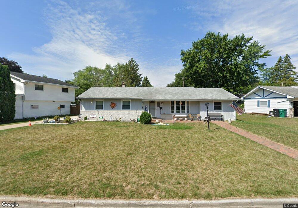
W172N9485 Shady Ln Menomonee Falls, WI 53051
Estimated Value: $361,000 - $392,407
3
Beds
2
Baths
1,536
Sq Ft
$246/Sq Ft
Est. Value
About This Home
This home is located at W172N9485 Shady Ln, Menomonee Falls, WI 53051 and is currently estimated at $378,102, approximately $246 per square foot. W172N9485 Shady Ln is a home located in Waukesha County with nearby schools including Shady Lane Elementary School, North Middle School, and Menomonee Falls High School.
Ownership History
Date
Name
Owned For
Owner Type
Purchase Details
Closed on
Aug 21, 2015
Sold by
Collard Sharon E
Bought by
Krause Robin M
Current Estimated Value
Home Financials for this Owner
Home Financials are based on the most recent Mortgage that was taken out on this home.
Original Mortgage
$189,000
Outstanding Balance
$148,647
Interest Rate
4.03%
Mortgage Type
VA
Estimated Equity
$229,455
Create a Home Valuation Report for This Property
The Home Valuation Report is an in-depth analysis detailing your home's value as well as a comparison with similar homes in the area
Home Values in the Area
Average Home Value in this Area
Purchase History
| Date | Buyer | Sale Price | Title Company |
|---|---|---|---|
| Krause Robin M | $189,000 | Priority Title Corp |
Source: Public Records
Mortgage History
| Date | Status | Borrower | Loan Amount |
|---|---|---|---|
| Open | Krause Robin M | $189,000 |
Source: Public Records
Tax History Compared to Growth
Tax History
| Year | Tax Paid | Tax Assessment Tax Assessment Total Assessment is a certain percentage of the fair market value that is determined by local assessors to be the total taxable value of land and additions on the property. | Land | Improvement |
|---|---|---|---|---|
| 2024 | $4,621 | $314,200 | $93,200 | $221,000 |
| 2023 | $4,917 | $314,200 | $93,200 | $221,000 |
| 2022 | $4,833 | $202,600 | $64,100 | $138,500 |
| 2021 | $4,559 | $202,600 | $64,100 | $138,500 |
| 2020 | $4,453 | $202,600 | $64,100 | $138,500 |
| 2019 | $4,693 | $202,600 | $64,100 | $138,500 |
| 2018 | $5,892 | $202,600 | $64,100 | $138,500 |
| 2017 | $5,323 | $202,600 | $64,100 | $138,500 |
| 2016 | $5,030 | $202,600 | $64,100 | $138,500 |
| 2015 | $3,453 | $202,600 | $64,100 | $138,500 |
| 2014 | $3,682 | $202,600 | $64,100 | $138,500 |
| 2013 | $3,682 | $202,600 | $64,100 | $138,500 |
Source: Public Records
Map
Nearby Homes
- N92W17274 Forest Dr
- W174N9287 Joper Rd
- N94W17842 Appleton Ave
- W166N9108 Grand Ave
- N90W16995 Appleton Ave
- W179N9765 Riversbend Cir W
- N99W16701 Woodcock Rd
- N99W17909 Appletree Ct Unit D-102
- W162N9761 Mayflower Dr
- N100W17560 Whitetail Run
- N89W16328 Cleveland Ave
- The Rosebud Plan at Heritage Park North
- The Charlotte Plan at Heritage Park North
- The Madison Plan at Heritage Park North
- The Julia Plan at Heritage Park North
- The Aubrey Plan at Heritage Park North
- The Isabella Plan at Heritage Park North
- The Elsa Plan at Heritage Park North
- The Prescott Plan at Heritage Park North
- The Celina Plan at Heritage Park North
- W172N9501 Shady Ln
- W172N9471 Shady Ln
- W173N9482 Erika Rd
- W172N9459 Shady Ln
- W172N9512 Erika Rd
- W172N9496 Erika Rd
- W172N9447 Shady Ln
- W173N9470 Erika Rd
- W173N9458 Erika Rd
- W173N9507 Erika Rd
- W172N9435 Shady Ln
- W173N9444 Erika Rd
- W173N9471 Erika Rd
- W173N9493 Erika Rd
- W173N9483 Erika Rd
- N95W17293 Shady Ln
- W173N9459 Erika Rd
- W173N9447 Erika Rd
- W173N9434 Erika Rd
- W172N9423 Shady Ln