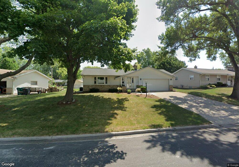
W174N9506 Devonwood Rd Menomonee Falls, WI 53051
Estimated Value: $376,000 - $387,000
3
Beds
3
Baths
1,354
Sq Ft
$281/Sq Ft
Est. Value
About This Home
This home is located at W174N9506 Devonwood Rd, Menomonee Falls, WI 53051 and is currently estimated at $380,410, approximately $280 per square foot. W174N9506 Devonwood Rd is a home located in Waukesha County with nearby schools including Shady Lane Elementary School, North Middle School, and Menomonee Falls High School.
Ownership History
Date
Name
Owned For
Owner Type
Purchase Details
Closed on
Aug 31, 2005
Sold by
Dantonio Diane M
Bought by
Kendall Daniel M and Kendall Sara J
Current Estimated Value
Home Financials for this Owner
Home Financials are based on the most recent Mortgage that was taken out on this home.
Original Mortgage
$172,800
Outstanding Balance
$92,681
Interest Rate
5.89%
Mortgage Type
Fannie Mae Freddie Mac
Estimated Equity
$287,729
Purchase Details
Closed on
Aug 18, 2003
Sold by
Bachtell Samantha S and Estate Of Frederick H Krause
Bought by
Dantonio Diane M
Home Financials for this Owner
Home Financials are based on the most recent Mortgage that was taken out on this home.
Original Mortgage
$148,000
Interest Rate
5.12%
Mortgage Type
Purchase Money Mortgage
Create a Home Valuation Report for This Property
The Home Valuation Report is an in-depth analysis detailing your home's value as well as a comparison with similar homes in the area
Home Values in the Area
Average Home Value in this Area
Purchase History
| Date | Buyer | Sale Price | Title Company |
|---|---|---|---|
| Kendall Daniel M | $216,000 | -- | |
| Dantonio Diane M | $185,000 | Gatewood Title Services |
Source: Public Records
Mortgage History
| Date | Status | Borrower | Loan Amount |
|---|---|---|---|
| Open | Kendall Daniel M | $172,800 | |
| Previous Owner | Dantonio Diane M | $148,000 |
Source: Public Records
Tax History Compared to Growth
Tax History
| Year | Tax Paid | Tax Assessment Tax Assessment Total Assessment is a certain percentage of the fair market value that is determined by local assessors to be the total taxable value of land and additions on the property. | Land | Improvement |
|---|---|---|---|---|
| 2024 | $3,776 | $336,200 | $87,700 | $248,500 |
| 2023 | $3,628 | $336,200 | $87,700 | $248,500 |
| 2022 | $3,457 | $216,400 | $60,300 | $156,100 |
| 2021 | $3,307 | $216,400 | $60,300 | $156,100 |
| 2020 | $3,259 | $202,600 | $60,300 | $142,300 |
| 2019 | $3,113 | $202,600 | $60,300 | $142,300 |
| 2018 | $3,259 | $202,600 | $60,300 | $142,300 |
| 2017 | $3,383 | $202,600 | $60,300 | $142,300 |
| 2016 | $3,440 | $202,600 | $60,300 | $142,300 |
| 2015 | $3,453 | $202,600 | $60,300 | $142,300 |
| 2014 | $3,682 | $202,600 | $60,300 | $142,300 |
| 2013 | $3,682 | $202,600 | $60,300 | $142,300 |
Source: Public Records
Map
Nearby Homes
- N94W17842 Appleton Ave
- W174N9287 Joper Rd
- N92W17274 Forest Dr
- W179N9765 Riversbend Cir W
- N99W17909 Appletree Ct Unit D-102
- N90W16995 Appleton Ave
- W166N9108 Grand Ave
- N100W17560 Whitetail Run
- N99W16701 Woodcock Rd
- W162N9761 Mayflower Dr
- W178N8846 Queensway St
- N88W17690 Christman Rd
- The Rosebud Plan at Heritage Park North
- The Charlotte Plan at Heritage Park North
- The Madison Plan at Heritage Park North
- The Julia Plan at Heritage Park North
- The Aubrey Plan at Heritage Park North
- The Isabella Plan at Heritage Park North
- The Elsa Plan at Heritage Park North
- The Prescott Plan at Heritage Park North
- W174N9494 Devonwood Rd
- W174N9520 Devonwood Rd
- W174N9501 Devonwood Rd
- W174N9511 Devonwood Rd
- W174N9482 Devonwood Rd
- W174N9521 Devonwood Rd
- W174N9529 Devonwood Rd
- W174N9491 Joper Rd
- W174N9472 Devonwood Rd
- W174N9493 Devonwood Rd
- W174N9530 Devonwood Rd
- W174N9471 Devonwood Rd
- W174N9479 Joper Rd
- W174N9460 Devonwood Rd
- W173N9503 Joper Rd
- W174N9540 Devonwood Rd
- W174N9537 Devonwood Rd
- W173N9523 Joper Rd
- W174N9467 Joper Rd
- W174N9459 Devonwood Rd