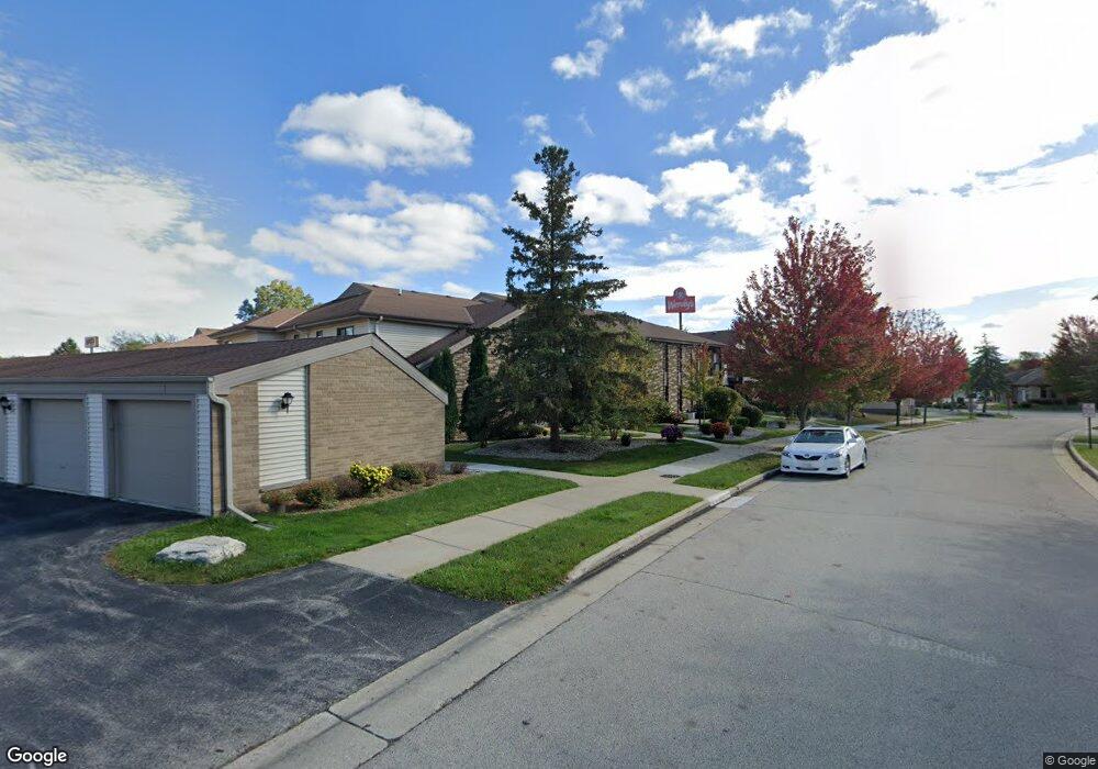
W176N9720 Riversbend Cir E Germantown, WI 53022
Estimated Value: $152,000 - $263,000
1
Bed
1
Bath
827
Sq Ft
$220/Sq Ft
Est. Value
About This Home
This home is located at W176N9720 Riversbend Cir E, Germantown, WI 53022 and is currently estimated at $181,785, approximately $219 per square foot. W176N9720 Riversbend Cir E is a home located in Washington County with nearby schools including Amy Belle Elementary School, Kennedy Middle School, and Germantown High School.
Create a Home Valuation Report for This Property
The Home Valuation Report is an in-depth analysis detailing your home's value as well as a comparison with similar homes in the area
Home Values in the Area
Average Home Value in this Area
Tax History Compared to Growth
Tax History
| Year | Tax Paid | Tax Assessment Tax Assessment Total Assessment is a certain percentage of the fair market value that is determined by local assessors to be the total taxable value of land and additions on the property. | Land | Improvement |
|---|---|---|---|---|
| 2024 | $1,699 | $149,500 | $35,000 | $114,500 |
| 2023 | $1,070 | $82,000 | $30,000 | $52,000 |
| 2022 | $1,101 | $82,000 | $30,000 | $52,000 |
| 2021 | $1,040 | $82,000 | $30,000 | $52,000 |
| 2020 | $1,142 | $82,000 | $30,000 | $52,000 |
| 2019 | $1,076 | $82,000 | $30,000 | $52,000 |
| 2018 | $934 | $66,500 | $28,000 | $38,500 |
| 2017 | $923 | $66,500 | $28,000 | $38,500 |
| 2016 | $1,005 | $66,500 | $28,000 | $38,500 |
| 2015 | $1,050 | $66,500 | $28,000 | $38,500 |
| 2014 | $1,563 | $96,000 | $28,000 | $68,000 |
| 2013 | $1,807 | $112,200 | $28,000 | $84,200 |
Source: Public Records
Map
Nearby Homes
- W176N9734 Riversbend Cir E
- W176N9746 Riversbend Cir E Unit E
- W179N9765 Riversbend Cir W
- N99W17909 Appletree Ct Unit D-102
- W180N9890 Riversbend Cir W
- N94W17842 Appleton Ave
- N100W17560 Whitetail Run
- W174N9287 Joper Rd
- N92W17274 Forest Dr
- N99W16701 Woodcock Rd
- W168N10125 Bittersweet Trail
- N101W16795 Gunflint Trail
- N90W16995 Appleton Ave
- W165N10401 Wagon Trail
- N98W15894 Concord Rd
- W178N8846 Queensway St
- N88W17868 Christman Rd
- N89W16328 Cleveland Ave
- N87W18225 Queensway St
- N108W17282 Lilac Ln
- W176N9722 Riversbend Cir E
- W176N9724 Riversbend Cir E
- W176N9716 Riversbend Cir E
- W176N9726 Riversbend Cir E
- W176N9718 Riversbend Cir E
- W176N9732 Riversbend Cir E
- W176N9730 Riversbend Cir E
- W176N9738 Riversbend Cir E
- W176N9746 Riversbend Cir E
- W176N9736 Riversbend Cir E
- W176N9740 Riversbend Cir E
- W176N9742 Riversbend Cir E
- W176N9744 Riversbend Cir E
- W176N9745 Rivercrest Dr
- W176N9729 Rivercrest Dr
- W176N9731 Rivercrest Dr
- W176N9737 Rivercrest Dr
- W176N9743 Rivercrest Dr
- W176N9743 Rivercrest Dr Unit 15
- W176N9717 Rivercrest Dr