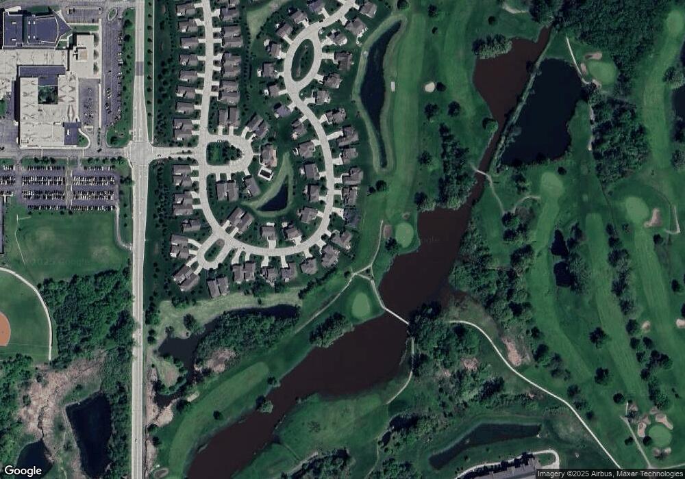
W177N11418 Blackstone Cir Germantown, WI 53022
Estimated Value: $646,000 - $800,000
4
Beds
4
Baths
3,945
Sq Ft
$190/Sq Ft
Est. Value
About This Home
This home is located at W177N11418 Blackstone Cir, Germantown, WI 53022 and is currently estimated at $747,674, approximately $189 per square foot. W177N11418 Blackstone Cir is a home with nearby schools including County Line Elementary School, Kennedy Middle School, and Germantown High School.
Ownership History
Date
Name
Owned For
Owner Type
Purchase Details
Closed on
Feb 12, 2021
Sold by
Kinsella Michael
Bought by
Foley Michael and Foley Susan
Current Estimated Value
Home Financials for this Owner
Home Financials are based on the most recent Mortgage that was taken out on this home.
Original Mortgage
$522,500
Outstanding Balance
$466,914
Interest Rate
2.65%
Mortgage Type
New Conventional
Estimated Equity
$280,760
Purchase Details
Closed on
Jul 2, 2015
Sold by
Demlang Builders Inc
Bought by
Kinsella Michael
Purchase Details
Closed on
Jul 16, 2014
Sold by
Midwest Lot Holdings Llc
Bought by
Demlang Builders Inc
Create a Home Valuation Report for This Property
The Home Valuation Report is an in-depth analysis detailing your home's value as well as a comparison with similar homes in the area
Home Values in the Area
Average Home Value in this Area
Purchase History
| Date | Buyer | Sale Price | Title Company |
|---|---|---|---|
| Foley Michael | $550,000 | Land Title Services Inc | |
| Kinsella Michael | $443,400 | -- | |
| Demlang Builders Inc | $287,700 | None Available |
Source: Public Records
Mortgage History
| Date | Status | Borrower | Loan Amount |
|---|---|---|---|
| Open | Foley Michael | $522,500 |
Source: Public Records
Tax History Compared to Growth
Tax History
| Year | Tax Paid | Tax Assessment Tax Assessment Total Assessment is a certain percentage of the fair market value that is determined by local assessors to be the total taxable value of land and additions on the property. | Land | Improvement |
|---|---|---|---|---|
| 2024 | $9,278 | $712,000 | $132,500 | $579,500 |
| 2023 | $9,761 | $584,100 | $130,600 | $453,500 |
| 2022 | $8,360 | $506,600 | $130,600 | $376,000 |
| 2021 | $7,450 | $471,100 | $130,600 | $340,500 |
| 2020 | $8,201 | $471,100 | $130,600 | $340,500 |
| 2019 | $7,404 | $471,100 | $130,600 | $340,500 |
| 2018 | $8,241 | $443,400 | $103,800 | $339,600 |
| 2017 | $7,982 | $443,400 | $103,800 | $339,600 |
| 2016 | $7,859 | $443,400 | $103,800 | $339,600 |
| 2015 | $4,555 | $268,800 | $103,800 | $165,000 |
| 2014 | $1,756 | $103,800 | $103,800 | $0 |
| 2013 | $1,000 | $60,000 | $60,000 | $0 |
Source: Public Records
Map
Nearby Homes
- W170N11497 Armada Dr Unit 16
- W170N11417 Armada Dr Unit 2
- W170N11583 Armada Dr Unit 16
- N115W17131 Armada Dr
- W170N11573 Armada Dr
- N115W17121 Armada Dr
- N115W17103 Armada Dr Unit 7
- W169N11452 Biscayne Dr Unit 14
- W169N11540 Biscayne Dr Unit 3, Bldg 9
- N110W17158 Ashbury Ln Unit 16
- N110W17098 Ashbury Ln Unit 5
- N114W16721 Royal Ct
- N114W16680 Crown Dr Unit 7
- N110W16867 Ashbury Cir Unit 3
- N108W17282 Lilac Ln
- N116W16416 Main St
- The Aspen Plan at Wrenwood - The Reserve at Wrenwood
- The Breckenridge Plan at Wrenwood - The Reserve at Wrenwood
- N119W14982 Ivy Ln
- Lt0 Wisconsin 145
- W177N11428 Blackstone Cir
- W177N11410 Blackstone Cir
- W177N11427 Blackstone Cir
- W177N11438 Blackstone Cir
- W177N11438 Blackstone Cir Unit W177N11438
- N114W17785 Blackstone Cir
- N114W17810 Blackstone Cir
- W177N11450 Blackstone Cir
- N114W17823 Blackstone Cir
- W177N11455 Blackstone Cir
- N114W17850 Blackstone Cir
- N114W17845 Blackstone Cir
- W177N11462 Blackstone Cir
- W177N11461 Blackstone Cir
- W179N11420 Blackstone Cir Unit 173
- W177N11468 Blackstone Cir
- N114W17862 Blackstone Ct
- N114W17844 Blackstone Ct
- W177N11483 Blackstone Cir
- W177N11486 Blackstone Cir
